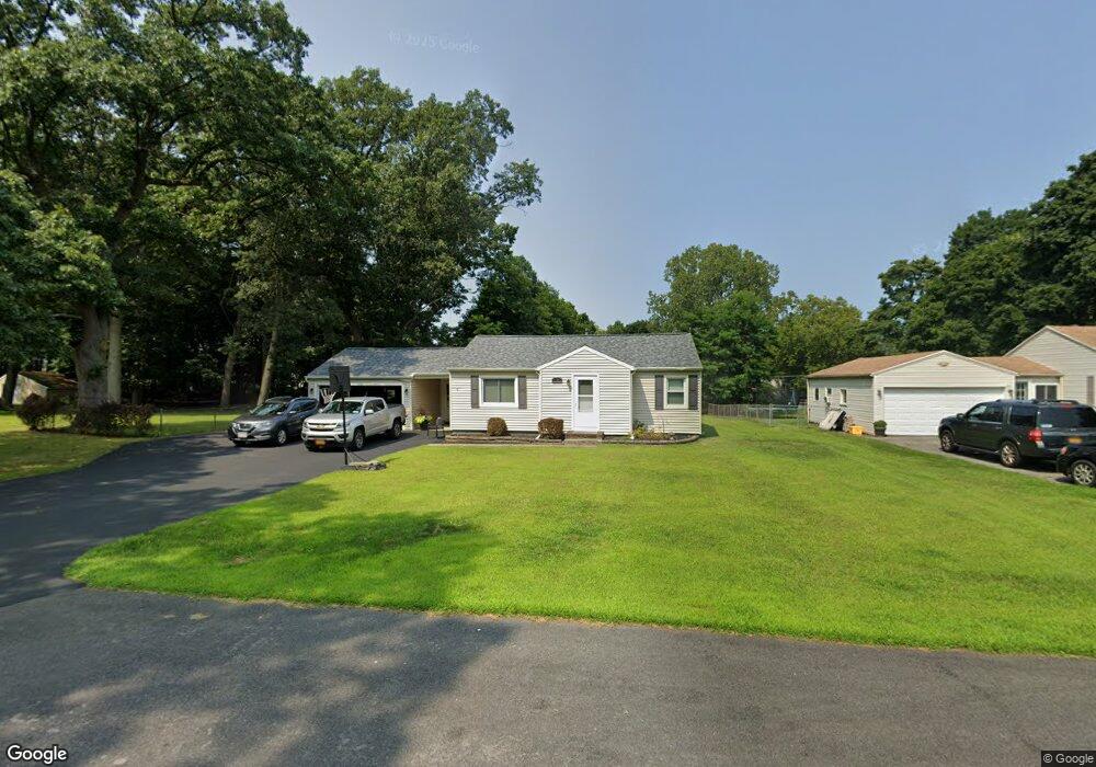
204 Bayway Dr Webster, NY 14580
Estimated Value: $261,944 - $283,000
2
Beds
1
Bath
1,234
Sq Ft
$220/Sq Ft
Est. Value
About This Home
This home is located at 204 Bayway Dr, Webster, NY 14580 and is currently estimated at $270,986, approximately $219 per square foot. 204 Bayway Dr is a home located in Monroe County with nearby schools including DeWitt Road Elementary School, Willink Middle School, and Thomas High School.
Ownership History
Date
Name
Owned For
Owner Type
Purchase Details
Closed on
Dec 8, 2012
Sold by
Dodge Sandra
Bought by
Dodge Michael
Current Estimated Value
Purchase Details
Closed on
Mar 10, 2010
Sold by
Michels James T
Bought by
Dodge Sandra R
Home Financials for this Owner
Home Financials are based on the most recent Mortgage that was taken out on this home.
Original Mortgage
$112,850
Interest Rate
5.5%
Mortgage Type
FHA
Purchase Details
Closed on
Dec 8, 1999
Sold by
Moss Scott
Bought by
Michels James T
Create a Home Valuation Report for This Property
The Home Valuation Report is an in-depth analysis detailing your home's value as well as a comparison with similar homes in the area
Home Values in the Area
Average Home Value in this Area
Purchase History
| Date | Buyer | Sale Price | Title Company |
|---|---|---|---|
| Dodge Michael | -- | -- | |
| Dodge Sandra R | $115,000 | None Available | |
| Michels James T | $74,000 | Peter Tumminelli |
Source: Public Records
Mortgage History
| Date | Status | Borrower | Loan Amount |
|---|---|---|---|
| Previous Owner | Dodge Sandra R | $112,850 |
Source: Public Records
Tax History Compared to Growth
Tax History
| Year | Tax Paid | Tax Assessment Tax Assessment Total Assessment is a certain percentage of the fair market value that is determined by local assessors to be the total taxable value of land and additions on the property. | Land | Improvement |
|---|---|---|---|---|
| 2024 | $4,166 | $94,100 | $27,900 | $66,200 |
| 2023 | $4,051 | $94,100 | $27,900 | $66,200 |
| 2022 | $4,421 | $94,100 | $27,900 | $66,200 |
| 2021 | $4,380 | $94,100 | $27,900 | $66,200 |
| 2020 | $3,701 | $94,100 | $27,900 | $66,200 |
| 2019 | $3,290 | $94,100 | $27,900 | $66,200 |
| 2018 | $3,468 | $94,100 | $27,900 | $66,200 |
| 2017 | $3,261 | $94,100 | $27,900 | $66,200 |
| 2016 | $3,290 | $94,100 | $27,900 | $66,200 |
| 2015 | -- | $94,100 | $27,900 | $66,200 |
| 2014 | -- | $94,100 | $27,900 | $66,200 |
Source: Public Records
Map
Nearby Homes
- 787 Dewitt Rd
- 758 Dewitt Rd
- 737 Admiralty Way
- 250 San Ron Dr
- 629 Midship Cir
- 717 Mariner Cir
- 769 Bay Rd
- 273 Circle Ln
- 673 Seneca Rd
- 474 Wood Harbor Trail
- 413 Bartell Ln
- 430 Sundance Trail
- 151 Shore Dr
- 409 Newport Rd
- 407 Newport Rd
- 408 Newport Rd
- 268 Lake Breeze Park
- 631 Bay Rd
- 59 Mooring Line Dr
- 2723 Titus Avenue Extension
- 206 Bayway Dr
- 206 Bayway Dr Unit N
- 202 Bayway Dr
- 208 Bayway Dr
- 207 Bayway Dr
- 195 Longview Dr
- 200 Bayway Dr
- 191 Longview Dr
- 199 Longview Dr
- 210 Bayway Dr
- 209 Bayway Dr
- 187 Longview Dr
- 203 Longview Dr
- 199 Bayway Dr
- 199 Bayway Dr Unit S
- 198 Bayway Dr
- 211 Bayway Dr
- 214 Bayway Dr
- 183 Longview Dr
- 207 Longview Dr