204 Bennie West Rd Waverly, GA 31565
Estimated Value: $311,000 - $453,000
3
Beds
2
Baths
2,164
Sq Ft
$177/Sq Ft
Est. Value
About This Home
This home is located at 204 Bennie West Rd, Waverly, GA 31565 and is currently estimated at $383,276, approximately $177 per square foot. 204 Bennie West Rd is a home located in Camden County with nearby schools including Woodbine Elementary School, Camden Middle School, and Camden County High School.
Ownership History
Date
Name
Owned For
Owner Type
Purchase Details
Closed on
Dec 29, 2006
Sold by
Not Provided
Bought by
Simon Lavonia and Simon Sarenda
Current Estimated Value
Home Financials for this Owner
Home Financials are based on the most recent Mortgage that was taken out on this home.
Original Mortgage
$161,385
Outstanding Balance
$94,156
Interest Rate
6.06%
Mortgage Type
FHA
Estimated Equity
$289,120
Create a Home Valuation Report for This Property
The Home Valuation Report is an in-depth analysis detailing your home's value as well as a comparison with similar homes in the area
Home Values in the Area
Average Home Value in this Area
Purchase History
| Date | Buyer | Sale Price | Title Company |
|---|---|---|---|
| Simon Lavonia | -- | -- |
Source: Public Records
Mortgage History
| Date | Status | Borrower | Loan Amount |
|---|---|---|---|
| Open | Simon Lavonia | $161,385 |
Source: Public Records
Tax History Compared to Growth
Tax History
| Year | Tax Paid | Tax Assessment Tax Assessment Total Assessment is a certain percentage of the fair market value that is determined by local assessors to be the total taxable value of land and additions on the property. | Land | Improvement |
|---|---|---|---|---|
| 2025 | $1,150 | $100,511 | $5,741 | $94,770 |
| 2024 | $1,202 | $100,511 | $5,741 | $94,770 |
| 2023 | $1,241 | $99,130 | $4,360 | $94,770 |
| 2022 | $1,221 | $88,013 | $4,360 | $83,653 |
| 2021 | $1,291 | $77,290 | $4,360 | $72,930 |
| 2020 | $1,328 | $72,564 | $4,360 | $68,204 |
| 2019 | $1,338 | $72,564 | $4,360 | $68,204 |
| 2018 | $1,203 | $72,564 | $4,360 | $68,204 |
| 2017 | $1,225 | $66,648 | $4,360 | $62,288 |
| 2016 | $1,217 | $64,748 | $4,360 | $60,388 |
| 2015 | $1,177 | $64,748 | $4,360 | $60,388 |
| 2014 | $1,920 | $65,005 | $4,617 | $60,388 |
Source: Public Records
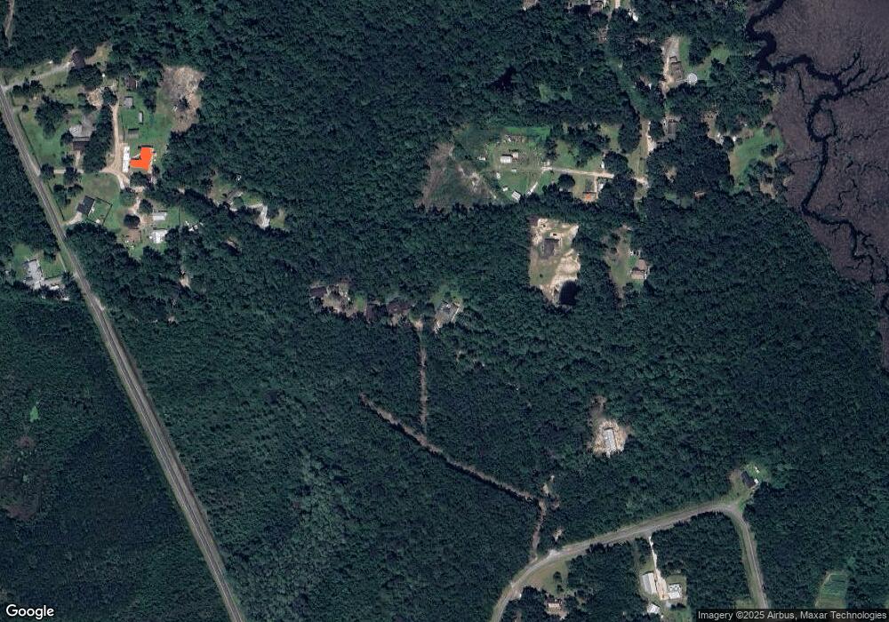
Map
Nearby Homes
- 321 Harbour Island Cir
- 51 Bluffs Landing
- 195 Ossabaw Way
- 73 Fairwinds Dr
- V/L 276 Harbour Island Cir
- Spring Valley II Plan at The Estates of Sanctuary Cove
- Pinehurst II Plan at The Estates of Sanctuary Cove
- Southport III Plan at The Estates of Sanctuary Cove
- Charleston II Plan at The Estates of Sanctuary Cove
- 35 Fairwinds Dr
- 352 Harbour Island Cir
- 424 Harbour Island Cir
- 0 US Hwy 17 Unit 163724
- 0 US Hwy 17 Unit 10488619
- 0 US Hwy 17 Unit 159908
- 0 US Hwy 17 Unit 163671
- 0 Dover Bluff Rd Unit 10276950
- 0 Dover Bluff Rd Unit 1645843
- 0 Dover Bluff Rd Unit 11355244
- Lot 17 B Sanderling Trace
- 182 Bennie West Rd
- 242 Bennie West Rd
- 172 McVeigh Rd
- 276 Bennie West Rd
- 110 Shaddix Ln
- 60 Bennie Rd W
- 89 Shaddix Ln
- 74 Shaddix Ln
- 60 Bennie West Rd
- 158 McVeigh Rd
- 150 McVeigh Rd
- 138 McVeigh Rd
- 111 Ossabaw Way
- 101 Ossabaw Way
- 56 McVeigh Rd
- 102 McVeigh Rd
- 97 Massey Ln
- 139 McVeigh Rd
- 99 McVeigh Rd Unit 1,2,3
- 105 Mount Calvary Church Rd