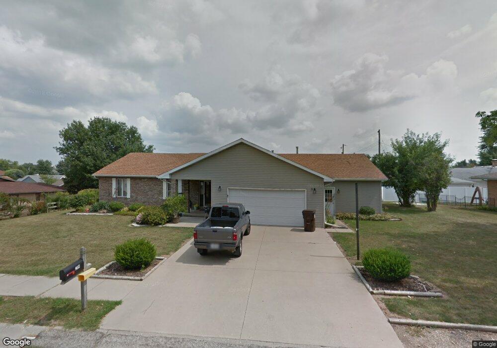
204 Cedar Dr Clinton, IL 61727
Estimated Value: $266,000 - $305,000
5
Beds
3
Baths
2,250
Sq Ft
$124/Sq Ft
Est. Value
About This Home
This home is located at 204 Cedar Dr, Clinton, IL 61727 and is currently estimated at $279,796, approximately $124 per square foot. 204 Cedar Dr is a home located in De Witt County with nearby schools including Clinton High School and Clinton Christian Academy.
Ownership History
Date
Name
Owned For
Owner Type
Purchase Details
Closed on
Sep 18, 2019
Sold by
Dalton Ryan H and Utterback Ryan
Bought by
Moore Jennifer L and Moore Jeffrey L
Current Estimated Value
Home Financials for this Owner
Home Financials are based on the most recent Mortgage that was taken out on this home.
Original Mortgage
$193,030
Outstanding Balance
$170,871
Interest Rate
4.13%
Mortgage Type
New Conventional
Estimated Equity
$108,925
Purchase Details
Closed on
Feb 20, 2019
Sold by
Dewitt County Sheriff
Bought by
Utterback Ryan and Decker Ryan
Purchase Details
Closed on
Jul 24, 2013
Sold by
James R James R and Decker Lillian L
Bought by
Decker James R
Create a Home Valuation Report for This Property
The Home Valuation Report is an in-depth analysis detailing your home's value as well as a comparison with similar homes in the area
Home Values in the Area
Average Home Value in this Area
Purchase History
| Date | Buyer | Sale Price | Title Company |
|---|---|---|---|
| Moore Jennifer L | $199,000 | None Available | |
| Utterback Ryan | -- | None Available | |
| Decker James R | -- | -- |
Source: Public Records
Mortgage History
| Date | Status | Borrower | Loan Amount |
|---|---|---|---|
| Open | Moore Jennifer L | $193,030 |
Source: Public Records
Tax History Compared to Growth
Tax History
| Year | Tax Paid | Tax Assessment Tax Assessment Total Assessment is a certain percentage of the fair market value that is determined by local assessors to be the total taxable value of land and additions on the property. | Land | Improvement |
|---|---|---|---|---|
| 2024 | $5,341 | $74,343 | $13,929 | $60,414 |
| 2023 | $4,957 | $67,708 | $12,686 | $55,022 |
| 2022 | $4,718 | $63,876 | $11,968 | $51,908 |
| 2021 | $4,610 | $62,015 | $11,619 | $50,396 |
| 2020 | $4,772 | $62,015 | $11,619 | $50,396 |
| 2019 | $5,316 | $62,015 | $11,619 | $50,396 |
| 2018 | $4,670 | $60,562 | $11,347 | $49,215 |
| 2017 | $4,588 | $58,926 | $10,911 | $48,015 |
| 2016 | $4,499 | $57,771 | $10,697 | $47,074 |
| 2015 | $4,350 | $57,771 | $10,697 | $47,074 |
| 2014 | $4,350 | $57,771 | $10,697 | $47,074 |
| 2013 | -- | $57,771 | $10,697 | $47,074 |
Source: Public Records
Map
Nearby Homes
- 46 Park Ln
- 613 S Quincy St
- 303 S Elm St
- 68 Somerset Dr
- 212 E Jefferson St
- 701 W Adams St
- 31 Colonial Dr
- 9 Kirkwood Dr
- 212 N Linden St
- 701 S Cain St
- 16 Holly Dr
- 402 N Madison St
- 109 W Macon St
- 505 N Center St
- 0 Betty Ln Unit 10514801
- 708 E Washington St
- 606 N Center St
- 1102 E Van Buren St
- 619 N Madison St
- 308 N Alexander St