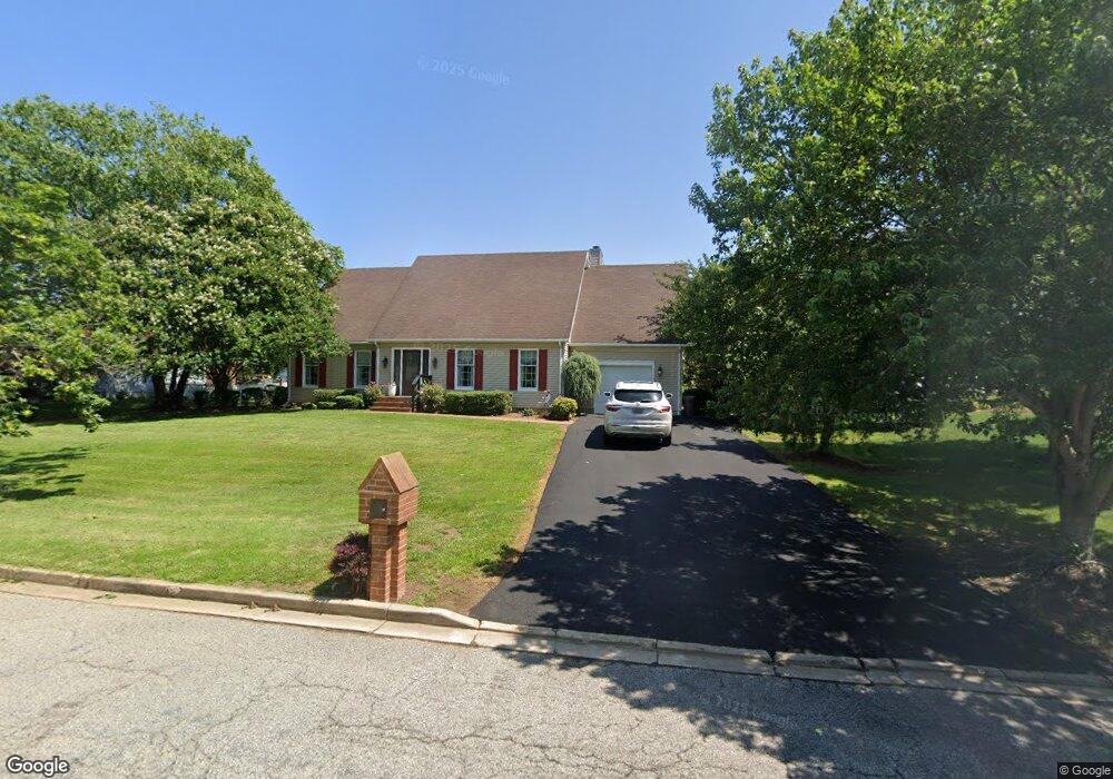
204 Devon Dr Chestertown, MD 21620
Estimated Value: $370,407 - $431,000
Studio
2
Baths
2,146
Sq Ft
$189/Sq Ft
Est. Value
About This Home
This home is located at 204 Devon Dr, Chestertown, MD 21620 and is currently estimated at $406,602, approximately $189 per square foot. 204 Devon Dr is a home located in Kent County with nearby schools including Kent County Middle School and Kent County High School.
Ownership History
Date
Name
Owned For
Owner Type
Purchase Details
Closed on
Jun 27, 2017
Sold by
Carr Gene L
Bought by
Southard Leslae P and Southard Bruce H
Current Estimated Value
Home Financials for this Owner
Home Financials are based on the most recent Mortgage that was taken out on this home.
Original Mortgage
$222,601
Outstanding Balance
$185,198
Interest Rate
3.94%
Mortgage Type
New Conventional
Estimated Equity
$221,405
Purchase Details
Closed on
Sep 16, 1994
Sold by
Coventry Farm Limited Partnership
Bought by
Carr Robert A and Carr Gene L
Create a Home Valuation Report for This Property
The Home Valuation Report is an in-depth analysis detailing your home's value as well as a comparison with similar homes in the area
Home Values in the Area
Average Home Value in this Area
Purchase History
| Date | Buyer | Sale Price | Title Company |
|---|---|---|---|
| Southard Leslae P | $220,375 | None Available | |
| Carr Robert A | $120,000 | -- |
Source: Public Records
Mortgage History
| Date | Status | Borrower | Loan Amount |
|---|---|---|---|
| Open | Southard Leslae P | $222,601 |
Source: Public Records
Tax History
| Year | Tax Paid | Tax Assessment Tax Assessment Total Assessment is a certain percentage of the fair market value that is determined by local assessors to be the total taxable value of land and additions on the property. | Land | Improvement |
|---|---|---|---|---|
| 2025 | $3,806 | $248,300 | $71,300 | $177,000 |
| 2024 | $3,623 | $235,333 | $0 | $0 |
| 2023 | $3,449 | $222,367 | $0 | $0 |
| 2022 | $3,261 | $209,400 | $66,300 | $143,100 |
| 2021 | $3,013 | $200,833 | $0 | $0 |
| 2020 | $3,013 | $192,267 | $0 | $0 |
| 2019 | $2,873 | $183,700 | $66,300 | $117,400 |
| 2018 | $2,855 | $183,700 | $66,300 | $117,400 |
| 2017 | $2,763 | $183,700 | $0 | $0 |
| 2016 | -- | $185,800 | $0 | $0 |
| 2015 | $3,000 | $185,800 | $0 | $0 |
| 2014 | $3,000 | $185,800 | $0 | $0 |
Source: Public Records
Map
Nearby Homes
- 218 Camelot Dr
- 301 Lincoln Dr
- 110 Trafford Dr
- 206 Camelot Dr
- 100 Adela Way
- 311 Devon Dr
- 116 Harlan Loop
- 0 Cromwell Clark Rd
- Lot 9 Prestwick Dr
- 2 Scheeler Rd
- 107 Oak Leaf Dr
- 107 Metcalfe Rd
- 109 Metcalfe Rd
- 112 Metcalf Rd
- 3 Haacke Dr
- 304 Hadaway Dr
- 201 Greenwood Ave
- 132 Prospect St
- 0 Elm St Unit MDKE2003590
- 201 N Lynchburg St
Your Personal Tour Guide
Ask me questions while you tour the home.