J
Seller's Agent in 2026
Jason Engel
RE/MAX Unlimited Results Realt
(419) 443-7653
17 Total Sales
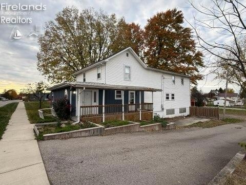
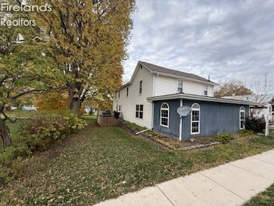
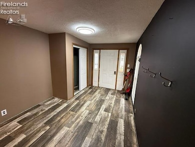
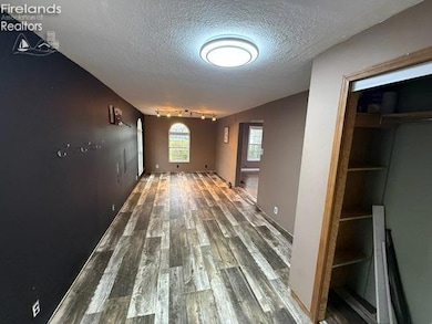
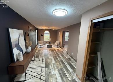
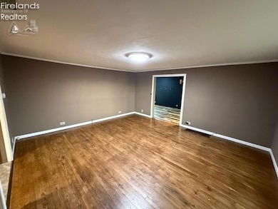

Beautiful SPACIOUS home located in the heart of Sycamore with nearly 3,000 square feet! Featuring 4 bedrooms and 1.5 baths, this home has a ton to offer. You wont believe the open concept of this house and the size of the rooms! The yard features a 1/4 acre with a nice deck and room for parking in the 1 car garage and outside the garage there is plenty of room. If you are looking for a large home that is affordable and in a great school district, you will want to set up your showing now!
Last Agent to Sell the Property
RE/MAX Unlimited Results Realt License #2023004198 Listed on: 11/03/2025

Co-Listed By
Default zSystem
zSystem Default
| Date | Type | Sale Price | Title Company |
|---|---|---|---|
| Warranty Deed | $145,000 | Union Title | |
| Warranty Deed | $120,000 | None Listed On Document | |
| Land Contract | $90,000 | None Available | |
| Interfamily Deed Transfer | -- | None Available |
| Date | Status | Loan Amount | Loan Type |
|---|---|---|---|
| Open | $119,556 | FHA | |
| Previous Owner | $89,300 | Land Contract Argmt. Of Sale |
| Date | Event | Price | List to Sale | Price per Sq Ft |
|---|---|---|---|---|
| 01/28/2026 01/28/26 | Sold | $145,000 | -9.4% | $49 / Sq Ft |
| 11/03/2025 11/03/25 | For Sale | $159,999 | -- | $54 / Sq Ft |
| Year | Tax Paid | Tax Assessment Tax Assessment Total Assessment is a certain percentage of the fair market value that is determined by local assessors to be the total taxable value of land and additions on the property. | Land | Improvement |
|---|---|---|---|---|
| 2025 | $1,414 | $42,820 | $2,250 | $40,570 |
| 2024 | $970 | $27,530 | $1,680 | $25,850 |
| 2023 | $970 | $27,530 | $1,680 | $25,850 |
| 2022 | $941 | $22,300 | $1,370 | $20,930 |
| 2021 | $810 | $22,300 | $1,370 | $20,930 |
| 2020 | $833 | $22,300 | $1,370 | $20,930 |
| 2019 | $826 | $22,300 | $1,370 | $20,930 |
| 2018 | $790 | $21,170 | $1,160 | $20,010 |
| 2017 | $799 | $21,170 | $1,160 | $20,010 |
| 2016 | -- | $21,170 | $1,160 | $20,010 |
| 2015 | -- | $21,170 | $1,160 | $20,010 |
| 2014 | -- | $21,170 | $1,160 | $20,010 |
| 2013 | -- | $21,170 | $1,160 | $20,010 |
J
Seller's Agent in 2026
Jason Engel
RE/MAX Unlimited Results Realt
(419) 443-7653
17 Total Sales
D
Seller Co-Listing Agent in 2026
Default zSystem
zSystem Default
S
Buyer's Agent in 2026
Steve Reser
RE/MAX Unlimited Results Realt
(419) 618-3277
54 Total Sales
Source: Firelands Association of REALTORS®
MLS Number: 20254412
APN: 37-163000.0000
Ask me questions while you tour the home.