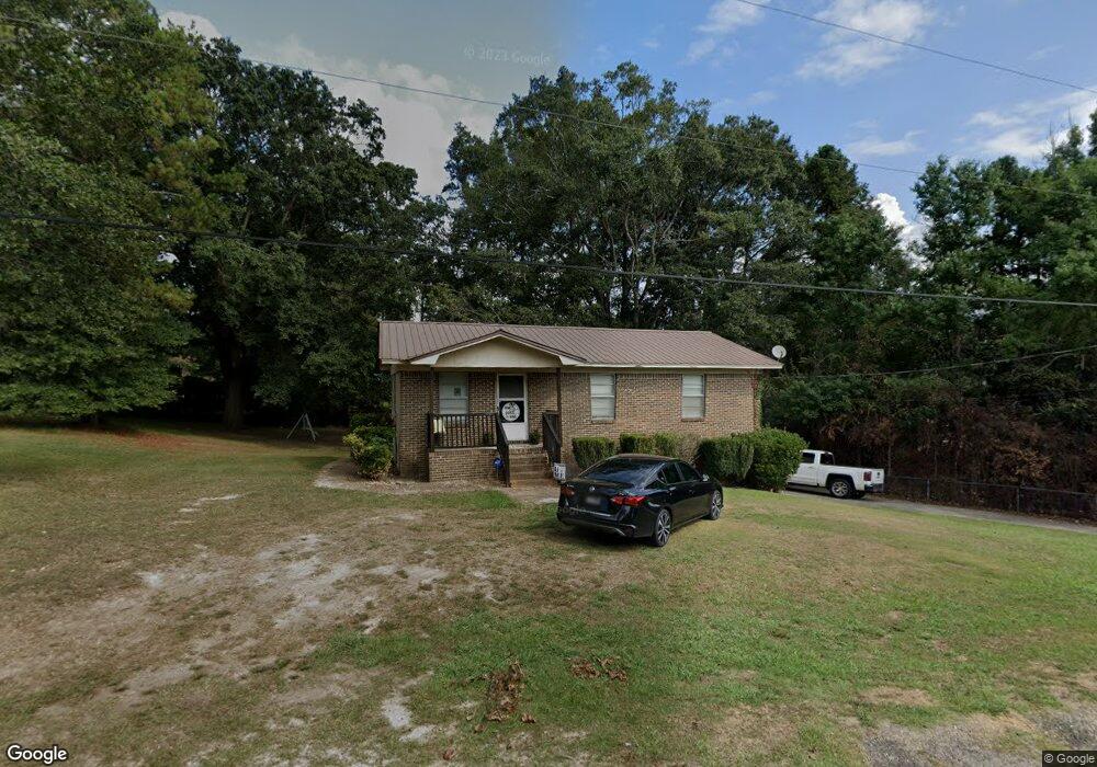
204 Elson Ave Clanton, AL 35045
Estimated Value: $124,560 - $178,000
Studio
--
Bath
1,053
Sq Ft
$151/Sq Ft
Est. Value
About This Home
This home is located at 204 Elson Ave, Clanton, AL 35045 and is currently estimated at $158,890, approximately $150 per square foot. 204 Elson Ave is a home with nearby schools including Clanton Elementary School, Thorsby High School, and Isabella High School.
Ownership History
Date
Name
Owned For
Owner Type
Purchase Details
Closed on
Nov 30, 2023
Sold by
Autery Robbie and Filascrie Person A
Bought by
Fletcher Jason T
Current Estimated Value
Home Financials for this Owner
Home Financials are based on the most recent Mortgage that was taken out on this home.
Original Mortgage
$166,822
Outstanding Balance
$164,121
Interest Rate
7.63%
Mortgage Type
FHA
Estimated Equity
-$5,231
Purchase Details
Closed on
May 14, 2021
Sold by
Cobb Desiree
Bought by
Autery Robbie
Home Financials for this Owner
Home Financials are based on the most recent Mortgage that was taken out on this home.
Original Mortgage
$91,000
Interest Rate
3.1%
Mortgage Type
New Conventional
Purchase Details
Closed on
Oct 23, 2020
Sold by
Nunnally Paul E
Bought by
Cobb Desiree
Purchase Details
Closed on
Jun 5, 2006
Sold by
Ellison Betty Jean
Bought by
Nunnally Paul E
Create a Home Valuation Report for This Property
The Home Valuation Report is an in-depth analysis detailing your home's value as well as a comparison with similar homes in the area
Purchase History
| Date | Buyer | Sale Price | Title Company |
|---|---|---|---|
| Fletcher Jason T | $169,900 | None Listed On Document | |
| Autery Robbie | $113,750 | None Available | |
| Cobb Desiree | $70,000 | None Available | |
| Nunnally Paul E | -- | -- | |
| Nunnally Paul E | $28,500 | None Available |
Source: Public Records
Mortgage History
| Date | Status | Borrower | Loan Amount |
|---|---|---|---|
| Open | Fletcher Jason T | $166,822 | |
| Previous Owner | Autery Robbie | $91,000 |
Source: Public Records
Tax History
| Year | Tax Paid | Tax Assessment Tax Assessment Total Assessment is a certain percentage of the fair market value that is determined by local assessors to be the total taxable value of land and additions on the property. | Land | Improvement |
|---|---|---|---|---|
| 2024 | $424 | $21,580 | $4,200 | $17,380 |
| 2023 | $459 | $20,860 | $4,000 | $16,860 |
| 2022 | $801 | $9,470 | $2,420 | $7,050 |
| 2021 | $592 | $7,830 | $2,000 | $5,830 |
| 2020 | $592 | $13,980 | $4,000 | $9,980 |
| 2019 | $592 | $15,260 | $4,000 | $11,260 |
| 2018 | $557 | $15,020 | $0 | $0 |
| 2017 | $557 | $0 | $0 | $0 |
| 2016 | $557 | $0 | $0 | $0 |
| 2015 | $549 | $0 | $0 | $0 |
| 2013 | $549 | $12,940 | $0 | $0 |
Source: Public Records
Map
Nearby Homes
- 103 Randall Cir
- 103 Windover Dr
- 800 Airport Rd
- 0 County Road 32 Unit 21440953
- 110 Round Forest Dr Unit 4
- 104 Adriane St
- 1302 Lay Dam Rd
- 1306 Lay Dam Rd
- 106 Bethany Ln
- 168 County Road 454
- 1912 Lay Dam Rd
- 75 County Road 920
- 6101 Alabama 145
- 1003 Lay Dam Rd
- 311 Thrash Rd
- 504 Adams St
- 01 Alabama 145
- 421 County Road 764
- 803 3rd St N
- 442 Thrash Rd
- 102 Randall Cir
- 215 Randall Cir
- 203 Elson Ave
- 100 Randall Cir
- 201 Elson Ave
- A Randall Cir
- 0 Randall Cir Unit 9.60 477344
- 0 Randall Cir Unit 25 522956
- 0 Randall Cir Unit 26 522955
- 0 Randall Cir Unit 25&26 602325
- 0 Randall Cir Unit 1 756826
- 0 Randall Cir Unit 26 248011
- 0 Randall Cir Unit 25 248009
- 0 Randall Cir Unit 25 290403
- 0 Randall Cir Unit 26 290404
- 0 Randall Cir Unit 25&26 310533
- B Randall Cir Unit 1
- B Randall Cir
- 212 Randall Cir
- 214 Randall Cir
Your Personal Tour Guide
Ask me questions while you tour the home.