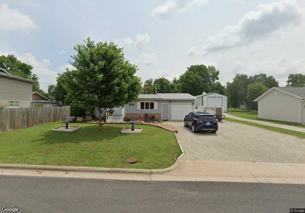
204 Francis St Branson, MO 65616
West Branson NeighborhoodEstimated Value: $174,974 - $256,000
Studio
--
Bath
1,420
Sq Ft
$159/Sq Ft
Est. Value
About This Home
This home is located at 204 Francis St, Branson, MO 65616 and is currently estimated at $226,244, approximately $159 per square foot. 204 Francis St is a home with nearby schools including Cedar Ridge Primary, Cedar Ridge Intermediate School, and Cedar Ridge Elementary School.
Create a Home Valuation Report for This Property
The Home Valuation Report is an in-depth analysis detailing your home's value as well as a comparison with similar homes in the area
Home Values in the Area
Average Home Value in this Area
Tax History
| Year | Tax Paid | Tax Assessment Tax Assessment Total Assessment is a certain percentage of the fair market value that is determined by local assessors to be the total taxable value of land and additions on the property. | Land | Improvement |
|---|---|---|---|---|
| 2025 | $649 | $10,740 | -- | -- |
| 2023 | $649 | $12,130 | $0 | $0 |
| 2022 | $631 | $12,130 | $0 | $0 |
| 2021 | $627 | $12,130 | $0 | $0 |
| 2019 | $583 | $10,820 | $0 | $0 |
| 2018 | $584 | $10,820 | $0 | $0 |
| 2017 | $578 | $10,820 | $0 | $0 |
| 2016 | $537 | $10,070 | $0 | $0 |
| 2015 | $532 | $10,070 | $0 | $0 |
| 2014 | $584 | $11,590 | $0 | $0 |
Source: Public Records
Map
Nearby Homes
- 119 Grand Mountain Ave
- 103 Garden Cir Unit 4
- 132 Rock Candy Ln Unit 1
- 108 Garden Cir Unit 104-3
- 133 Rock Candy Ln
- 135 Rock Candy Ln
- 237 Oakridge Rd Unit 2
- 239 Oakridge Rd Unit 237/239
- 239 Oakridge Rd Unit 1
- 667 Henderson St
- 316 Summer Dr
- 228 Oakridge Rd
- 238 Oakridge Rd
- 745 Aaron Way
- 264 Oakridge Rd
- 271 Oakridge Rd Unit 1
- 269 Oakridge Rd Unit 2
- 220 Harmony Ln
- 2800 Green Mountain Dr Unit 111 B & C
- 2800 Green Mountain Dr Unit 112 B & C
Your Personal Tour Guide
Ask me questions while you tour the home.