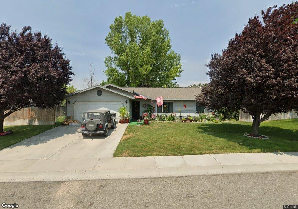
204 Garnet Dr Kimberly, ID 83341
Estimated Value: $319,920 - $334,000
3
Beds
2
Baths
1,364
Sq Ft
$239/Sq Ft
Est. Value
About This Home
This home is located at 204 Garnet Dr, Kimberly, ID 83341 and is currently estimated at $326,480, approximately $239 per square foot. 204 Garnet Dr is a home located in Twin Falls County with nearby schools including Kimberly Elementary School, STRICKER ELEMENTARY SCHOOL, and Kimberly Middle School.
Ownership History
Date
Name
Owned For
Owner Type
Purchase Details
Closed on
Jan 29, 2015
Sold by
Hughes Jeanette and Charters Jeanette
Bought by
Reay Tonny L
Current Estimated Value
Purchase Details
Closed on
Oct 27, 2010
Sold by
Ideal Property Options Llc
Bought by
Hudeison Eva M
Purchase Details
Closed on
May 20, 2010
Sold by
Potmesil Mark S
Bought by
Ideal Property Options Llc
Purchase Details
Closed on
Feb 8, 2010
Sold by
Albers John and Albers Alison
Bought by
Beneficial Idaho Inc
Create a Home Valuation Report for This Property
The Home Valuation Report is an in-depth analysis detailing your home's value as well as a comparison with similar homes in the area
Home Values in the Area
Average Home Value in this Area
Purchase History
| Date | Buyer | Sale Price | Title Company |
|---|---|---|---|
| Reay Tonny L | -- | First American Title Ins Co | |
| Hudeison Eva M | -- | -- | |
| Ideal Property Options Llc | $72,000 | -- | |
| Beneficial Idaho Inc | $63,873 | -- |
Source: Public Records
Tax History
| Year | Tax Paid | Tax Assessment Tax Assessment Total Assessment is a certain percentage of the fair market value that is determined by local assessors to be the total taxable value of land and additions on the property. | Land | Improvement |
|---|---|---|---|---|
| 2025 | $1,463 | $277,548 | $69,518 | $208,030 |
| 2024 | $1,454 | $280,248 | $69,518 | $210,730 |
| 2023 | $1,298 | $274,848 | $69,518 | $205,330 |
| 2022 | $1,875 | $278,720 | $60,078 | $218,642 |
| 2021 | $1,871 | $224,026 | $47,626 | $176,400 |
| 2020 | $1,496 | $176,325 | $47,626 | $128,699 |
| 2019 | $1,526 | $166,223 | $39,740 | $126,483 |
| 2018 | $1,495 | $156,283 | $28,949 | $127,334 |
| 2017 | $1,358 | $137,908 | $28,949 | $108,959 |
| 2016 | $1,223 | $119,417 | $0 | $0 |
| 2015 | $1,200 | $116,666 | $0 | $0 |
| 2012 | -- | $117,864 | $0 | $0 |
Source: Public Records
Map
Nearby Homes
- 1111 Cole St
- 1011 Gem Ave
- 4035 N 3510 E
- 4022 N 3536 E
- 3492 E 3600 N
- 178 Maxine Ln W Unit homesite 204
- 178 Maxine Ln W
- 160 Maxine Ln W Unit Homesite 203
- 160 Maxine Ln W
- 258 Maxine Ln W
- 258 Maxine Ln W Unit Homesite 207
- 306 Maxine Ln W
- 306 Maxine Ln W Unit Homesite 209
- 322 Maxine Ln W Unit Homesite 210
- 322 Maxine Ln W
- 336 Maxine Ln W
- 336 Maxine Ln Unit Homesite 211
- 3311 E 3818 N
- 3319 E 3818 N
- 1151 Connor Ct
Your Personal Tour Guide
Ask me questions while you tour the home.