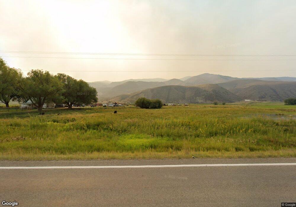
204 Highway 93 N Salmon, ID 83467
Estimated Value: $399,000 - $457,000
3
Beds
1
Bath
1,775
Sq Ft
$244/Sq Ft
Est. Value
About This Home
This home is located at 204 Highway 93 N, Salmon, ID 83467 and is currently estimated at $433,330, approximately $244 per square foot. 204 Highway 93 N is a home located in Lemhi County with nearby schools including Salmon Pioneer Primary School, Salmon Jr./Sr. High School, and Fern-Waters Public Charter School.
Ownership History
Date
Name
Owned For
Owner Type
Purchase Details
Closed on
Sep 15, 2023
Sold by
Raymond Beverly Cockrell Family Living T
Bought by
Kc Ranch Llc and Cockrell
Current Estimated Value
Purchase Details
Closed on
Dec 2, 2009
Sold by
Joy N Jesus Living Trust and Jones Sherrie Carlston
Bought by
Jones Jeremiah P
Home Financials for this Owner
Home Financials are based on the most recent Mortgage that was taken out on this home.
Original Mortgage
$90,000
Interest Rate
4.99%
Mortgage Type
Purchase Money Mortgage
Create a Home Valuation Report for This Property
The Home Valuation Report is an in-depth analysis detailing your home's value as well as a comparison with similar homes in the area
Home Values in the Area
Average Home Value in this Area
Purchase History
| Date | Buyer | Sale Price | Title Company |
|---|---|---|---|
| Kc Ranch Llc | -- | None Listed On Document | |
| Jones Jeremiah P | -- | Alliance Title |
Source: Public Records
Mortgage History
| Date | Status | Borrower | Loan Amount |
|---|---|---|---|
| Previous Owner | Jones Jeremiah P | $90,000 |
Source: Public Records
Tax History Compared to Growth
Tax History
| Year | Tax Paid | Tax Assessment Tax Assessment Total Assessment is a certain percentage of the fair market value that is determined by local assessors to be the total taxable value of land and additions on the property. | Land | Improvement |
|---|---|---|---|---|
| 2025 | $768 | $258,925 | $30,545 | $228,380 |
| 2024 | $719 | $259,612 | $31,232 | $228,380 |
| 2023 | $487 | $258,782 | $30,402 | $228,380 |
| 2022 | $566 | $258,198 | $29,818 | $228,380 |
| 2021 | $490 | $148,116 | $29,618 | $118,498 |
| 2020 | $438 | $116,328 | $29,585 | $86,743 |
| 2019 | $430 | $116,490 | $29,747 | $86,743 |
| 2018 | $400 | $101,819 | $30,331 | $71,488 |
| 2017 | $439 | $101,637 | $30,149 | $71,488 |
| 2016 | $511 | $92,678 | $31,063 | $61,615 |
| 2013 | $500 | $90,727 | $29,112 | $61,615 |
| 2011 | $500 | $96,379 | $27,320 | $69,059 |
Source: Public Records
Map
Nearby Homes
- 113 U S 93
- TBD Blackrock Rd
- 309 Cobalt St
- 409 Lombard St
- 432 U S 93
- LOT 2 Old Leesburg Rd
- LOT 4 Old Leesburg Rd
- LOT 3 Old Leesburg Rd
- LOT 1 Old Leesburg Rd
- Lot 1 Old Leesburg Rd
- 1104 Taft Ave
- 1307 Taft Ave
- 1505 Taft Ave
- 114 Neyman St
- 322 N Saint Charles St
- 315 Riverfront Dr
- 1304 Tendoy Ave
- TBD Truth Dr
- 111 10th St
- 233 Obsidian Dr
- 1395 N Highway 93
- 190 Highway 93 N
- 4 N Dogwood Ln
- 10 N Dogwood Ln
- 999 Loening Rd
- 5 N Dogwood Ln
- 9 N Dogwood Ln
- 22 N Dogwood Ln
- 13 N Dogwood Ln
- 24 N Dogwood Ln
- 24 Dogwood Ln
- 26 N Dogwood Ln
- 23 N Dogwood Ln
- 25 N Dogwood Ln
- 35 Dogwood Ln
- 161 Highway 93 N
- 36 N Dogwood Ln
- 162 Highway 93 N
- 193 Highway 93 N
- 38 Dogwood Ln
