Estimated Value: $256,000 - $345,302
4
Beds
4
Baths
2,444
Sq Ft
$120/Sq Ft
Est. Value
About This Home
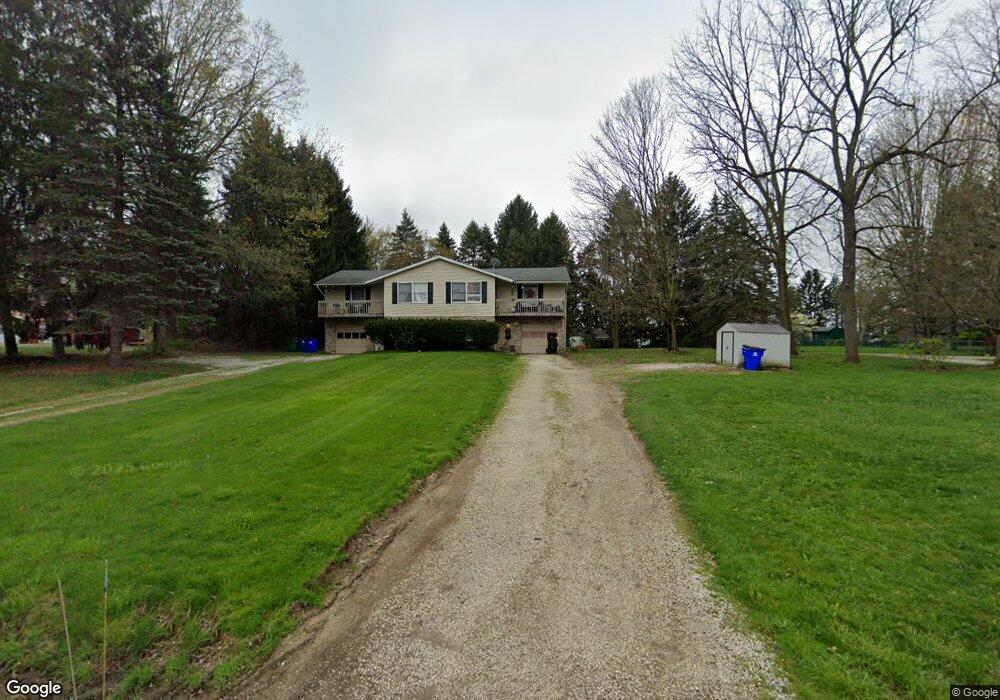
This home is located at 204 Howe Rd, Kent, OH 44240 and is currently estimated at $294,326, approximately $120 per square foot. 204 Howe Rd is a home located in Portage County with nearby schools including Brimfield Elementary School, Field Middle School, and Field High School.
Ownership History
Date
Name
Owned For
Owner Type
Purchase Details
Closed on
Nov 5, 2018
Sold by
Weaver John J
Bought by
Weaver Janet K
Current Estimated Value
Purchase Details
Closed on
Oct 11, 2000
Sold by
Lunceford Edward W & Wilda R Trustees
Bought by
Weaver John J and Weaver Janet K
Home Financials for this Owner
Home Financials are based on the most recent Mortgage that was taken out on this home.
Original Mortgage
$79,461
Interest Rate
8.03%
Mortgage Type
Seller Take Back
Create a Home Valuation Report for This Property
The Home Valuation Report is an in-depth analysis detailing your home's value as well as a comparison with similar homes in the area
Home Values in the Area
Average Home Value in this Area
Purchase History
| Date | Buyer | Sale Price | Title Company |
|---|---|---|---|
| Weaver Janet K | -- | -- | |
| Weaver John J | $131,500 | Approved Statewide Title Age |
Source: Public Records
Mortgage History
| Date | Status | Borrower | Loan Amount |
|---|---|---|---|
| Previous Owner | Weaver John J | $79,461 |
Source: Public Records
Tax History Compared to Growth
Tax History
| Year | Tax Paid | Tax Assessment Tax Assessment Total Assessment is a certain percentage of the fair market value that is determined by local assessors to be the total taxable value of land and additions on the property. | Land | Improvement |
|---|---|---|---|---|
| 2024 | $4,290 | $88,450 | $14,000 | $74,450 |
| 2023 | $4,376 | $72,730 | $8,750 | $63,980 |
| 2022 | $4,456 | $72,730 | $8,750 | $63,980 |
| 2021 | $4,332 | $72,730 | $8,750 | $63,980 |
| 2020 | $3,714 | $56,490 | $8,750 | $47,740 |
| 2019 | $3,677 | $56,490 | $8,750 | $47,740 |
| 2018 | $2,536 | $45,920 | $8,750 | $37,170 |
| 2017 | $2,536 | $45,920 | $8,750 | $37,170 |
| 2016 | $2,526 | $45,920 | $8,750 | $37,170 |
| 2015 | $2,502 | $45,920 | $8,750 | $37,170 |
| 2014 | $2,365 | $45,920 | $8,750 | $37,170 |
| 2013 | $2,312 | $45,920 | $8,750 | $37,170 |
Source: Public Records
Map
Nearby Homes
- 43 Picadilly Ct
- 779 Atwood Dr
- 59 Tudor Ln
- 98 Benjamin Way
- 4196 Lancaster Ln
- 4642 Creekside Dr Unit 4642
- 4649 Creekside Dr Unit 4649
- 1072 Carol Ln
- 313 Whittlesey Dr
- 847 Lakeview Ct
- V/L Tallmadge Rd
- 124 Tallmadge Rd
- 112 Tallmadge Rd
- Aspire Plan at Tallmadge Reserve
- Fairview Plan at Tallmadge Reserve
- Crisfield Plan at Tallmadge Reserve
- Mitchell Plan at Tallmadge Reserve
- Passport Plan at Tallmadge Reserve
- Hampton Plan at Tallmadge Reserve
- Oakdale Plan at Tallmadge Reserve