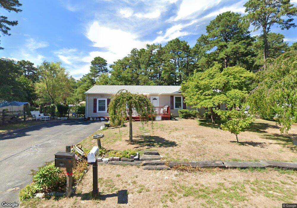
204 John Rd Browns Mills, NJ 08015
Estimated Value: $340,288 - $404,000
--
Bed
--
Bath
1,456
Sq Ft
$250/Sq Ft
Est. Value
About This Home
This home is located at 204 John Rd, Browns Mills, NJ 08015 and is currently estimated at $363,322, approximately $249 per square foot. 204 John Rd is a home located in Burlington County.
Ownership History
Date
Name
Owned For
Owner Type
Purchase Details
Closed on
Feb 19, 2003
Sold by
Pittman Roger W and Pittman Nancy J
Bought by
Hemphill Kimberly A
Current Estimated Value
Home Financials for this Owner
Home Financials are based on the most recent Mortgage that was taken out on this home.
Original Mortgage
$84,000
Interest Rate
5.64%
Mortgage Type
Purchase Money Mortgage
Purchase Details
Closed on
Aug 2, 2000
Sold by
Polinski Ginger L
Bought by
Pittman Roger W and Pittman Nancy J
Purchase Details
Closed on
Oct 28, 1997
Sold by
Blahut James D and Blahut Csilla E
Bought by
Polinski Ginger L
Home Financials for this Owner
Home Financials are based on the most recent Mortgage that was taken out on this home.
Original Mortgage
$87,000
Interest Rate
7.23%
Create a Home Valuation Report for This Property
The Home Valuation Report is an in-depth analysis detailing your home's value as well as a comparison with similar homes in the area
Home Values in the Area
Average Home Value in this Area
Purchase History
| Date | Buyer | Sale Price | Title Company |
|---|---|---|---|
| Hemphill Kimberly A | $105,000 | -- | |
| Pittman Roger W | $89,900 | Surety Title Corporation | |
| Polinski Ginger L | $87,000 | Congress Title Corp |
Source: Public Records
Mortgage History
| Date | Status | Borrower | Loan Amount |
|---|---|---|---|
| Previous Owner | Hemphill Kimberly A | $84,000 | |
| Previous Owner | Polinski Ginger L | $87,000 |
Source: Public Records
Tax History Compared to Growth
Tax History
| Year | Tax Paid | Tax Assessment Tax Assessment Total Assessment is a certain percentage of the fair market value that is determined by local assessors to be the total taxable value of land and additions on the property. | Land | Improvement |
|---|---|---|---|---|
| 2025 | $4,944 | $161,300 | $40,300 | $121,000 |
| 2024 | $4,639 | $161,300 | $40,300 | $121,000 |
| 2023 | $4,639 | $161,300 | $40,300 | $121,000 |
| 2022 | $4,294 | $161,300 | $40,300 | $121,000 |
| 2021 | $3,918 | $161,300 | $40,300 | $121,000 |
| 2020 | $3,963 | $161,300 | $40,300 | $121,000 |
| 2019 | $3,795 | $161,300 | $40,300 | $121,000 |
| 2018 | $3,666 | $161,300 | $40,300 | $121,000 |
| 2017 | $3,591 | $161,300 | $40,300 | $121,000 |
| 2016 | $3,480 | $93,100 | $27,000 | $66,100 |
| 2015 | $3,452 | $93,100 | $27,000 | $66,100 |
| 2014 | $3,300 | $93,100 | $27,000 | $66,100 |
Source: Public Records
Map
Nearby Homes
- 1714 Red Feather Trail
- 203 Seneca Trail
- 224 Cherokee Dr
- 406 Cherokee Dr
- 304 Mohawk Trail
- 6 Spring Terrace
- 14 Akwaala Trail
- 13 Muskogean Trail
- 9 Winnebago Trail
- 317 Cayuga Trail
- 22 Maricopa Trail
- 77 Sepulga Dr
- 306 Apache Trail
- 2 Kiowa Trail
- 315 Algonquin Trail
- 208 Wichita Trail
- 206 Piute Trail
- 310 Piute Trail
- 764 Lakehurst Rd
- 111 Huckleberry Ln
- 205 Blue Jay Rd
- 202 John Rd
- 203 Blue Jay Rd
- 207 John Rd
- 205 John Rd
- 1730 Red Feather Trail
- 1732 Red Feather Trail
- 1728 Red Feather Trail
- 203 John Rd
- 1724 Red Feather Trail
- 318 Cherokee Dr
- 1734 Red Feather Trail
- 1723 Red Feather Trail
- 316 Cherokee Dr
- 201 John Rd
- 1736 Red Feather Trail
- 206 Allen Rd
- 204 Allen Rd
- 208 Allen Rd
- 202 Allen Rd