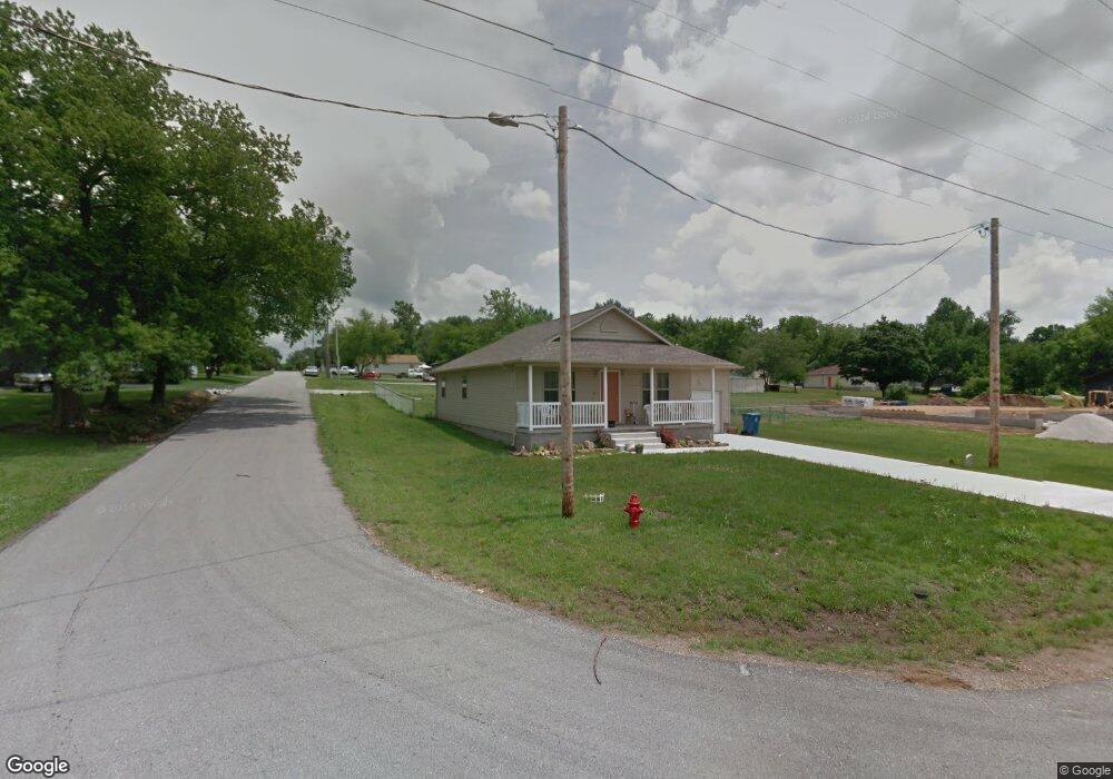
204 John St Oronogo, MO 64855
Estimated Value: $163,159 - $213,000
Studio
2
Baths
1,176
Sq Ft
$164/Sq Ft
Est. Value
About This Home
This home is located at 204 John St, Oronogo, MO 64855 and is currently estimated at $192,290, approximately $163 per square foot. 204 John St is a home with nearby schools including Webb City High School.
Ownership History
Date
Name
Owned For
Owner Type
Purchase Details
Closed on
Sep 24, 2018
Sold by
Craig Donald L and Craig Catherine E
Bought by
Spencer Deborah K
Current Estimated Value
Home Financials for this Owner
Home Financials are based on the most recent Mortgage that was taken out on this home.
Original Mortgage
$95,799
Outstanding Balance
$83,198
Interest Rate
4.5%
Mortgage Type
FHA
Estimated Equity
$109,092
Purchase Details
Closed on
Jun 26, 2013
Sold by
Ingersoll Trana G and Cooper Trana G
Bought by
Craig Donald Lee
Home Financials for this Owner
Home Financials are based on the most recent Mortgage that was taken out on this home.
Original Mortgage
$80,000
Interest Rate
3.54%
Mortgage Type
Future Advance Clause Open End Mortgage
Purchase Details
Closed on
Jun 5, 2013
Sold by
Buck Johnny and Buck Barbara
Bought by
Craig Donald Lee
Home Financials for this Owner
Home Financials are based on the most recent Mortgage that was taken out on this home.
Original Mortgage
$80,000
Interest Rate
3.54%
Mortgage Type
Future Advance Clause Open End Mortgage
Create a Home Valuation Report for This Property
The Home Valuation Report is an in-depth analysis detailing your home's value as well as a comparison with similar homes in the area
Home Values in the Area
Average Home Value in this Area
Purchase History
| Date | Buyer | Sale Price | Title Company |
|---|---|---|---|
| Spencer Deborah K | -- | -- | |
| Craig Donald Lee | -- | None Available | |
| Craig Donald Lee | -- | None Available |
Source: Public Records
Mortgage History
| Date | Status | Borrower | Loan Amount |
|---|---|---|---|
| Open | Spencer Deborah K | $95,799 | |
| Previous Owner | Craig Donald Lee | $80,000 |
Source: Public Records
Tax History
| Year | Tax Paid | Tax Assessment Tax Assessment Total Assessment is a certain percentage of the fair market value that is determined by local assessors to be the total taxable value of land and additions on the property. | Land | Improvement |
|---|---|---|---|---|
| 2025 | $899 | $19,330 | $880 | $18,450 |
| 2024 | $857 | $17,330 | $880 | $16,450 |
| 2023 | $857 | $16,510 | $880 | $15,630 |
| 2022 | $854 | $16,500 | $880 | $15,620 |
| 2021 | $849 | $16,500 | $880 | $15,620 |
| 2020 | $746 | $15,110 | $880 | $14,230 |
| 2019 | $748 | $15,110 | $880 | $14,230 |
| 2018 | $773 | $15,640 | $0 | $0 |
| 2017 | $775 | $15,640 | $0 | $0 |
| 2016 | $722 | $15,640 | $0 | $0 |
Source: Public Records
Map
Nearby Homes
- 908 Gregory Dr
- TBD S 4th St
- 524 Mineral St
- 913 Samthea Dr
- 321 S 4th St
- TBD 3 87 Acres County Lane 228
- 000 State Highway 96
- TBD Hwy 171 & Centennial
- 901 D Hwy
- 1761 Webbwood Dr
- 2177 Webbwood Dr
- 9945 County Lane 217
- 1106 Pawpaw Place
- 8940 County Lane 214
- 329 Sidney Ln
- 2306 N Greystone Square
- 337 Swaden Ln
- 335 Swaden Ln
- 2038 Blue Jay Dr
- 340 E Greystone Square
Your Personal Tour Guide
Ask me questions while you tour the home.