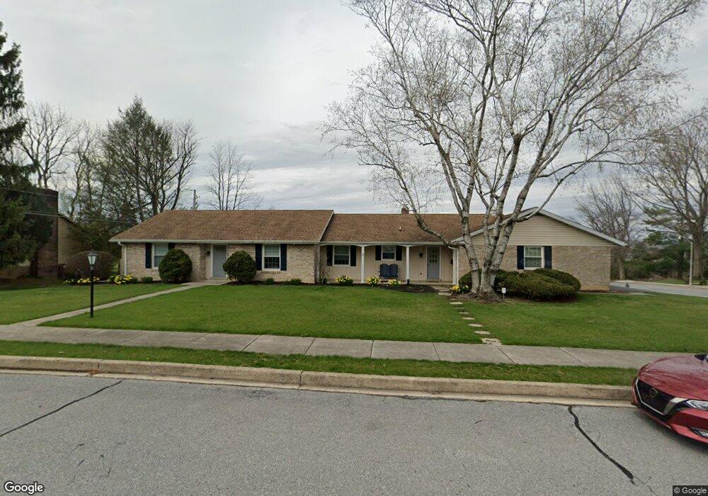
204 Julia Rd Ephrata, PA 17522
Estimated Value: $392,000 - $451,000
2
Beds
2
Baths
2,209
Sq Ft
$192/Sq Ft
Est. Value
About This Home
This home is located at 204 Julia Rd, Ephrata, PA 17522 and is currently estimated at $423,516, approximately $191 per square foot. 204 Julia Rd is a home located in Lancaster County with nearby schools including Ephrata Intermediate School, Clay Elementary School, and Ephrata Senior High School.
Ownership History
Date
Name
Owned For
Owner Type
Purchase Details
Closed on
Oct 26, 2023
Sold by
Witwer Gail Louise and Rabold Phoebe J
Bought by
Martzall Michael R and Martzall Sharon L
Current Estimated Value
Home Financials for this Owner
Home Financials are based on the most recent Mortgage that was taken out on this home.
Original Mortgage
$361,000
Outstanding Balance
$353,654
Interest Rate
7.18%
Mortgage Type
New Conventional
Estimated Equity
$69,862
Create a Home Valuation Report for This Property
The Home Valuation Report is an in-depth analysis detailing your home's value as well as a comparison with similar homes in the area
Home Values in the Area
Average Home Value in this Area
Purchase History
| Date | Buyer | Sale Price | Title Company |
|---|---|---|---|
| Martzall Michael R | $380,000 | None Listed On Document |
Source: Public Records
Mortgage History
| Date | Status | Borrower | Loan Amount |
|---|---|---|---|
| Open | Martzall Michael R | $361,000 |
Source: Public Records
Tax History Compared to Growth
Tax History
| Year | Tax Paid | Tax Assessment Tax Assessment Total Assessment is a certain percentage of the fair market value that is determined by local assessors to be the total taxable value of land and additions on the property. | Land | Improvement |
|---|---|---|---|---|
| 2025 | $5,703 | $237,800 | $62,200 | $175,600 |
| 2024 | $5,703 | $237,800 | $62,200 | $175,600 |
| 2023 | $5,562 | $237,800 | $62,200 | $175,600 |
| 2022 | $5,325 | $237,800 | $62,200 | $175,600 |
| 2021 | $5,213 | $237,800 | $62,200 | $175,600 |
| 2020 | $5,213 | $237,800 | $62,200 | $175,600 |
| 2019 | $5,142 | $237,800 | $62,200 | $175,600 |
| 2018 | $3,903 | $237,800 | $62,200 | $175,600 |
| 2017 | $4,708 | $177,900 | $44,400 | $133,500 |
| 2016 | $4,671 | $177,900 | $44,400 | $133,500 |
| 2015 | $1,033 | $177,900 | $44,400 | $133,500 |
| 2014 | $3,360 | $177,900 | $44,400 | $133,500 |
Source: Public Records
Map
Nearby Homes
- 1212 W Main St
- 57 Perseverance Ln
- 84 Weaver Ave
- 992 Hammon Ave
- 837 Martin Ave
- 124 Morning Dr
- 00 Morning Dr
- 65 Weidmansville Rd
- 131 Sunrise Ln
- 314 Freedom Dr
- 144 Sunrise Ln
- Amberbrook Plan at Wyndale
- Northfield Plan at Wyndale
- Logan Plan at Wyndale
- Stonecroft Plan at Wyndale
- Darien Plan at Wyndale
- Atworth Plan at Wyndale
- Magnolia Plan at Wyndale
- Baker Plan at Wyndale
- Huntington Plan at Wyndale
- 218 Julia Rd
- 205 Julia Rd
- 120 Julia Rd
- 219 Julia Rd
- 1357 Marie Ave
- 1330 Marie Ave
- 121 Julia Rd
- 1331 Marilyn Ave
- 1329 Marie Ave
- 1322 Marie Ave
- 104 Julia Rd
- 1321 Marilyn Ave
- 1356 Lincoln Heights Ave
- 1321 Marie Ave
- 103 Julia Rd
- 1314 Marie Ave
- 1315 Marilyn Ave
- 1332 Marilyn Ave
- 1330 Lincoln Heights Ave
- 1313 Marie Ave