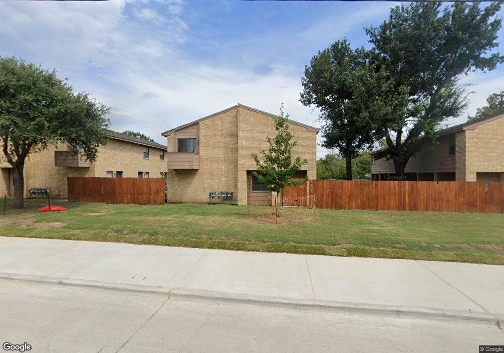
204 Lincoln Ave Unit AD College Station, TX 77840
Eastgate NeighborhoodEstimated Value: $522,000 - $809,000
--
Bed
--
Bath
3,874
Sq Ft
$172/Sq Ft
Est. Value
About This Home
This home is located at 204 Lincoln Ave Unit AD, College Station, TX 77840 and is currently estimated at $665,667, approximately $171 per square foot. 204 Lincoln Ave Unit AD is a home located in Brazos County with nearby schools including College Hills Elementary School, A&M Consolidated Middle School, and Oakwood Intermediate School.
Ownership History
Date
Name
Owned For
Owner Type
Purchase Details
Closed on
Apr 5, 2024
Sold by
Clapp Christophe Lawrence and Ostrem Cerise N
Bought by
Colbie Properties Llc-Rs 204 Lincoln
Current Estimated Value
Home Financials for this Owner
Home Financials are based on the most recent Mortgage that was taken out on this home.
Original Mortgage
$387,187
Outstanding Balance
$380,031
Interest Rate
6.66%
Mortgage Type
New Conventional
Estimated Equity
$285,636
Purchase Details
Closed on
Feb 27, 2024
Sold by
Lesikar Bruce J and Lesikar Melissa E
Bought by
Clapp Christophe Lawrence and Ostrem Cerise N
Home Financials for this Owner
Home Financials are based on the most recent Mortgage that was taken out on this home.
Original Mortgage
$387,187
Outstanding Balance
$380,031
Interest Rate
6.66%
Mortgage Type
New Conventional
Estimated Equity
$285,636
Purchase Details
Closed on
Mar 10, 2014
Sold by
Mcelroy Robert Wesley and Mcelroy Christine
Bought by
Lesikar Bruce J and Lesikar Melissa E
Home Financials for this Owner
Home Financials are based on the most recent Mortgage that was taken out on this home.
Original Mortgage
$168,750
Interest Rate
4.36%
Mortgage Type
New Conventional
Purchase Details
Closed on
Jul 29, 2011
Sold by
Mcelroy Robert P
Bought by
Mcelroy Robert Wesley
Home Financials for this Owner
Home Financials are based on the most recent Mortgage that was taken out on this home.
Original Mortgage
$143,957
Interest Rate
4.53%
Mortgage Type
Purchase Money Mortgage
Purchase Details
Closed on
Jul 7, 2008
Sold by
Lasalle Bank Na
Bought by
Mcelroy Robert Wesley and Mcelroy Robert P
Home Financials for this Owner
Home Financials are based on the most recent Mortgage that was taken out on this home.
Original Mortgage
$139,400
Interest Rate
6.47%
Mortgage Type
Purchase Money Mortgage
Purchase Details
Closed on
Jan 1, 2008
Sold by
Martell Marilyn and Martell Joseph Randall
Bought by
Lasalle Bank Na and Structured Asset Securities Corp Structu
Create a Home Valuation Report for This Property
The Home Valuation Report is an in-depth analysis detailing your home's value as well as a comparison with similar homes in the area
Home Values in the Area
Average Home Value in this Area
Purchase History
| Date | Buyer | Sale Price | Title Company |
|---|---|---|---|
| Colbie Properties Llc-Rs 204 Lincoln | -- | None Listed On Document | |
| Clapp Christophe Lawrence | -- | South Land Title | |
| Lesikar Bruce J | -- | None Available | |
| Mcelroy Robert Wesley | -- | None Available | |
| Mcelroy Robert Wesley | -- | Lsi Title Agency Inc | |
| Lasalle Bank Na | $152,644 | None Available |
Source: Public Records
Mortgage History
| Date | Status | Borrower | Loan Amount |
|---|---|---|---|
| Open | Clapp Christophe Lawrence | $387,187 | |
| Previous Owner | Lesikar Bruce J | $168,750 | |
| Previous Owner | Mcelroy Robert Wesley | $143,957 | |
| Previous Owner | Mcelroy Robert Wesley | $139,400 |
Source: Public Records
Tax History Compared to Growth
Tax History
| Year | Tax Paid | Tax Assessment Tax Assessment Total Assessment is a certain percentage of the fair market value that is determined by local assessors to be the total taxable value of land and additions on the property. | Land | Improvement |
|---|---|---|---|---|
| 2025 | $9,525 | $462,991 | $207,750 | $255,241 |
| 2024 | $9,525 | $499,815 | $207,750 | $292,065 |
| 2023 | $9,525 | $504,392 | $189,986 | $314,406 |
| 2022 | $10,032 | $470,523 | $172,755 | $297,768 |
| 2021 | $8,849 | $391,797 | $172,755 | $219,042 |
| 2020 | $8,989 | $395,778 | $172,755 | $223,023 |
| 2019 | $7,960 | $336,900 | $167,780 | $169,120 |
| 2018 | $7,921 | $332,750 | $167,780 | $164,970 |
| 2017 | $6,671 | $283,460 | $118,490 | $164,970 |
| 2016 | $5,777 | $245,470 | $83,940 | $161,530 |
| 2015 | $4,711 | $221,530 | $66,350 | $155,180 |
| 2014 | $4,711 | $203,280 | $63,680 | $139,600 |
Source: Public Records
Map
Nearby Homes
- 406 Ash St Unit CS
- 1010 Milner Dr
- 1008 Puryear Dr
- 1017 Milner Dr
- The Poppy Plan at Greens Prairie Reserve
- The Lily Plan at Greens Prairie Reserve
- The Laurel Plan at Greens Prairie Reserve
- The Jasmine Plan at Greens Prairie Reserve
- The Iris Plan at Greens Prairie Reserve
- The Dahlia Plan at Greens Prairie Reserve
- The Violet Plan at Greens Prairie Reserve
- The Rose Plan at Greens Prairie Reserve
- The Lavender Plan at Greens Prairie Reserve
- The Orchid Plan at Greens Prairie Reserve
- The Azalea Plan at Greens Prairie Reserve
- The Sage Plan at Greens Prairie Reserve
- 304 Cooner St
- 304 Cooner St Unit A
- 1201 Walton Dr
- 1311 Milner Dr
- 204 Lincoln Ave Unit A
- 204 Lincoln Ave Unit C
- 204 Lincoln Ave
- 202 Lincoln Ave Unit AD
- 202 Lincoln Ave
- 202 Lincoln Ave Unit B
- 202 Lincoln Ave Unit A
- 202 Lincoln Ave Unit C
- 202 Lincoln Ave Unit D
- 206 Lincoln Ave Unit AD
- 206 Lincoln Ave Unit A
- 206 Lincoln Ave Unit B
- 206 Lincoln Ave Unit C
- 206 Lincoln Ave Unit D
- 206 Lincoln Ave
- 903 Foster Ave
- 200 Lincoln Ave Unit AD
- 200 Lincoln Ave Unit A
- 200 Lincoln Ave Unit D
- 200 Lincoln Ave Unit B