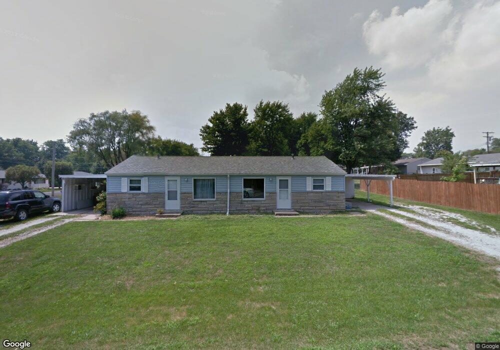
204 Locust St Washington, IL 61571
Hillcrest NeighborhoodEstimated Value: $176,996 - $227,000
4
Beds
2
Baths
1,404
Sq Ft
$139/Sq Ft
Est. Value
About This Home
This home is located at 204 Locust St, Washington, IL 61571 and is currently estimated at $195,749, approximately $139 per square foot. 204 Locust St is a home located in Tazewell County with nearby schools including Central Primary School, Central Intermediate School, and Washington Community High School.
Ownership History
Date
Name
Owned For
Owner Type
Purchase Details
Closed on
Jul 5, 2007
Sold by
Gabbert Richard O
Bought by
Lambert Christopher O and Lambert Amy J
Current Estimated Value
Home Financials for this Owner
Home Financials are based on the most recent Mortgage that was taken out on this home.
Original Mortgage
$100,000
Interest Rate
6.37%
Mortgage Type
Purchase Money Mortgage
Create a Home Valuation Report for This Property
The Home Valuation Report is an in-depth analysis detailing your home's value as well as a comparison with similar homes in the area
Home Values in the Area
Average Home Value in this Area
Purchase History
| Date | Buyer | Sale Price | Title Company |
|---|---|---|---|
| Lambert Christopher O | $101,500 | None Available |
Source: Public Records
Mortgage History
| Date | Status | Borrower | Loan Amount |
|---|---|---|---|
| Closed | Lambert Christopher O | $100,000 |
Source: Public Records
Tax History
| Year | Tax Paid | Tax Assessment Tax Assessment Total Assessment is a certain percentage of the fair market value that is determined by local assessors to be the total taxable value of land and additions on the property. | Land | Improvement |
|---|---|---|---|---|
| 2024 | $3,538 | $42,490 | $10,620 | $31,870 |
| 2023 | $3,538 | $39,420 | $9,850 | $29,570 |
| 2022 | $3,396 | $36,830 | $9,200 | $27,630 |
| 2021 | $3,271 | $35,920 | $8,970 | $26,950 |
| 2020 | $3,224 | $35,920 | $8,970 | $26,950 |
| 2019 | $3,150 | $35,920 | $8,970 | $26,950 |
| 2018 | $3,073 | $35,920 | $8,970 | $26,950 |
| 2017 | $2,973 | $32,560 | $8,130 | $24,430 |
| 2016 | $2,894 | $32,560 | $8,130 | $24,430 |
| 2015 | $2,852 | $0 | $0 | $0 |
| 2013 | $2,657 | $32,560 | $8,130 | $24,430 |
Source: Public Records
Map
Nearby Homes
- 1830 Kern Rd
- 1918 Canterbury Dr Unit F
- 306 Parkview Dr
- 1930 Cobblestone
- 1506 Woodbine Dr
- 1950 English Oak
- 1506 Kern Rd
- 609 Patricia St
- 737 Pintail Ln
- 201 Willa Ln
- 0 Cummings & Cruger Rd Unit PA1222417
- 0 W Cruger Rd Unit 1190158
- 0 W Cruger Rd Unit 22212313
- Lot 9 Sonny Dr
- 1423 Calvin Dr
- 610 Westminster Dr
- 0 Nofsinger Rd
- 417 Wagner St
- 1617 Kensington Dr
- 719 Wellington Dr
- 1872 Hickory St
- 205 Locust St
- 1871 Linsley St
- 202 Locust St
- 1874 Hickory St
- 1871 Hickory St
- 203 Locust St
- 1873 Linsley St
- 1875 Hickory St
- 1876 Hickory St
- 303 Locust St
- 1877 Hickory St
- 1877 Linsley St
- N Summit Dr
- 1878 Hickory St
- 305 Locust St
- 1872 Linsley St
- 1874 Poplar St
- 0 Eastgate Unit MRDPA1241205
- 0 Eastgate Unit MRDPA1241204
Your Personal Tour Guide
Ask me questions while you tour the home.