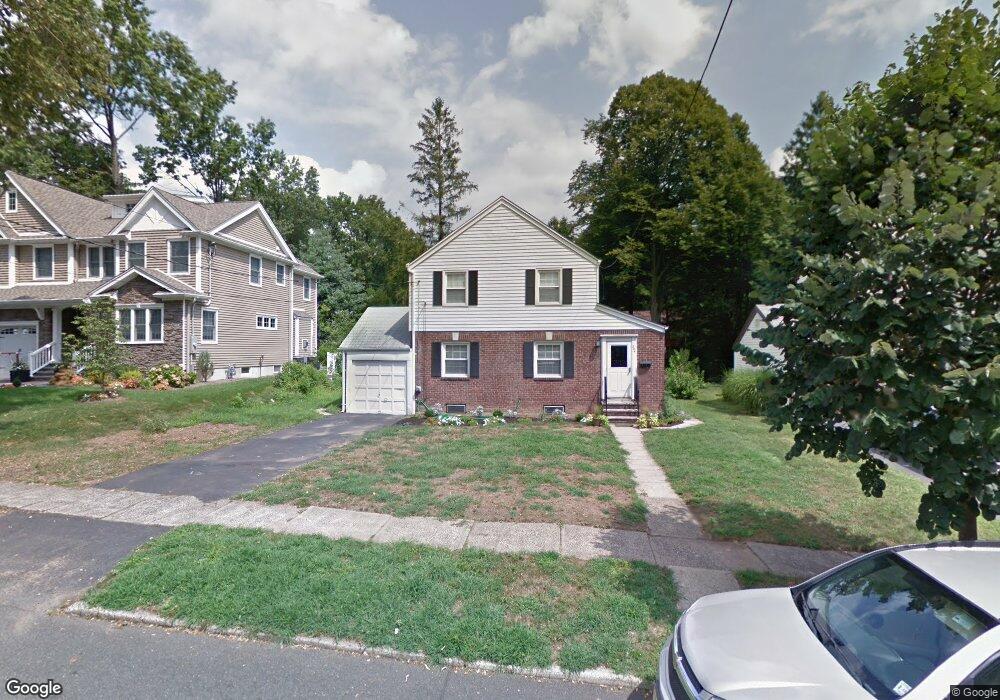
204 Manning Ave River Edge, NJ 07661
Estimated Value: $827,000 - $1,162,000
--
Bed
--
Bath
1,432
Sq Ft
$684/Sq Ft
Est. Value
About This Home
This home is located at 204 Manning Ave, River Edge, NJ 07661 and is currently estimated at $979,129, approximately $683 per square foot. 204 Manning Ave is a home located in Bergen County with nearby schools including Roosevelt Elementary School, River Dell Middle School, and River Dell Regional High School.
Ownership History
Date
Name
Owned For
Owner Type
Purchase Details
Closed on
Jun 9, 2011
Sold by
Kaufhold Michael A
Bought by
Kasaryan Nubar C and Kasaryan Tania
Current Estimated Value
Home Financials for this Owner
Home Financials are based on the most recent Mortgage that was taken out on this home.
Original Mortgage
$290,400
Outstanding Balance
$199,914
Interest Rate
4.6%
Mortgage Type
Purchase Money Mortgage
Estimated Equity
$779,215
Create a Home Valuation Report for This Property
The Home Valuation Report is an in-depth analysis detailing your home's value as well as a comparison with similar homes in the area
Home Values in the Area
Average Home Value in this Area
Purchase History
| Date | Buyer | Sale Price | Title Company |
|---|---|---|---|
| Kasaryan Nubar C | $363,000 | -- |
Source: Public Records
Mortgage History
| Date | Status | Borrower | Loan Amount |
|---|---|---|---|
| Open | Kasaryan Nubar C | $290,400 |
Source: Public Records
Tax History Compared to Growth
Tax History
| Year | Tax Paid | Tax Assessment Tax Assessment Total Assessment is a certain percentage of the fair market value that is determined by local assessors to be the total taxable value of land and additions on the property. | Land | Improvement |
|---|---|---|---|---|
| 2025 | $18,390 | $983,900 | $345,000 | $638,900 |
| 2024 | $17,931 | $463,800 | $198,800 | $265,000 |
| 2023 | $17,161 | $463,800 | $198,800 | $265,000 |
| 2022 | $17,161 | $463,800 | $198,800 | $265,000 |
| 2021 | $16,822 | $463,800 | $198,800 | $265,000 |
| 2020 | $11,288 | $316,200 | $198,800 | $117,400 |
| 2019 | $10,966 | $316,200 | $198,800 | $117,400 |
| 2018 | $10,735 | $316,200 | $198,800 | $117,400 |
| 2017 | $10,631 | $316,200 | $198,800 | $117,400 |
| 2016 | $10,390 | $316,200 | $198,800 | $117,400 |
| 2015 | $10,172 | $316,200 | $198,800 | $117,400 |
| 2014 | $10,191 | $316,200 | $198,800 | $117,400 |
Source: Public Records
Map
Nearby Homes
- 224 Manning Ave
- 168 Voorhis Ave
- 175 Monroe Ave
- 160 Kensington Rd
- 276 Greenway Terrace
- 245 Madison Ave
- 280 North Dr
- 421 Lafayette Ave
- 712 6th Ave
- 302 Howland Ave
- 1 Sipporta Ln
- 189 Forest Ave Unit 303
- 189 Forest Ave Unit 409
- 12 Gainesborough Terrace Unit 1B
- 761 6th Ave
- 130 Howland Ave
- 784 Millbrook Rd
- 766 7th Ave
- 327 van Saun Dr
- 291 Bogert Rd Unit 2A
- 208 Manning Ave
- 200 Manning Ave
- 212 Manning Ave
- 207 Concord Dr
- 199 Concord Dr
- 211 Concord Dr
- 216 Manning Ave
- 203 Manning Ave
- 199 Manning Ave
- 518 Elm Ave
- 211 Manning Ave
- 219 Concord Dr
- 220 Manning Ave
- 528 Elm Ave
- 215 Manning Ave
- 184 Manning Ave
- 225 Concord Dr
- 492 Elm Ave
- 219 Manning Ave
- 208 Concord Dr