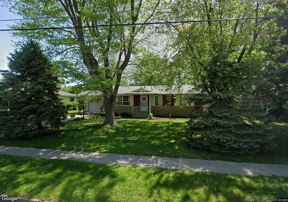
204 Maple St Auburn, MI 48611
Estimated Value: $168,000 - $236,000
3
Beds
1
Bath
1,303
Sq Ft
$154/Sq Ft
Est. Value
About This Home
This home is located at 204 Maple St, Auburn, MI 48611 and is currently estimated at $201,093, approximately $154 per square foot. 204 Maple St is a home located in Bay County with nearby schools including Auburn Elementary School, Western Middle School, and Bay City Western High School.
Ownership History
Date
Name
Owned For
Owner Type
Purchase Details
Closed on
Sep 7, 2021
Sold by
Bradley G Mooney Llc
Bought by
Jajou Auburn Building Llc
Current Estimated Value
Purchase Details
Closed on
Jul 10, 2009
Sold by
Wendell Philip N and Wendell Sally Jo
Bought by
Dudewicz Stacey
Home Financials for this Owner
Home Financials are based on the most recent Mortgage that was taken out on this home.
Original Mortgage
$95,144
Interest Rate
5.32%
Mortgage Type
FHA
Create a Home Valuation Report for This Property
The Home Valuation Report is an in-depth analysis detailing your home's value as well as a comparison with similar homes in the area
Home Values in the Area
Average Home Value in this Area
Purchase History
| Date | Buyer | Sale Price | Title Company |
|---|---|---|---|
| Jajou Auburn Building Llc | $100,000 | None Available | |
| Dudewicz Stacey | $96,900 | First American Title Ins Co |
Source: Public Records
Mortgage History
| Date | Status | Borrower | Loan Amount |
|---|---|---|---|
| Previous Owner | Dudewicz Stacey | $95,144 |
Source: Public Records
Tax History
| Year | Tax Paid | Tax Assessment Tax Assessment Total Assessment is a certain percentage of the fair market value that is determined by local assessors to be the total taxable value of land and additions on the property. | Land | Improvement |
|---|---|---|---|---|
| 2025 | $2,466 | $97,900 | $0 | $0 |
| 2024 | $2,394 | $87,000 | $0 | $0 |
| 2023 | $2,279 | $81,000 | $0 | $0 |
| 2022 | $2,752 | $75,900 | $0 | $0 |
| 2021 | $2,589 | $73,300 | $73,300 | $0 |
| 2020 | $2,429 | $58,500 | $58,500 | $0 |
| 2019 | $2,349 | $56,700 | $0 | $0 |
| 2018 | $2,289 | $54,700 | $0 | $0 |
| 2017 | $2,116 | $53,300 | $0 | $0 |
| 2016 | $2,040 | $52,100 | $0 | $52,100 |
| 2015 | -- | $52,600 | $0 | $52,600 |
| 2014 | -- | $51,100 | $0 | $51,100 |
Source: Public Records
Map
Nearby Homes
- 0 W North Union Rd Unit 50166876
- 4760 Putt Ln
- 710 W North Union Rd
- 4648 Meadow Ct
- 319 Price St
- 201 Grant St
- 1365 W North Union Rd
- 0 S Auburn Rd
- 1415 W North Union Rd
- 0 Court St
- 203 Park Ave
- 1598 Fisherville Ct
- 1587 Fisherville Ct
- Parcel D W North Union Rd
- Parcel E W North Union Rd
- Parcel G W North Union Rd
- Parcel H W North Union Rd
- Parcel I W North Union Rd
- Parcel F W North Union Rd
- 1598 Dawn Marie Ct
Your Personal Tour Guide
Ask me questions while you tour the home.