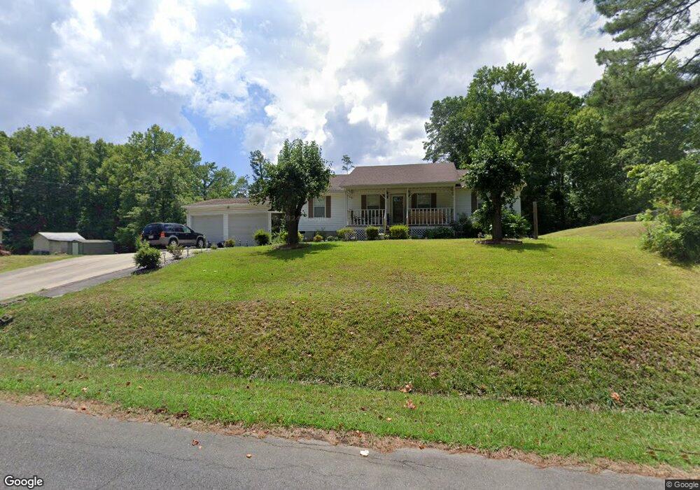
204 Matlock Dr SE Dalton, GA 30721
Estimated Value: $229,000 - $288,000
--
Bed
2
Baths
1,400
Sq Ft
$175/Sq Ft
Est. Value
About This Home
This home is located at 204 Matlock Dr SE, Dalton, GA 30721 and is currently estimated at $245,073, approximately $175 per square foot. 204 Matlock Dr SE is a home located in Whitfield County with nearby schools including Cedar Ridge Elementary School, Eastbrook Middle School, and Southeast Whitfield County High School.
Ownership History
Date
Name
Owned For
Owner Type
Purchase Details
Closed on
Sep 6, 2024
Sold by
Carballo Rafael
Bought by
Carballo Rafael and Barrera-Monroy Jose Luis
Current Estimated Value
Purchase Details
Closed on
Feb 5, 2005
Sold by
Not Provided
Bought by
Carballo Rafael
Purchase Details
Closed on
Aug 25, 2000
Sold by
Rittenberry Gary L and Rittenberry Belinda M
Bought by
Carballo Rafael
Purchase Details
Closed on
Jun 1, 1993
Bought by
Rittenberry Gary L and Rittenberry Belinda M
Create a Home Valuation Report for This Property
The Home Valuation Report is an in-depth analysis detailing your home's value as well as a comparison with similar homes in the area
Home Values in the Area
Average Home Value in this Area
Purchase History
| Date | Buyer | Sale Price | Title Company |
|---|---|---|---|
| Carballo Rafael | $105,000 | None Listed On Document | |
| Carballo Rafael | $3,500 | -- | |
| Carballo Rafael | $89,000 | -- | |
| Rittenberry Gary L | -- | -- |
Source: Public Records
Tax History Compared to Growth
Tax History
| Year | Tax Paid | Tax Assessment Tax Assessment Total Assessment is a certain percentage of the fair market value that is determined by local assessors to be the total taxable value of land and additions on the property. | Land | Improvement |
|---|---|---|---|---|
| 2024 | $1,584 | $92,567 | $15,000 | $77,567 |
| 2023 | $1,584 | $59,846 | $11,200 | $48,646 |
| 2022 | $1,207 | $49,469 | $11,200 | $38,269 |
| 2021 | $1,207 | $49,469 | $11,200 | $38,269 |
| 2020 | $1,237 | $49,469 | $11,200 | $38,269 |
| 2019 | $1,152 | $46,269 | $8,000 | $38,269 |
| 2018 | $1,238 | $48,584 | $9,000 | $39,584 |
| 2017 | $1,239 | $48,584 | $9,000 | $39,584 |
| 2016 | $988 | $41,448 | $5,355 | $36,093 |
| 2014 | $917 | $41,448 | $5,355 | $36,093 |
| 2013 | -- | $41,448 | $5,355 | $36,092 |
Source: Public Records
Map
Nearby Homes
- 1142 Ben Hill Rd SE
- 3657 Airport Rd
- 01 Headrick Cir SE
- 00 Headrick Cir SE
- 2200 Ridge Rd SE
- 1271 Ridge Rd SE
- 296 Wagner Dr
- 215 Wagner Dr
- 00 Hill Rd
- 00 Tibbs Bridge Rd
- 129 Hillwood Dr
- 1401 Eastbrook Dr SE
- 760 Keith Rd SE
- 4322 Banks Dr SE
- 0 Tibbs Bridge Rd SE
- 118 Hill Rd
- 185 Cedar Ridge Rd
- 0 Ledford Ave SE
- TBD Old Grade Rd
- 0 Old Grade Rd
- 205 Matlock Dr SE
- 208 Matlock Dr SE
- 2006 Kingsport Dr
- 1855 Flair Knoll Dr SE
- 2000 Kingsport Dr
- 203 Matlock Dr SE
- 00 Flair Knoll Dr SE
- 1859 Flair Knoll Dr SE
- 2013 Kingsport Dr
- 2010 Waterloo Dr SE
- 2005 Kingsport Dr
- 1850 Flair Knoll Dr SE
- 1840 Flair Knoll Dr SE
- 1873 Flair Knoll Dr SE
- 214 Matlock Dr SE
- 2008 Waterloo Dr SE
- 1830 Flair Knoll Dr SE
- 2003 Waterloo Dr SE
- 1870 Flair Knoll Dr SE
- 2014 Waterloo Dr SE