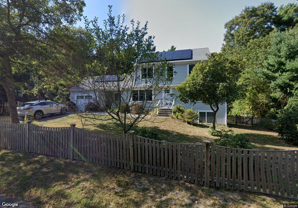
204 Mooring Dr Cotuit, MA 02635
Cotuit NeighborhoodEstimated Value: $781,000 - $907,000
About This Home
This home is located at 204 Mooring Dr, Cotuit, MA 02635 and is currently estimated at $823,576, approximately $367 per square foot. 204 Mooring Dr is a home located in Barnstable County with nearby schools including West Villages Elementary School, Barnstable United Elementary School, and Barnstable Intermediate School.
Ownership History
We collect this data history from publicly available records. To have your information removed, we recommend requesting removal directly through your county’s website.
Purchase Details
Purchase Details
Home Financials for this Owner
Home Financials are based on the most recent Mortgage that was taken out on this home.Purchase Details
Home Financials for this Owner
Home Financials are based on the most recent Mortgage that was taken out on this home.Purchase Details
Home Values in the Area
Average Home Value in this Area
Purchase History
We collect this data history from publicly available records. To have your information removed, we recommend requesting removal directly through your county’s website.
| Date | Buyer | Sale Price | Title Company |
|---|---|---|---|
| -- | -- | ||
| $93,730 | -- | ||
| $93,730 | -- | ||
| $106,000 | -- |
Mortgage History
We collect this data history from publicly available records. To have your information removed, we recommend requesting removal directly through your county’s website.
| Date | Status | Borrower | Loan Amount |
|---|---|---|---|
| Previous Owner | $200,000 | ||
| Previous Owner | $70,000 | ||
| Previous Owner | $75,000 |
Tax History
We collect this data history from publicly available records. To have your information removed, we recommend requesting removal directly through your county’s website.
| Year | Tax Paid | Tax Assessment Tax Assessment Total Assessment is a certain percentage of the fair market value that is determined by local assessors to be the total taxable value of land and additions on the property. | Land | Improvement |
|---|---|---|---|---|
| 2025 | $6,378 | $763,800 | $155,900 | $607,900 |
| 2024 | $6,072 | $770,600 | $155,900 | $614,700 |
| 2023 | $5,579 | $666,500 | $141,700 | $524,800 |
| 2022 | $5,652 | $546,600 | $105,000 | $441,600 |
| 2021 | $5,240 | $474,600 | $105,000 | $369,600 |
| 2020 | $5,553 | $474,200 | $105,000 | $369,200 |
| 2019 | $5,152 | $433,700 | $105,000 | $328,700 |
| 2018 | $4,473 | $376,500 | $110,500 | $266,000 |
| 2017 | $3,758 | $318,500 | $110,500 | $208,000 |
| 2016 | $3,247 | $282,100 | $111,500 | $170,600 |
| 2015 | $2,787 | $241,900 | $109,000 | $132,900 |
Map
- 1519 Santuit Newtown Rd
- 1456 Santuit Newtown Rd
- 80 Roosevelt Rd
- 75 Bob White Run
- 75 Trout Brook Rd
- 102 Waterford Dr
- 54 Frazier Way
- 552 Main St
- 535 Main St
- 205 Little River Rd
- 174 Little River Rd
- 70 Cape Dr Unit 14D
- 70 Cape Dr Unit 8B
- 70 Cape Dr Unit 8B
- 131 Dunrobin Rd
- 7 Oxford Dr
- 140 Pheasant Hill Cir
- 140 Pheasant Hill Cir
- 4 Bishops Park
- 125 Highpoint Rd
- 382 Mariner Cir
- 400 Mariner Cir
- 354 Mariner Cir
- 383 Mariner Cir
- 192 Mooring Dr
- 371 Mariner Cir
- 395 Mariner Cir
- 414 Mariner Cir
- 407 Mariner Cir
- 355 Mariner Cir
- 375 Mariner Cir
- 180 Mooring Dr
- 203 Mooring Dr
- 330 Mariner Cir
- 343 Mariner Cir
- 191 Mooring Dr
- 419 Mariner Cir
- 330 Mariners
- 4339 Falmouth Rd
- 4351 Falmouth Rd
Ask me questions while you tour the home.