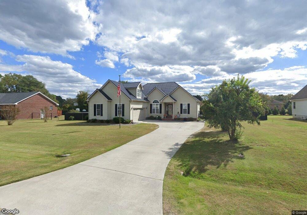
204 Morgan Trace Ln Goldsboro, NC 27530
Estimated Value: $329,000 - $339,000
3
Beds
2
Baths
2,165
Sq Ft
$154/Sq Ft
Est. Value
About This Home
This home is located at 204 Morgan Trace Ln, Goldsboro, NC 27530 and is currently estimated at $333,317, approximately $153 per square foot. 204 Morgan Trace Ln is a home located in Wayne County with nearby schools including Northwest Elementary School, Norwayne Middle School, and Charles B. Aycock High School.
Ownership History
Date
Name
Owned For
Owner Type
Purchase Details
Closed on
Feb 5, 2021
Sold by
Parrish Dean F and Parrish Kathleen M
Bought by
Parrish Dean F and Parrish Kathleen M
Current Estimated Value
Purchase Details
Closed on
Nov 14, 2005
Sold by
Webb Mark David and Webb Deborah Ferguson
Bought by
Parrish Dean F and Parrish Kathleen M
Home Financials for this Owner
Home Financials are based on the most recent Mortgage that was taken out on this home.
Original Mortgage
$182,800
Interest Rate
5.9%
Mortgage Type
VA
Purchase Details
Closed on
Nov 1, 1999
Purchase Details
Closed on
Feb 1, 1999
Create a Home Valuation Report for This Property
The Home Valuation Report is an in-depth analysis detailing your home's value as well as a comparison with similar homes in the area
Home Values in the Area
Average Home Value in this Area
Purchase History
| Date | Buyer | Sale Price | Title Company |
|---|---|---|---|
| Parrish Dean F | -- | None Available | |
| Parrish Dean F | -- | None Listed On Document | |
| Parrish Dean F | $179,000 | None Availabel | |
| -- | $145,500 | -- | |
| -- | $12,000 | -- |
Source: Public Records
Mortgage History
| Date | Status | Borrower | Loan Amount |
|---|---|---|---|
| Previous Owner | Parrish Dean F | $182,800 |
Source: Public Records
Tax History Compared to Growth
Tax History
| Year | Tax Paid | Tax Assessment Tax Assessment Total Assessment is a certain percentage of the fair market value that is determined by local assessors to be the total taxable value of land and additions on the property. | Land | Improvement |
|---|---|---|---|---|
| 2025 | $2,180 | $351,010 | $38,500 | $312,510 |
| 2024 | $1,499 | $221,210 | $22,000 | $199,210 |
| 2023 | $1,455 | $203,010 | $20,000 | $183,010 |
| 2022 | $1,814 | $203,010 | $20,000 | $183,010 |
| 2021 | $1,598 | $203,010 | $20,000 | $183,010 |
| 2020 | $1,509 | $203,010 | $20,000 | $183,010 |
| 2018 | $1,537 | $187,650 | $20,000 | $167,650 |
| 2017 | $1,398 | $187,650 | $20,000 | $167,650 |
| 2016 | $1,398 | $187,650 | $20,000 | $167,650 |
| 2015 | $1,401 | $187,650 | $20,000 | $167,650 |
| 2014 | $1,403 | $187,650 | $20,000 | $167,650 |
Source: Public Records
Map
Nearby Homes
- 205 Carlyle Cir
- 302 Morgan Trace Ln
- 600 Morgan Trace Ln
- 408 Perkins Rd
- 461 Perkins
- 176 Perkins Rd
- 455 Perkins Rd
- 479 Perkins Rd
- 104 Angel Place
- 216 Koufax Dr
- 206 Koufax Dr
- 0 Buck Swamp Unit 100521598
- 203 Lane Tree Dr
- 220 Creek Ridge Dr
- 101 Mcwood Place
- 106 Yelverton Place
- 139 Livingston Dr
- 276 Buck Swamp Rd
- 106 Pony Cir NW
- Lot 14 Pony Dr
- 202 Morgan Trace Ln
- 206 Morgan Trace Ln
- 105 Carlyle Cir
- 205 Morgan Trace Ln
- 103 Carlyle Cir
- 207 Morgan Trace Ln
- 200 Morgan Trace Ln
- 203 Morgan Trace Ln
- 114 Carlyle Cir
- 116 Carlyle Cir
- 112 Carlyle Cir
- 201 Morgan Trace Ln
- 120 Carlyle Cir
- 203 Carlyle Cir
- 118 Carlyle Cir
- 110 Carlyle Cir
- 301 Morgan Trace Ln
- 106 Carlyle Cir
- 104 Carlyle Cir
- 108 Carlyle Cir