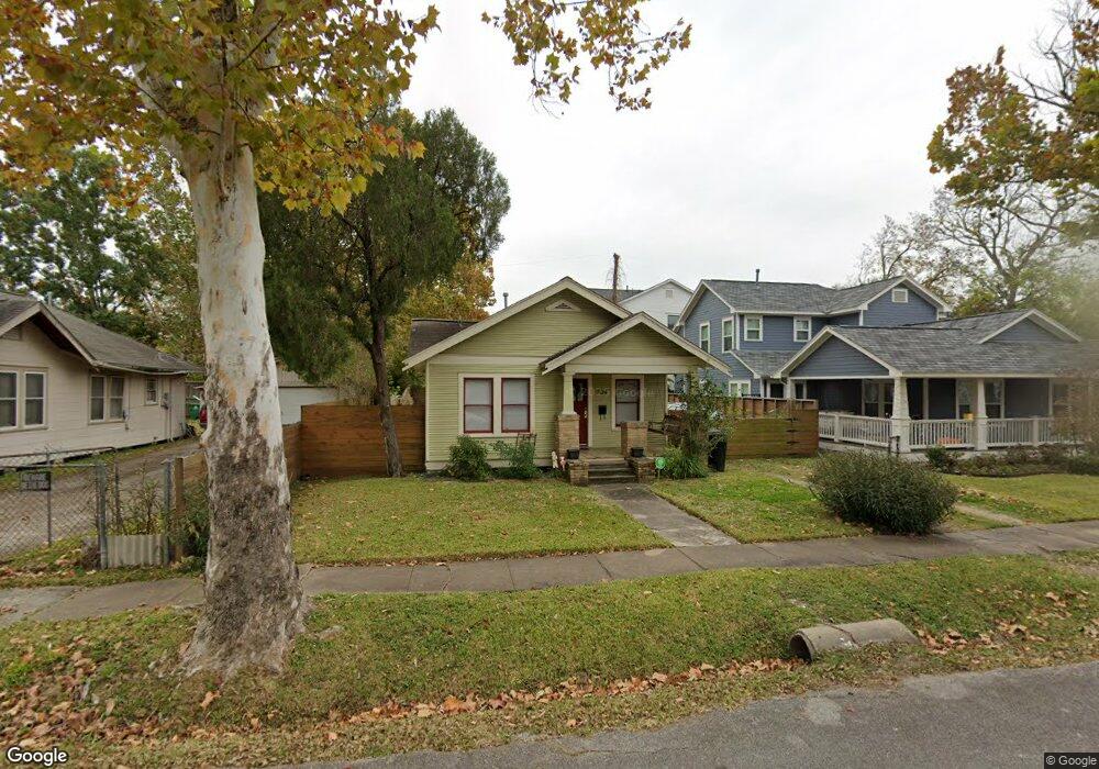
204 Munford St Houston, TX 77008
Greater Heights NeighborhoodEstimated Value: $457,000 - $566,000
2
Beds
1
Bath
852
Sq Ft
$606/Sq Ft
Est. Value
About This Home
This home is located at 204 Munford St, Houston, TX 77008 and is currently estimated at $516,493, approximately $606 per square foot. 204 Munford St is a home located in Harris County with nearby schools including Helms Elementary School, Hamilton Middle, and Heights High School.
Ownership History
Date
Name
Owned For
Owner Type
Purchase Details
Closed on
Aug 14, 2008
Sold by
Leal David and Leal Amanda Jane
Bought by
Myernick Kelly
Current Estimated Value
Home Financials for this Owner
Home Financials are based on the most recent Mortgage that was taken out on this home.
Original Mortgage
$188,100
Outstanding Balance
$123,758
Interest Rate
6.38%
Mortgage Type
Purchase Money Mortgage
Estimated Equity
$392,735
Purchase Details
Closed on
Oct 20, 2005
Sold by
Leal David
Bought by
Leal Amanda Jane
Home Financials for this Owner
Home Financials are based on the most recent Mortgage that was taken out on this home.
Original Mortgage
$141,600
Interest Rate
5.73%
Mortgage Type
Stand Alone First
Purchase Details
Closed on
Jan 20, 2004
Sold by
Gieses Mary Jo
Bought by
Leal David
Home Financials for this Owner
Home Financials are based on the most recent Mortgage that was taken out on this home.
Original Mortgage
$94,250
Interest Rate
5.88%
Mortgage Type
Purchase Money Mortgage
Purchase Details
Closed on
Jan 14, 2004
Sold by
May Charles Stacy and May Kimberly Dawn
Bought by
Gieses Mary Jo
Home Financials for this Owner
Home Financials are based on the most recent Mortgage that was taken out on this home.
Original Mortgage
$94,250
Interest Rate
5.88%
Mortgage Type
Purchase Money Mortgage
Purchase Details
Closed on
May 18, 1998
Sold by
Johnson James A
Bought by
Giese Mary Jo
Purchase Details
Closed on
May 15, 1998
Sold by
Johnson Jacob C
Bought by
Giese Mary Jo
Purchase Details
Closed on
Apr 28, 1998
Sold by
Sparks Tommy Gaines
Bought by
Giese Mary Jo
Purchase Details
Closed on
Apr 2, 1998
Sold by
Sparks Vernon Isaac
Bought by
Giese Mary Jo
Purchase Details
Closed on
Apr 11, 1996
Sold by
Armantrout Loretta and Armantrout Larry
Bought by
Loera Jesus and Villanueva Yolanda
Create a Home Valuation Report for This Property
The Home Valuation Report is an in-depth analysis detailing your home's value as well as a comparison with similar homes in the area
Home Values in the Area
Average Home Value in this Area
Purchase History
| Date | Buyer | Sale Price | Title Company |
|---|---|---|---|
| Myernick Kelly | -- | Stewart Title | |
| Leal Amanda Jane | -- | Alamo Title | |
| Leal David | -- | American Title Co | |
| Gieses Mary Jo | -- | -- | |
| Giese Mary Jo | -- | -- | |
| Giese Mary Jo | -- | -- | |
| Giese Mary Jo | -- | -- | |
| Giese Mary Jo | -- | -- | |
| Loera Jesus | -- | Fidelity National Title |
Source: Public Records
Mortgage History
| Date | Status | Borrower | Loan Amount |
|---|---|---|---|
| Open | Myernick Kelly | $188,100 | |
| Previous Owner | Leal Amanda Jane | $141,600 | |
| Previous Owner | Leal David | $94,250 | |
| Closed | Leal David | $17,650 |
Source: Public Records
Tax History Compared to Growth
Tax History
| Year | Tax Paid | Tax Assessment Tax Assessment Total Assessment is a certain percentage of the fair market value that is determined by local assessors to be the total taxable value of land and additions on the property. | Land | Improvement |
|---|---|---|---|---|
| 2025 | $9,800 | $517,433 | $450,500 | $66,933 |
| 2024 | $9,800 | $468,371 | $397,500 | $70,871 |
| 2023 | $9,800 | $442,309 | $371,000 | $71,309 |
| 2022 | $9,132 | $414,730 | $355,100 | $59,630 |
| 2021 | $9,031 | $387,504 | $333,900 | $53,604 |
| 2020 | $9,384 | $387,504 | $318,000 | $69,504 |
| 2019 | $9,184 | $362,922 | $318,000 | $44,922 |
| 2018 | $9,286 | $366,970 | $318,000 | $48,970 |
| 2017 | $9,279 | $366,970 | $318,000 | $48,970 |
| 2016 | $9,333 | $369,087 | $315,000 | $54,087 |
| 2015 | $6,667 | $305,000 | $262,500 | $42,500 |
| 2014 | $6,667 | $259,362 | $210,000 | $49,362 |
Source: Public Records
Map
Nearby Homes
- 203 E 24th St
- 108 Munford St
- 117 E 25th St
- 310 E 25th St
- 208 Aurora St Unit B
- 110 E 23rd St
- 121 E 22nd St
- 109 E 25th St
- 2219 Arlington St
- 329 E 25th St
- 205 W 24th St
- 424 E 24th St
- 224 W 23rd St Unit B
- 2415 Columbia St
- 118 E 27th St Unit A
- 222 E 27th St
- 2017 Cortlandt St
- 506 E 24th St
- 319 E 26th St
- 2706 Harvard St
- 214 1/2 Munford St Unit B
- 214 1/2 Munford St Unit A
- 202 Munford St
- 206 Munford St
- 208 Munford St
- 205 E 24th St
- 201 E 24th St
- 207 E 24th St
- 140 Munford St
- 210 Munford St
- 205 Munford St
- 201 Munford St
- 121 E 24th St
- 211 E 24th St
- 118 Munford St
- 212 Munford St
- 209 Munford St
- 119 Munford St
- 119 E 24th St
- 213 E 24th St