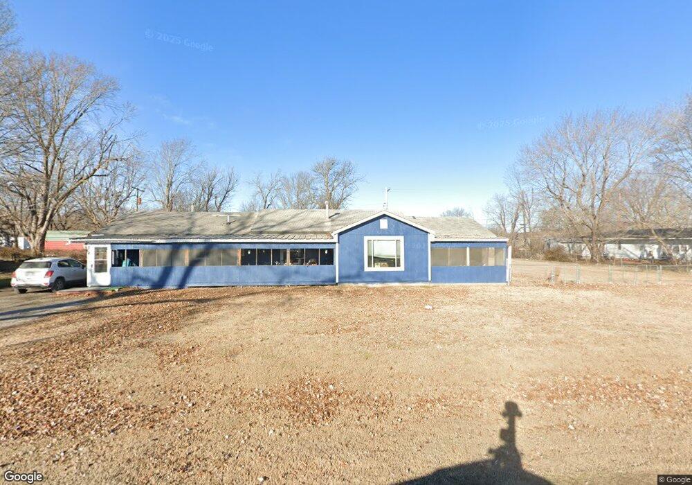
204 N Frankfort Ave Sperry, OK 74073
Estimated Value: $204,000 - $286,000
4
Beds
2
Baths
2,262
Sq Ft
$113/Sq Ft
Est. Value
About This Home
This home is located at 204 N Frankfort Ave, Sperry, OK 74073 and is currently estimated at $254,667, approximately $112 per square foot. 204 N Frankfort Ave is a home located in Tulsa County with nearby schools including Sperry Elementary School, Sperry Middle School, and Sperry High School.
Ownership History
Date
Name
Owned For
Owner Type
Purchase Details
Closed on
May 4, 2023
Sold by
Smith Gary L and Smith Collette
Bought by
Winfox Financial Services Llc
Current Estimated Value
Purchase Details
Closed on
Nov 1, 2017
Sold by
Doshier Fred A and Doshier Chiristy K
Bought by
Smith Gary L and Jones Collette
Home Financials for this Owner
Home Financials are based on the most recent Mortgage that was taken out on this home.
Original Mortgage
$25,000
Interest Rate
3.83%
Mortgage Type
Future Advance Clause Open End Mortgage
Purchase Details
Closed on
Aug 6, 2010
Sold by
Citimortgage Inc
Bought by
Doshier Fred A and Doshier Christye K
Create a Home Valuation Report for This Property
The Home Valuation Report is an in-depth analysis detailing your home's value as well as a comparison with similar homes in the area
Home Values in the Area
Average Home Value in this Area
Purchase History
| Date | Buyer | Sale Price | Title Company |
|---|---|---|---|
| Winfox Financial Services Llc | $100,000 | -- | |
| Smith Gary L | $25,000 | None Available | |
| Doshier Fred A | $28,500 | None Available |
Source: Public Records
Mortgage History
| Date | Status | Borrower | Loan Amount |
|---|---|---|---|
| Previous Owner | Smith Gary L | $25,000 |
Source: Public Records
Tax History Compared to Growth
Tax History
| Year | Tax Paid | Tax Assessment Tax Assessment Total Assessment is a certain percentage of the fair market value that is determined by local assessors to be the total taxable value of land and additions on the property. | Land | Improvement |
|---|---|---|---|---|
| 2024 | $720 | $6,804 | $199 | $6,605 |
| 2023 | $720 | $6,480 | $317 | $6,163 |
| 2022 | $691 | $6,172 | $1,111 | $5,061 |
| 2021 | $676 | $6,064 | $1,092 | $4,972 |
| 2020 | $644 | $5,776 | $1,040 | $4,736 |
| 2019 | $617 | $5,500 | $990 | $4,510 |
| 2018 | $617 | $5,500 | $990 | $4,510 |
| 2017 | $570 | $6,240 | $977 | $5,263 |
| 2016 | $548 | $6,058 | $948 | $5,110 |
| 2015 | $526 | $6,325 | $990 | $5,335 |
| 2014 | $502 | $6,325 | $990 | $5,335 |
Source: Public Records
Map
Nearby Homes
- 10201 N Cincinnati Ave
- 9545 S Cincinnati St
- 299 W Cherry
- 9610 N Peoria Ave
- 9839 N Peoria Ave
- 2012 W 88th St N
- 8588 N Cincinnati Ave
- 9084 N Osage Dr
- 8601 N Peoria Ave
- 0003 E 84th St N
- 1819 W Oak Knoll
- 9026 Crestwood Dr
- 4812 E 76th
- 6146 W 108th St N
- 2744 W 103rd St N
- 10044 N 30th West Ave
- 2781 W 88th St N
- 0 N 36th West Ave
- 7512 N Owasso Place
- 9858 N 38 Ave W
- 210 N Frankfort Ave
- 409 E Ada St
- 205 N Elgin Ave
- 207 N Elgin Ave
- 203 N Elgin Ave
- 209 N Elgin Ave
- 212 N Frankfort Ave
- 201 N Elgin Ave
- 205 N Frankfort Ave
- 203 N Frankfort Ave
- 207 N Frankfort Ave
- 211 N Elgin Ave
- 201 N Frankfort Ave
- 214 N Frankfort Ave
- 122 N Frankfort Ave
- 213 N Elgin Ave
- 213 N Frankfort Ave
- 216 N Frankfort Ave
- 507 E Ada St