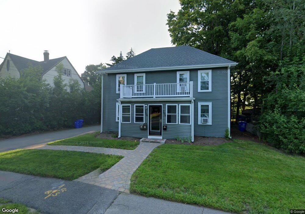
204 N Franklin St Unit B Holbrook, MA 02343
Estimated Value: $722,000 - $926,986
3
Beds
1
Bath
1,200
Sq Ft
$717/Sq Ft
Est. Value
About This Home
This home is located at 204 N Franklin St Unit B, Holbrook, MA 02343 and is currently estimated at $860,747, approximately $717 per square foot. 204 N Franklin St Unit B is a home located in Norfolk County with nearby schools including John F. Kennedy Elementary School, Holbrook Middle High School, and Boston Higashi School.
Ownership History
Date
Name
Owned For
Owner Type
Purchase Details
Closed on
Mar 27, 2025
Sold by
31-39 Bel Air Rt and Mento
Bought by
Duncanson Candace and Duncanson Andrew
Current Estimated Value
Home Financials for this Owner
Home Financials are based on the most recent Mortgage that was taken out on this home.
Original Mortgage
$787,500
Outstanding Balance
$784,151
Interest Rate
6.87%
Mortgage Type
Purchase Money Mortgage
Estimated Equity
$76,596
Purchase Details
Closed on
Dec 10, 2019
Sold by
Elbokhari Chirin and Darwiche Eddie A
Bought by
31-39 Bel Air Rt and Mento
Home Financials for this Owner
Home Financials are based on the most recent Mortgage that was taken out on this home.
Original Mortgage
$363,750
Interest Rate
3.75%
Mortgage Type
New Conventional
Purchase Details
Closed on
Jan 7, 2015
Sold by
Ryan Joseph G
Bought by
Bokhari Chirin E and Darwiche Eddie A
Purchase Details
Closed on
Oct 31, 2014
Sold by
Thomas R Cummings Irt and Cummings
Bought by
Ryan Joseph G
Purchase Details
Closed on
Nov 28, 2012
Sold by
Cummings Thomas R
Bought by
Thomas R Cummings Irt and Cummings
Create a Home Valuation Report for This Property
The Home Valuation Report is an in-depth analysis detailing your home's value as well as a comparison with similar homes in the area
Home Values in the Area
Average Home Value in this Area
Purchase History
| Date | Buyer | Sale Price | Title Company |
|---|---|---|---|
| Duncanson Candace | $875,000 | None Available | |
| Duncanson Candace | $875,000 | None Available | |
| 31-39 Bel Air Rt | $385,000 | None Available | |
| 31-39 Bel Air Rt | $385,000 | None Available | |
| 31-39 Bel Air Rt | $385,000 | None Available | |
| Bokhari Chirin E | $275,000 | -- | |
| Bokhari Chirin E | $275,000 | -- | |
| Bokhari Chirin E | $275,000 | -- | |
| Ryan Joseph G | $140,000 | -- | |
| Ryan Joseph G | $140,000 | -- | |
| Ryan Joseph G | $140,000 | -- | |
| Thomas R Cummings Irt | -- | -- | |
| Thomas R Cummings Irt | -- | -- | |
| Thomas R Cummings Irt | -- | -- |
Source: Public Records
Mortgage History
| Date | Status | Borrower | Loan Amount |
|---|---|---|---|
| Open | Duncanson Candace | $787,500 | |
| Closed | Duncanson Candace | $787,500 | |
| Previous Owner | 31-39 Bel Air Rt | $363,750 |
Source: Public Records
Tax History Compared to Growth
Tax History
| Year | Tax Paid | Tax Assessment Tax Assessment Total Assessment is a certain percentage of the fair market value that is determined by local assessors to be the total taxable value of land and additions on the property. | Land | Improvement |
|---|---|---|---|---|
| 2025 | $8,218 | $623,500 | $215,900 | $407,600 |
| 2024 | $7,879 | $586,200 | $196,400 | $389,800 |
| 2023 | $8,413 | $547,000 | $178,500 | $368,500 |
| 2022 | $8,034 | $487,200 | $156,200 | $331,000 |
| 2021 | $7,945 | $461,400 | $142,000 | $319,400 |
| 2020 | $6,804 | $370,400 | $138,500 | $231,900 |
| 2019 | $6,426 | $330,200 | $131,900 | $198,300 |
| 2018 | $5,852 | $283,100 | $111,200 | $171,900 |
| 2017 | $5,526 | $264,400 | $101,300 | $163,100 |
| 2016 | $5,232 | $266,400 | $103,300 | $163,100 |
| 2015 | $4,951 | $259,500 | $99,300 | $160,200 |
| 2014 | $4,953 | $263,900 | $99,300 | $164,600 |
Source: Public Records
Map
Nearby Homes
- 187 Belcher St
- 148 N Franklin St
- 373 N Franklin St
- 27 Winter St
- 5 Clarendon Cir Unit Lot 4
- 63 Cedarhill Rd
- 152 S Franklin St
- 181 S Franklin St Unit 102
- 360 Plymouth St
- 45-R Ernest St
- 104 Milton Rd
- 22 Medallion Rd
- 45 King Rd
- 14 Fern Rd
- 40 Overlook Rd
- 88 Roseen Rd
- 169 Pond St
- 29 Woodedge Ave
- 61 Woodside Ave
- 46 Wilmarth Rd
- 204 N Franklin St Unit 206
- 202 N Franklin St
- 198 N Franklin St
- 214 N Franklin St Unit 2
- 214 N Franklin St Unit 4
- 214 N Franklin St Unit 1
- 214 N Franklin St
- 205 N Franklin St
- 9 Sunset Ave
- 211 N Franklin St
- 211 N Franklin St Unit 2
- 197 N Franklin St
- 217 N Franklin St Unit 3
- 37 Elm Ave
- 49 Elm Ave
- 189 N Franklin St
- 228 N Franklin St
- 230 N Franklin St
- 227 N Franklin St
- 11 Noonans Ln