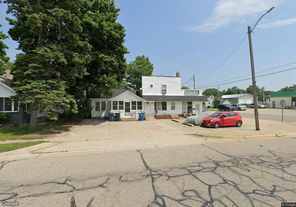
204 N Main St Wayland, MI 49348
Estimated Value: $209,583
1
Bed
1
Bath
446
Sq Ft
$470/Sq Ft
Est. Value
About This Home
This home is located at 204 N Main St, Wayland, MI 49348 and is currently estimated at $209,583, approximately $469 per square foot. 204 N Main St is a home located in Allegan County with nearby schools including Wayland High School and St. Therese Catholic School.
Ownership History
Date
Name
Owned For
Owner Type
Purchase Details
Closed on
May 20, 2022
Sold by
2-Future Llc
Bought by
Micuso Llc
Current Estimated Value
Purchase Details
Closed on
Nov 28, 2017
Sold by
Howard Peter A and Howard Marsha E
Bought by
2 Future Llc
Purchase Details
Closed on
Jan 15, 2014
Sold by
Frederick Janice K and Frederick Edward E
Bought by
Janice Kay Frederick Trust
Purchase Details
Closed on
Oct 28, 2004
Sold by
J F K Realty Co
Bought by
204 S Main Inc
Purchase Details
Closed on
Sep 30, 1996
Sold by
Lodenstein David D and Lodenstein Patricia
Bought by
Howard Peter A
Purchase Details
Closed on
Sep 1, 1996
Sold by
Lodenstein David D and Lodenstein Patricia
Bought by
Howard Peter A
Create a Home Valuation Report for This Property
The Home Valuation Report is an in-depth analysis detailing your home's value as well as a comparison with similar homes in the area
Home Values in the Area
Average Home Value in this Area
Purchase History
| Date | Buyer | Sale Price | Title Company |
|---|---|---|---|
| Micuso Llc | -- | Chicago Title | |
| 2 Future Llc | -- | None Available | |
| Janice Kay Frederick Trust | -- | None Available | |
| 204 S Main Inc | -- | -- | |
| Howard Peter A | $48,000 | -- | |
| Howard Peter A | $48,000 | -- |
Source: Public Records
Tax History Compared to Growth
Tax History
| Year | Tax Paid | Tax Assessment Tax Assessment Total Assessment is a certain percentage of the fair market value that is determined by local assessors to be the total taxable value of land and additions on the property. | Land | Improvement |
|---|---|---|---|---|
| 2025 | $3,785 | $85,600 | $18,000 | $67,600 |
| 2024 | $3,327 | $87,600 | $17,700 | $69,900 |
| 2023 | $3,327 | $57,800 | $6,000 | $51,800 |
| 2022 | $3,327 | $54,700 | $6,000 | $48,700 |
| 2021 | $3,154 | $51,800 | $6,000 | $45,800 |
| 2020 | $3,154 | $53,100 | $6,000 | $47,100 |
| 2019 | $0 | $53,100 | $6,000 | $47,100 |
| 2018 | $0 | $48,800 | $6,000 | $42,800 |
| 2017 | $0 | $52,800 | $6,000 | $46,800 |
| 2016 | $0 | $54,000 | $6,000 | $48,000 |
| 2015 | -- | $54,000 | $6,000 | $48,000 |
| 2014 | -- | $63,800 | $11,900 | $51,900 |
| 2013 | -- | $59,400 | $11,900 | $47,500 |
Source: Public Records
Map
Nearby Homes
- 212 E Superior St
- 146 Hanlon Ct
- 110 E Sycamore St
- 545 N Main St
- 621 S Main St
- 219 Alpine St
- 319 Alpine St
- 3610 Garden St
- 330 Lotz Ct
- 3570 Windsor Woods Dr
- 1143 Regina Trail
- 835 Wild Flower Ct
- 3770 Division Ave S
- 3685 Calkins Ct
- 4674 12th St
- 3282 Stonehill Ct
- 3296 Stonehill Ct
- 3897 Division St
- 3214 7th St
- 3669 Kalamazoo Dr
- 103 E Maple St
- 202 N Main St
- 202 N Main St Unit 206
- 210 N Main St
- 115 E Maple St
- 220 N Main St
- 118 E Maple St
- 125 E Maple St
- 226 N Main St
- 209 N Main St
- 129 E Maple St
- 215 N Main St
- 232 N Main St
- 223 N Main St
- 137 E Maple St
- 229 N Main St
- 236 N Main St
- 145 Forrest St Unit 147
- 135 N Main St
- 124 W Maple St