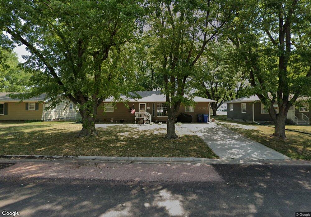
204 N Maple St Viborg, SD 57070
Estimated Value: $218,000 - $300,000
3
Beds
2
Baths
2,328
Sq Ft
$108/Sq Ft
Est. Value
About This Home
This home is located at 204 N Maple St, Viborg, SD 57070 and is currently estimated at $251,064, approximately $107 per square foot. 204 N Maple St is a home located in Turner County with nearby schools including Viborg-Hurley Elementary School, Cameron Colony Elementary School, and Viborg-Hurley Middle School.
Ownership History
Date
Name
Owned For
Owner Type
Purchase Details
Closed on
Aug 3, 2011
Sold by
Koenig Mark T and Koenig Dawn R
Bought by
Weier Kevin G and Weier Dawn
Current Estimated Value
Home Financials for this Owner
Home Financials are based on the most recent Mortgage that was taken out on this home.
Original Mortgage
$85,769
Outstanding Balance
$58,829
Interest Rate
4.37%
Mortgage Type
FHA
Estimated Equity
$192,235
Create a Home Valuation Report for This Property
The Home Valuation Report is an in-depth analysis detailing your home's value as well as a comparison with similar homes in the area
Purchase History
| Date | Buyer | Sale Price | Title Company |
|---|---|---|---|
| Weier Kevin G | -- | -- |
Source: Public Records
Mortgage History
| Date | Status | Borrower | Loan Amount |
|---|---|---|---|
| Open | Weier Kevin G | $85,769 |
Source: Public Records
Tax History
| Year | Tax Paid | Tax Assessment Tax Assessment Total Assessment is a certain percentage of the fair market value that is determined by local assessors to be the total taxable value of land and additions on the property. | Land | Improvement |
|---|---|---|---|---|
| 2025 | $3,076 | $200,866 | $11,317 | $189,549 |
| 2024 | $2,961 | $200,866 | $11,317 | $189,549 |
| 2023 | $2,625 | $200,866 | $11,317 | $189,549 |
| 2022 | $2,211 | $176,198 | $9,927 | $166,271 |
| 2021 | $2,199 | $135,537 | $7,636 | $127,901 |
| 2020 | $2,094 | $135,537 | $7,636 | $127,901 |
| 2019 | $2,078 | $124,345 | $7,005 | $117,340 |
| 2018 | $1,957 | $120,720 | $6,800 | $113,920 |
| 2017 | $1,784 | $106,410 | $4,050 | $102,360 |
| 2016 | $1,649 | $92,530 | $3,520 | $89,010 |
| 2015 | $1,649 | $77,110 | $2,935 | $74,175 |
| 2012 | -- | $103,530 | $4,080 | $99,450 |
Source: Public Records
Map
Nearby Homes
- 202 N Kemper St
- 306 N Main St
- 0 Lot 10 Block 2 Valhalla Dr Dr
- 0 Lot 10 Block 4 Viking Ave Ave Unit 22600393
- 0 N Elmwood St Unit 22507122
- 0 Lot 1a Block 3 Viking Ave Ave Unit 22600396
- 105 N Nora St
- 208 S Clark St
- 210 Clark St
- 210 S Clark
- 0 Tbd Dakota Tr 7 Ave Ave Unit 22601212
- 0 Tbd Industrial Tr 19 St St Unit 22601215
- 0 Tbd Dakota Tr 8 Ave Ave Unit 22601214
- 0 Tbd Jorgensen Tr 11 St St Unit 22601210
- 0 Tbd Jorgensen Tr 13 St St Unit 22601207
- 0 455th Ave
- 0 290th St Unit 22201045
- 101 Lakeview Dr
- 100 Bright Shores Dr Dr
- 452nd Avenue
- 202 N Maple St
- 206 N Maple St
- 200 N Maple St
- 203 N Maple St
- 205 N Maple St
- 300 W Blaine Ave
- 207 N Maple St
- 207 N Washington St
- 205 N Washington St
- 209 N Washington St
- 208 N Maple St
- 201 N Maple St
- 211 N Washington St
- 203 N Washington St
- 201 N Washington St
- 209 N Maple St
- 210 N Maple St
- 213 N Washington St
- 301 W Blaine Ave
Your Personal Tour Guide
Ask me questions while you tour the home.