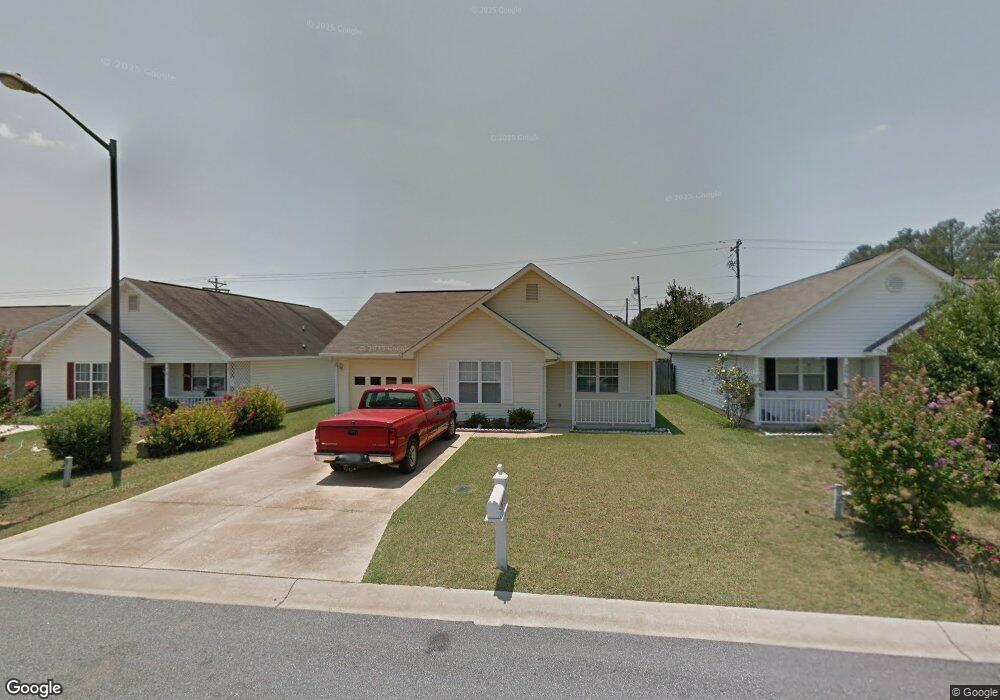
204 Nesting Way Warner Robins, GA 31093
Estimated Value: $176,000 - $188,000
2
Beds
2
Baths
1,206
Sq Ft
$151/Sq Ft
Est. Value
About This Home
This home is located at 204 Nesting Way, Warner Robins, GA 31093 and is currently estimated at $181,608, approximately $150 per square foot. 204 Nesting Way is a home located in Houston County with nearby schools including Parkwood Elementary School, Northside Middle School, and Northside High School.
Ownership History
Date
Name
Owned For
Owner Type
Purchase Details
Closed on
Jan 12, 2021
Sold by
Bush Michael L
Bought by
Hays Sonja K
Current Estimated Value
Home Financials for this Owner
Home Financials are based on the most recent Mortgage that was taken out on this home.
Original Mortgage
$112,917
Outstanding Balance
$100,779
Interest Rate
2.71%
Mortgage Type
FHA
Estimated Equity
$80,829
Purchase Details
Closed on
Sep 17, 2020
Sold by
Hampton Ellen
Bought by
Bush Michael L
Purchase Details
Closed on
Feb 15, 2002
Sold by
Bry-Mel Homes
Bought by
Hampton Ellen
Create a Home Valuation Report for This Property
The Home Valuation Report is an in-depth analysis detailing your home's value as well as a comparison with similar homes in the area
Home Values in the Area
Average Home Value in this Area
Purchase History
| Date | Buyer | Sale Price | Title Company |
|---|---|---|---|
| Hays Sonja K | $115,000 | None Available | |
| Bush Michael L | $80,000 | None Listed On Document | |
| Hampton Ellen | $78,500 | -- |
Source: Public Records
Mortgage History
| Date | Status | Borrower | Loan Amount |
|---|---|---|---|
| Open | Hays Sonja K | $112,917 |
Source: Public Records
Tax History Compared to Growth
Tax History
| Year | Tax Paid | Tax Assessment Tax Assessment Total Assessment is a certain percentage of the fair market value that is determined by local assessors to be the total taxable value of land and additions on the property. | Land | Improvement |
|---|---|---|---|---|
| 2024 | $1,826 | $57,200 | $8,000 | $49,200 |
| 2023 | $1,431 | $44,800 | $8,000 | $36,800 |
| 2022 | $847 | $38,840 | $4,800 | $34,040 |
| 2021 | $740 | $35,640 | $4,800 | $30,840 |
| 2020 | $319 | $31,960 | $4,800 | $27,160 |
| 2019 | $696 | $31,960 | $4,800 | $27,160 |
| 2018 | $696 | $31,960 | $4,800 | $27,160 |
| 2017 | $697 | $31,960 | $4,800 | $27,160 |
| 2016 | $698 | $31,960 | $4,800 | $27,160 |
| 2015 | -- | $31,960 | $4,800 | $27,160 |
| 2014 | $342 | $34,200 | $4,800 | $29,400 |
| 2013 | $342 | $34,200 | $4,800 | $29,400 |
Source: Public Records
Map
Nearby Homes
- 152 Rock Run Trail
- 131 Martin Mill Trail
- 102 Montiego Ct
- 857 Ola Dr
- 107 Galahad Dr
- 208 Pellimore Dr
- 118 Avalon Dr
- 112 Willow Glen
- 115 Wray St
- 106 Tor Dr
- 102 Pine Glen Ct
- 303 Pinecrest Dr
- 103 Persimmon Glen Ct
- 136 Scarborough Rd
- 213 Dogwood Glen
- 317 Emory Dr
- 725 B East Side Dr
- 112 Emory Dr
- 111 Red Oak Glen
- 94 Tiffany Ln
- 202 Nesting Way
- 206 Nesting Way
- 200 Nesting Way
- 0 Nesting Way
- 101 Bald Eagle Trail
- 106 Nesting Way
- 215 Golden Eagle Trail
- 103 Bald Eagle Trail
- 104 Nesting Way
- 213 Golden Eagle Trail
- 302 Golden Eagle Trail
- 228 Golden Eagle Trail
- 100 Bald Eagle Trail
- 226 Golden Eagle Trail
- 949 Carl Vinson Pkwy
- 105 Bald Eagle Trail
- 102 Nesting Way
- 211 Golden Eagle Trail
- 102 Bald Eagle Trail
- 224 Golden Eagle Trail