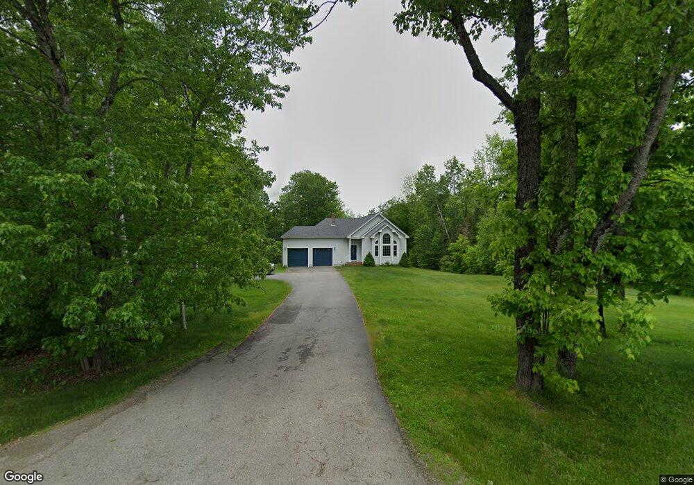
204 Patterson Hampden, ME 04444
Estimated Value: $514,000 - $580,000
3
Beds
2
Baths
2,397
Sq Ft
$226/Sq Ft
Est. Value
About This Home
This home is located at 204 Patterson, Hampden, ME 04444 and is currently estimated at $542,452, approximately $226 per square foot. 204 Patterson is a home located in Penobscot County.
Ownership History
Date
Name
Owned For
Owner Type
Purchase Details
Closed on
Aug 25, 2009
Sold by
Lindsay Gina
Bought by
Dean Charles C and Dean Martha A
Current Estimated Value
Purchase Details
Closed on
Sep 7, 2007
Sold by
Currier Tristine M
Bought by
Lindsay Gina M and Whitney Jeremy S
Home Financials for this Owner
Home Financials are based on the most recent Mortgage that was taken out on this home.
Original Mortgage
$27,200
Interest Rate
6.74%
Mortgage Type
Commercial
Create a Home Valuation Report for This Property
The Home Valuation Report is an in-depth analysis detailing your home's value as well as a comparison with similar homes in the area
Home Values in the Area
Average Home Value in this Area
Purchase History
| Date | Buyer | Sale Price | Title Company |
|---|---|---|---|
| Dean Charles C | -- | -- | |
| Lindsay Gina M | -- | -- |
Source: Public Records
Mortgage History
| Date | Status | Borrower | Loan Amount |
|---|---|---|---|
| Open | Lindsay Gina M | $265,170 | |
| Closed | Lindsay Gina M | $243,000 | |
| Previous Owner | Lindsay Gina M | $27,200 |
Source: Public Records
Tax History Compared to Growth
Tax History
| Year | Tax Paid | Tax Assessment Tax Assessment Total Assessment is a certain percentage of the fair market value that is determined by local assessors to be the total taxable value of land and additions on the property. | Land | Improvement |
|---|---|---|---|---|
| 2024 | $6,418 | $410,100 | $63,300 | $346,800 |
| 2023 | $6,464 | $335,800 | $51,900 | $283,900 |
| 2022 | $5,641 | $272,500 | $42,300 | $230,200 |
| 2021 | $5,641 | $272,500 | $42,300 | $230,200 |
| 2020 | $5,559 | $272,500 | $42,300 | $230,200 |
| 2019 | $5,412 | $265,300 | $41,100 | $224,200 |
| 2018 | $5,200 | $265,300 | $41,100 | $224,200 |
| 2017 | $4,882 | $265,300 | $41,100 | $224,200 |
| 2016 | $4,823 | $265,000 | $41,000 | $224,000 |
| 2015 | $4,638 | $265,000 | $41,000 | $224,000 |
| 2014 | $4,643 | $265,300 | $41,100 | $224,200 |
| 2013 | $4,417 | $265,300 | $41,100 | $224,200 |
Source: Public Records
Map
Nearby Homes
- 0 Rt 1a (Honey Hill Estates) Unit Lot 2
- 0 Rt 1a (Honey Hill Estates) Unit Lot 19
- 0 Rt 1a (Honey Hill Estates) Unit Lot 10
- 0 Rt 1a (Honey Hill Estates) Unit Lot 7
- 302 Canaan Rd
- 22 Meadow Rd
- 23 Ichabod Ln
- 00 Meadow Rd
- 9 Patterson Rd
- Lot 25 Canaan Rd
- 692 Kennebec Rd
- 778 Kennebec Rd
- 59 Patterson Rd
- 829 Kennebec Rd
- 179 Monroe Rd
- Lot 65 Freedom Ave
- 594 Western Ave
- TBD Western Ave
- 514 Meadow Rd
- 45 Hughes Blvd
- 208 Patterson Rd
- 220 Patterson Rd
- 200 Patterson Rd
- 203 Patterson Rd
- 192 Patterson Rd
- 201 Patterson Rd
- 199 Patterson Rd
- 213 Patterson Rd
- 193 Patterson Rd
- 188 Patterson Rd
- 184 Patterson Rd
- 180 Patterson Rd
- 189 Patterson Rd
- Lot 6 Graystone Dr
- 384 Canaan Rd
- 181 Patterson Rd
- 178 Patterson Rd
- 171 Patterson Rd
- 0000 Meadow Rd
- 165 Patterson Rd