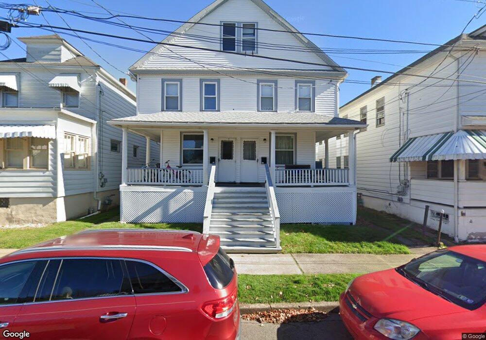
204 Phillip St Nanticoke, PA 18634
Estimated Value: $156,000 - $250,000
--
Bed
--
Bath
2,584
Sq Ft
$74/Sq Ft
Est. Value
About This Home
This home is located at 204 Phillip St, Nanticoke, PA 18634 and is currently estimated at $192,353, approximately $74 per square foot. 204 Phillip St is a home located in Luzerne County with nearby schools including Kennedy Early Childhood Center, Nanticoke Area Elementary Center Center, and Greater Nanticoke Area Senior High School.
Ownership History
Date
Name
Owned For
Owner Type
Purchase Details
Closed on
Mar 2, 2021
Sold by
Mcclain Michael and Catalano Mcclain Gloria
Bought by
Mcclain Michael
Current Estimated Value
Home Financials for this Owner
Home Financials are based on the most recent Mortgage that was taken out on this home.
Original Mortgage
$52,635
Outstanding Balance
$47,342
Interest Rate
2.9%
Mortgage Type
FHA
Estimated Equity
$145,011
Purchase Details
Closed on
May 8, 2006
Sold by
Jp Morgan Chase Bank
Bought by
Mcclain Michael and Mcclain Gloria Catalano
Create a Home Valuation Report for This Property
The Home Valuation Report is an in-depth analysis detailing your home's value as well as a comparison with similar homes in the area
Home Values in the Area
Average Home Value in this Area
Purchase History
| Date | Buyer | Sale Price | Title Company |
|---|---|---|---|
| Mcclain Michael | -- | Accommodation | |
| Mcclain Michael | $45,500 | None Available |
Source: Public Records
Mortgage History
| Date | Status | Borrower | Loan Amount |
|---|---|---|---|
| Open | Mcclain Michael | $52,635 |
Source: Public Records
Tax History Compared to Growth
Tax History
| Year | Tax Paid | Tax Assessment Tax Assessment Total Assessment is a certain percentage of the fair market value that is determined by local assessors to be the total taxable value of land and additions on the property. | Land | Improvement |
|---|---|---|---|---|
| 2025 | $2,017 | $77,300 | $20,900 | $56,400 |
| 2024 | $2,017 | $77,300 | $20,900 | $56,400 |
| 2023 | $1,989 | $77,300 | $20,900 | $56,400 |
| 2022 | $1,897 | $77,300 | $20,900 | $56,400 |
| 2021 | $1,856 | $77,300 | $20,900 | $56,400 |
| 2020 | $1,856 | $77,300 | $20,900 | $56,400 |
| 2019 | $1,841 | $77,300 | $20,900 | $56,400 |
| 2018 | $1,809 | $77,300 | $20,900 | $56,400 |
| 2017 | $1,776 | $77,300 | $20,900 | $56,400 |
| 2016 | $856 | $77,300 | $20,900 | $56,400 |
| 2015 | -- | $77,300 | $20,900 | $56,400 |
| 2014 | -- | $77,300 | $20,900 | $56,400 |
Source: Public Records
Map
Nearby Homes
- 138 Espy St
- 25 Cherry Dr
- 0 Middle Rd
- 418 E Washington St
- 416 E Washington St
- 246 E Washington St
- 65 W South St
- 0 Enterprise St
- 257 E Ridge St
- 24 Varsity Dr
- 23 Varsity Dr
- 22 Varsity Dr
- 21 Brian Place
- 20 Brian Place
- Lot 16 Tomko Ave
- Lot 18 Tomko Ave
- 44.16 Tomko Ave
- 44.16 Acre Tomko Ave
- 34.03 Acre Tomko Ave
- 10.13 Acre Tomko Ave
- 208 Phillip St
- 204 Phillips St
- 204 Phillips St
- 208-1/2 Phillips St
- 202 Phillip St
- 210 Phillips St
- 208 1/2 Phillip St
- 210 Phillip St
- 150 Phillip St
- 216 Phillip St
- 203-205 Phillips St
- 148 Phillip St
- 220 Phillip St
- 205 Mosier St
- 207 Mosier St
- 146 Phillip St
- 201 Mosier St
- 149 Phillip St
- 211 Mosier St
- 203 Phillip St