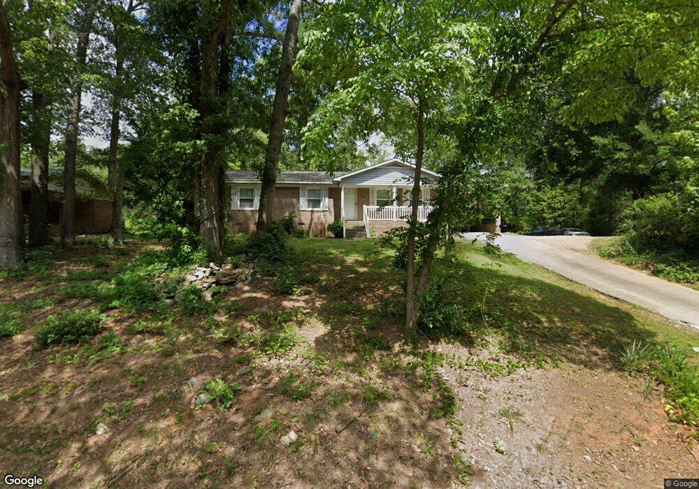
204 Rock St Lancaster, SC 29720
Estimated Value: $106,000 - $209,000
About This Home
This home is located at 204 Rock St, Lancaster, SC 29720 and is currently estimated at $164,594, approximately $131 per square foot. 204 Rock St is a home located in Lancaster County with nearby schools including Clinton Elementary School, Buford Middle School, and Lancaster High School.
Ownership History
We collect this data history from publicly available records. To have your information removed, we recommend requesting removal directly through your county’s website.
Purchase Details
Purchase Details
Purchase Details
Home Values in the Area
Average Home Value in this Area
Purchase History
We collect this data history from publicly available records. To have your information removed, we recommend requesting removal directly through your county’s website.
| Date | Buyer | Sale Price | Title Company |
|---|---|---|---|
| $27,500 | -- | ||
| $20,000 | -- | ||
| $2,500 | -- |
Mortgage History
We collect this data history from publicly available records. To have your information removed, we recommend requesting removal directly through your county’s website.
| Date | Status | Borrower | Loan Amount |
|---|---|---|---|
| Closed | $52,000 |
Tax History
We collect this data history from publicly available records. To have your information removed, we recommend requesting removal directly through your county’s website.
| Year | Tax Paid | Tax Assessment Tax Assessment Total Assessment is a certain percentage of the fair market value that is determined by local assessors to be the total taxable value of land and additions on the property. | Land | Improvement |
|---|---|---|---|---|
| 2025 | $1,467 | $3,415 | $291 | $3,124 |
| 2024 | $1,299 | $2,970 | $462 | $2,508 |
| 2023 | $1,324 | $2,970 | $462 | $2,508 |
| 2022 | $1,326 | $2,970 | $462 | $2,508 |
| 2021 | $1,309 | $2,970 | $462 | $2,508 |
| 2020 | $1,235 | $2,832 | $462 | $2,370 |
| 2019 | $1,446 | $2,832 | $462 | $2,370 |
| 2018 | $921 | $2,832 | $462 | $2,370 |
| 2017 | $1,157 | $0 | $0 | $0 |
| 2016 | $1,163 | $0 | $0 | $0 |
| 2015 | $1,415 | $0 | $0 | $0 |
| 2014 | $1,415 | $0 | $0 | $0 |
| 2013 | $1,415 | $0 | $0 | $0 |
Map
- 829 E Arch St
- 825 E Arch St
- 801 Calhoun St
- 000 E Arch St
- 308 Kershaw St
- 705 Sumter St
- 108 Marion St
- 802 Chesterfield Ave
- 1105 Marion St
- 711 Chesterfield Ave
- 504 Chesterfield Ave
- 111 Magnolia Ln
- 1208 E Arch St
- 6327 Witherspoon
- 00 Pageland Hwy
- 000 Pageland Hwy
- 5496 Pageland Hwy
- Lot C Camp Creek Rd
- A3 Camp Creek Rd Unit Parcel A3
- Lot D Camp Creek Rd
Ask me questions while you tour the home.