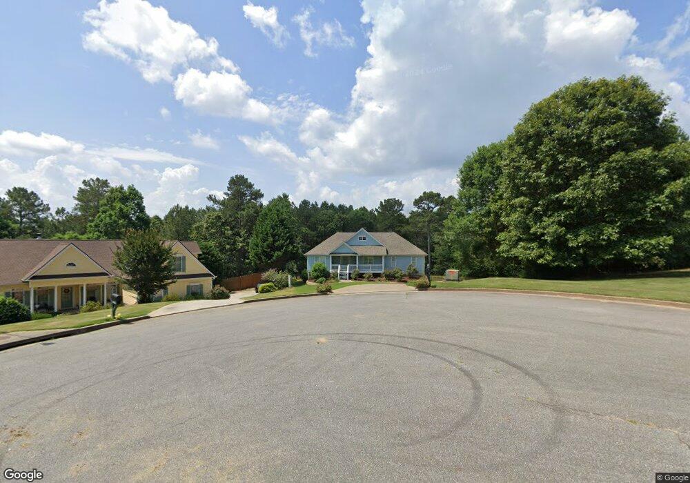
204 Rushmore Way Canton, GA 30114
Sutallee NeighborhoodEstimated Value: $519,127 - $614,000
3
Beds
3
Baths
2,713
Sq Ft
$209/Sq Ft
Est. Value
About This Home
This home is located at 204 Rushmore Way, Canton, GA 30114 and is currently estimated at $566,564, approximately $208 per square foot. 204 Rushmore Way is a home located in Cherokee County with nearby schools including J. Knox Elementary School, Teasley Middle School, and Cherokee High School.
Ownership History
Date
Name
Owned For
Owner Type
Purchase Details
Closed on
Nov 29, 2004
Sold by
Bresnahan John F
Bought by
Bresnahan John F and Bresnahan Yasar
Current Estimated Value
Home Financials for this Owner
Home Financials are based on the most recent Mortgage that was taken out on this home.
Original Mortgage
$141,900
Interest Rate
4.97%
Mortgage Type
New Conventional
Create a Home Valuation Report for This Property
The Home Valuation Report is an in-depth analysis detailing your home's value as well as a comparison with similar homes in the area
Home Values in the Area
Average Home Value in this Area
Purchase History
| Date | Buyer | Sale Price | Title Company |
|---|---|---|---|
| Bresnahan John F | -- | -- | |
| Bresnahan John F | $242,900 | -- |
Source: Public Records
Mortgage History
| Date | Status | Borrower | Loan Amount |
|---|---|---|---|
| Closed | Bresnahan John F | $141,900 |
Source: Public Records
Tax History Compared to Growth
Tax History
| Year | Tax Paid | Tax Assessment Tax Assessment Total Assessment is a certain percentage of the fair market value that is determined by local assessors to be the total taxable value of land and additions on the property. | Land | Improvement |
|---|---|---|---|---|
| 2025 | $1,057 | $185,480 | $40,000 | $145,480 |
| 2024 | $1,024 | $183,600 | $40,000 | $143,600 |
| 2023 | $896 | $186,960 | $40,000 | $146,960 |
| 2022 | $963 | $150,240 | $40,000 | $110,240 |
| 2021 | $951 | $125,920 | $26,000 | $99,920 |
| 2020 | $918 | $116,160 | $24,000 | $92,160 |
| 2019 | $878 | $105,560 | $24,000 | $81,560 |
| 2018 | $2,878 | $104,200 | $24,000 | $80,200 |
| 2017 | $2,656 | $236,100 | $24,000 | $70,440 |
| 2016 | $2,623 | $231,000 | $21,600 | $70,800 |
| 2015 | $2,597 | $226,600 | $21,600 | $69,040 |
| 2014 | $2,323 | $202,900 | $16,600 | $64,560 |
Source: Public Records
Map
Nearby Homes
- 133 Sweetwater Creek Trail
- 551 Harvey Fields Rd
- 204 Red Fox Ct
- 919 Fields Chapel Rd
- 327 Red Fox Dr
- 285 Fields Chapel Rd
- 402 Eileen Cir
- 328 Allatoona Shores Dr
- 829 Valley Dr
- 711 Tall Oaks Dr
- 834 Valley Dr Unit 1K
- 3018 Heatherbrook Trace
- 3021 Heatherbrook Trace
- 301 Dogwood Heights
- 164 Henley St
- 160 Henley St Unit 15
- 160 Henley St
- 552 Steels Bridge Rd
- Jasper II Plan at Cambridge at Steels Bridge
- Newton II Plan at Cambridge at Steels Bridge
- 202 Rushmore Way
- 206 Rushmore Way
- 131 Sweetwater Creek Trail
- 200 Rushmore Way
- 205 Rushmore Way
- 301 Sheridan Place
- 203 Rushmore Way
- 201 Rushmore Way
- 130 Sweetwater Creek Trail
- 0 Sweetwater Creel Dr Unit 3159225
- 128 Sweetwater Creek Trail
- 135 Sweetwater Creek Trail
- 125 Sweetwater Creek Trail
- 134 Sweetwater Creek Trail
- 126 Sweetwater Creek Trail
- 302 Sheridan Place
- 1398 Fields Chapel Rd
- 303 Sheridan Place
- 137 Sweetwater Creek Trail
- 304 Sheridan Place