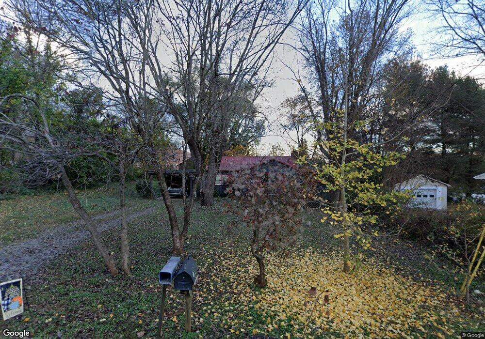
204 S Matthews St Morganton, NC 28655
Estimated Value: $183,000 - $231,000
3
Beds
1
Bath
1,333
Sq Ft
$159/Sq Ft
Est. Value
About This Home
This home is located at 204 S Matthews St, Morganton, NC 28655 and is currently estimated at $212,378, approximately $159 per square foot. 204 S Matthews St is a home located in Burke County with nearby schools including Forest Hill Elementary School, Liberty Middle School, and Robert L. Patton High School.
Ownership History
Date
Name
Owned For
Owner Type
Purchase Details
Closed on
Dec 20, 2017
Sold by
Barrier Michael Dale and Barrier Patricia
Bought by
Barrier Jennifer Nicole
Current Estimated Value
Home Financials for this Owner
Home Financials are based on the most recent Mortgage that was taken out on this home.
Original Mortgage
$80,000
Interest Rate
3.9%
Mortgage Type
New Conventional
Purchase Details
Closed on
Apr 14, 2014
Sold by
Barrier Sybil P
Bought by
Barrier Michael Dale and Barrier Timothy Brian
Create a Home Valuation Report for This Property
The Home Valuation Report is an in-depth analysis detailing your home's value as well as a comparison with similar homes in the area
Home Values in the Area
Average Home Value in this Area
Purchase History
| Date | Buyer | Sale Price | Title Company |
|---|---|---|---|
| Barrier Jennifer Nicole | $80,000 | None Available | |
| Barrier Michael Dale | -- | None Available |
Source: Public Records
Mortgage History
| Date | Status | Borrower | Loan Amount |
|---|---|---|---|
| Closed | Barrier Jennifer Nicole | $80,000 |
Source: Public Records
Tax History Compared to Growth
Tax History
| Year | Tax Paid | Tax Assessment Tax Assessment Total Assessment is a certain percentage of the fair market value that is determined by local assessors to be the total taxable value of land and additions on the property. | Land | Improvement |
|---|---|---|---|---|
| 2025 | $838 | $133,545 | $14,410 | $119,135 |
| 2024 | $841 | $133,545 | $14,410 | $119,135 |
| 2023 | $836 | $133,545 | $14,410 | $119,135 |
| 2022 | $661 | $83,341 | $11,000 | $72,341 |
| 2021 | $655 | $83,341 | $11,000 | $72,341 |
| 2020 | $651 | $83,341 | $11,000 | $72,341 |
| 2019 | $651 | $83,341 | $11,000 | $72,341 |
| 2018 | $644 | $82,340 | $11,000 | $71,340 |
| 2017 | $642 | $82,344 | $11,000 | $71,344 |
| 2016 | $625 | $82,344 | $11,000 | $71,344 |
| 2015 | $619 | $82,344 | $11,000 | $71,344 |
| 2014 | $617 | $81,871 | $10,500 | $71,371 |
| 2013 | $617 | $81,871 | $10,500 | $71,371 |
Source: Public Records
Map
Nearby Homes
- 108 Logan St Unit 110
- 107 Dale Cir
- 107 N Matthews St
- VL Blvd
- 207 Stacy St
- 0 Coal Shute Rd Unit CAR3935533
- 107 Oakwood St
- 0 Coffey St
- Lot 2 Lane St Unit 2
- Lot 5 Lane St Unit 5
- Lot 6 Lane St Unit 6
- Lot 4 Lane St Unit 4
- Lot 3 Lane St Unit 3
- 421 Bethel Rd
- 103 Ramsey St
- 6 Lane St Unit 6
- 106 Rebel Run
- 805 Old Nc 18 Hwy
- 00000 Knollwood Dr
- 0 Hopewell Rd Unit CAR4310549
- 202 S Matthews St
- 203 S Matthews St
- 200 S Matthews St
- 205 Old Nc 18
- 102 Logan St
- 104 Logan St
- 203 Old Nc 18
- 102 Shady Rest Rd
- 101 Dale Cir
- 201 S Matthews St
- 106 Logan St
- 100 Shady Rest Rd
- 200 Shady Rest Rd
- 103 Dale Cir
- 109 Logan St
- 101B Shady Rest Rd
- 101A Shady Rest Rd
- 101A Shady Rest Rd
- 101 Shady Rest Rd
- 101 Shady Rest Rd Unit A&B