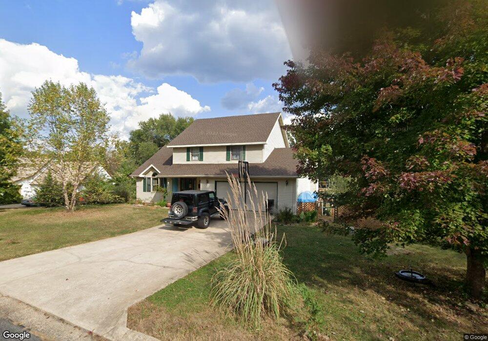
204 Tremont Dr Waynesville, MO 65583
Estimated Value: $274,000 - $312,000
4
Beds
4
Baths
3,702
Sq Ft
$79/Sq Ft
Est. Value
About This Home
This home is located at 204 Tremont Dr, Waynesville, MO 65583 and is currently estimated at $293,204, approximately $79 per square foot. 204 Tremont Dr is a home located in Pulaski County with nearby schools including Waynesville East Elementary School, Freedom Elementary School, and Waynesville Middle School.
Ownership History
Date
Name
Owned For
Owner Type
Purchase Details
Closed on
Mar 24, 2014
Sold by
Romae Marie Romae Marie
Bought by
Araud Luis G
Current Estimated Value
Home Financials for this Owner
Home Financials are based on the most recent Mortgage that was taken out on this home.
Original Mortgage
$155,759
Outstanding Balance
$118,373
Interest Rate
4.41%
Mortgage Type
New Conventional
Estimated Equity
$174,831
Create a Home Valuation Report for This Property
The Home Valuation Report is an in-depth analysis detailing your home's value as well as a comparison with similar homes in the area
Home Values in the Area
Average Home Value in this Area
Purchase History
| Date | Buyer | Sale Price | Title Company |
|---|---|---|---|
| Araud Luis G | -- | -- |
Source: Public Records
Mortgage History
| Date | Status | Borrower | Loan Amount |
|---|---|---|---|
| Open | Araud Luis G | $155,759 |
Source: Public Records
Tax History Compared to Growth
Tax History
| Year | Tax Paid | Tax Assessment Tax Assessment Total Assessment is a certain percentage of the fair market value that is determined by local assessors to be the total taxable value of land and additions on the property. | Land | Improvement |
|---|---|---|---|---|
| 2024 | $1,583 | $37,433 | $5,852 | $31,581 |
| 2023 | $1,545 | $37,433 | $5,852 | $31,581 |
| 2022 | $1,534 | $37,433 | $5,852 | $31,581 |
| 2021 | $1,517 | $37,433 | $5,852 | $31,581 |
| 2020 | $1,488 | $31,498 | $0 | $0 |
| 2019 | $1,487 | $35,929 | $0 | $0 |
| 2018 | $1,486 | $35,929 | $0 | $0 |
| 2017 | $1,468 | $31,498 | $0 | $0 |
| 2016 | $1,396 | $35,930 | $0 | $0 |
| 2015 | -- | $35,930 | $0 | $0 |
| 2014 | $1,369 | $35,930 | $0 | $0 |
Source: Public Records
Map
Nearby Homes
- 307 Ellis Ave
- 212 Tremont Dr
- 312 Summit Ave
- 0 Lot 1 Westwinds S D
- 100 S Newport Ln
- 107 Hull Dr
- 103 S Newport Ln
- 1201 Hull Valley Dr
- 412 Fleetwood Dr
- 123 Hull Dr
- 107 Tiger St
- 0 El Loma St
- 1802 Pearson St
- 8 Nathan St
- 602 Sunset Dr
- 600 Sunset Dr
- 101 Ridge Ct
- 000 Discovery Dr
- 114 Pioneer Ct
- 104 Story St
- 206 Tremont Dr
- 209 Summit Ave
- 205 Summit Ave
- 211 Summit Ave
- 205 Tremont Dr
- 213 Summit Ave
- 201 Summit Ave
- 208 Tremont Dr
- 215 Summit Ave
- 105 Summit Ave
- 202 Summit Ave
- 204 Lafayette Cir
- 200 Summit Ave
- 210 Tremont Dr
- 206 Lafayette Cir
- 204 Summit Ave
- 1212 Home Ave
- 217 Summit Ave
- 206 Summit Ave
- 103 Summit Ave