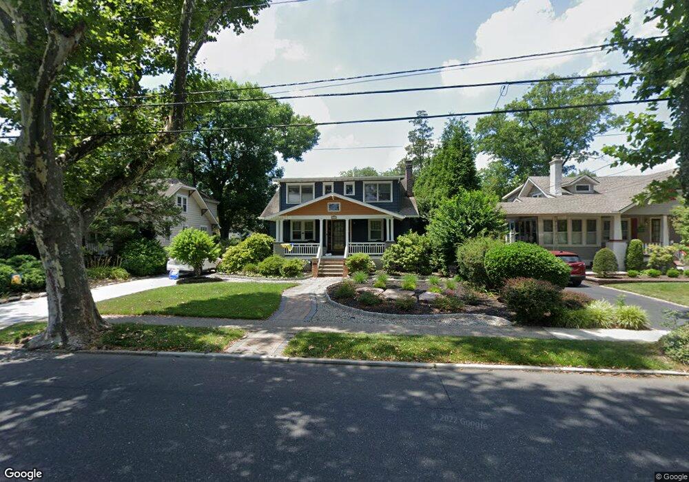
204 W Browning Rd Collingswood, NJ 08108
Estimated Value: $640,000 - $822,000
--
Bed
--
Bath
2,318
Sq Ft
$314/Sq Ft
Est. Value
About This Home
This home is located at 204 W Browning Rd, Collingswood, NJ 08108 and is currently estimated at $728,509, approximately $314 per square foot. 204 W Browning Rd is a home located in Camden County with nearby schools including Mark Newbie Elementary School, Collingswood Middle School, and Collingswood High School.
Ownership History
Date
Name
Owned For
Owner Type
Purchase Details
Closed on
Jul 11, 2024
Sold by
Roof Robert E and Roof Hillary Bass
Bought by
Cruz David and Cruz Amanda
Current Estimated Value
Home Financials for this Owner
Home Financials are based on the most recent Mortgage that was taken out on this home.
Original Mortgage
$684,000
Outstanding Balance
$674,536
Interest Rate
6.95%
Mortgage Type
New Conventional
Estimated Equity
$53,973
Create a Home Valuation Report for This Property
The Home Valuation Report is an in-depth analysis detailing your home's value as well as a comparison with similar homes in the area
Home Values in the Area
Average Home Value in this Area
Purchase History
| Date | Buyer | Sale Price | Title Company |
|---|---|---|---|
| Cruz David | $720,000 | Velocity Title | |
| Cruz David | $720,000 | Velocity Title |
Source: Public Records
Mortgage History
| Date | Status | Borrower | Loan Amount |
|---|---|---|---|
| Open | Cruz David | $684,000 | |
| Closed | Cruz David | $684,000 |
Source: Public Records
Tax History Compared to Growth
Tax History
| Year | Tax Paid | Tax Assessment Tax Assessment Total Assessment is a certain percentage of the fair market value that is determined by local assessors to be the total taxable value of land and additions on the property. | Land | Improvement |
|---|---|---|---|---|
| 2025 | $13,127 | $687,100 | $215,700 | $471,400 |
| 2024 | $12,934 | $338,400 | $128,800 | $209,600 |
| 2023 | $12,934 | $338,400 | $128,800 | $209,600 |
| 2022 | $12,612 | $338,400 | $128,800 | $209,600 |
| 2021 | $12,423 | $338,400 | $128,800 | $209,600 |
| 2020 | $12,135 | $338,400 | $128,800 | $209,600 |
| 2019 | $11,871 | $338,400 | $128,800 | $209,600 |
| 2018 | $11,756 | $338,400 | $128,800 | $209,600 |
| 2017 | $11,600 | $338,400 | $128,800 | $209,600 |
| 2016 | $11,299 | $338,400 | $128,800 | $209,600 |
| 2015 | $10,964 | $338,400 | $128,800 | $209,600 |
| 2014 | $10,660 | $338,400 | $128,800 | $209,600 |
Source: Public Records
Map
Nearby Homes
- 345 Park Ave
- 416 Virginia Ave
- 512 Jessamine Ave
- 272 Haddon Ave
- 236 White Horse Pike
- 221 Richey Ave
- 425 Park Ave
- 112 E Franklin Ave
- 232 Richey Ave
- 306 Richey Ave
- 38 W Crescent Blvd
- 429 Park Ave
- 14 Bellevue Terrace
- 705 W Browning Rd
- 705 Grant Ave
- 508 Richey Ave
- 504 Richey Ave
- 6 Allen Ln
- 339 Comly Ave
- 124 Crestmont Terrace
- 204 Browning Rd
- 206 W Browning Rd
- 202 W Browning Rd
- 206 Browning Rd
- 208 W Browning Rd
- 200 W Browning Rd
- 325 Virginia Ave
- 323 Virginia Ave
- 284 Park Ave
- 329 Virginia Ave
- 321 Virginia Ave
- 331 Virginia Ave
- 210 Browning Rd
- 210 W Browning Rd
- 333 Virginia Ave
- 317 Virginia Ave
- 276 Park Ave
- 335 Virginia Ave
- 212 W Browning Rd
- 127 W Browning Rd