Studio
--
Bath
11,000
Sq Ft
1.38
Acres Lot
About This Home
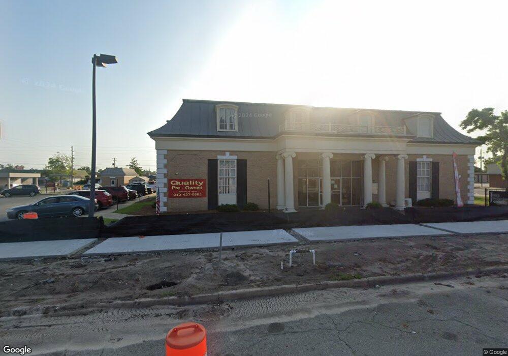
This home is located at 204 W Cherry St, Jesup, GA 31545. 204 W Cherry St is a home located in Wayne County with nearby schools including Martha Rawls Smith Elementary School, Arthur Williams Middle School, and Wayne County High School.
Ownership History
Date
Name
Owned For
Owner Type
Purchase Details
Closed on
Apr 9, 2013
Sold by
Ghm Cherry Street Property
Bought by
Ghm Real Estate & Development
Purchase Details
Closed on
May 30, 2008
Sold by
First Fin Jesup Llc
Bought by
Ghm Cherry Street Property Llc
Purchase Details
Closed on
Jul 19, 2007
Sold by
First States Investors 520
Bought by
American Financial Trust Inc
Purchase Details
Closed on
Oct 1, 2004
Create a Home Valuation Report for This Property
The Home Valuation Report is an in-depth analysis detailing your home's value as well as a comparison with similar homes in the area
Purchase History
We collect this data history from publicly available records. To have your information removed, we recommend requesting removal directly through your county’s website.
| Date | Buyer | Sale Price | Title Company |
|---|---|---|---|
| Ghm Real Estate & Development | -- | -- | |
| Ghm Cherry Street Property Llc | $665,000 | -- | |
| American Financial Trust Inc | -- | -- | |
| -- | $569,200 | -- |
Source: Public Records
Tax History
| Year | Tax Paid | Tax Assessment Tax Assessment Total Assessment is a certain percentage of the fair market value that is determined by local assessors to be the total taxable value of land and additions on the property. | Land | Improvement |
|---|---|---|---|---|
| 2025 | $9,616 | $304,734 | $53,602 | $251,132 |
| 2024 | $8,968 | $293,233 | $53,602 | $239,631 |
| 2023 | $10,307 | $291,374 | $53,602 | $237,772 |
| 2022 | $8,528 | $270,877 | $53,602 | $217,275 |
| 2021 | $6,947 | $206,035 | $53,280 | $152,755 |
| 2020 | $7,188 | $206,035 | $53,280 | $152,755 |
| 2019 | $7,401 | $206,035 | $53,280 | $152,755 |
| 2018 | $10,253 | $285,412 | $53,280 | $232,132 |
| 2017 | $8,826 | $285,412 | $53,280 | $232,132 |
| 2016 | $8,540 | $285,412 | $53,280 | $232,132 |
| 2013 | -- | $285,412 | $53,280 | $232,132 |
Source: Public Records
Map
Nearby Homes
- 00 84 Hwy
- 180 S Macon St
- 98 Bream Dr
- Lot 12 Moss Landing
- 104 Mangrove Ct
- 102 Mangrove Ct
- 110 Mangrove Ct
- Lot 13 Moss Landing
- 187 E Pine St
- 0 N 4th St Unit 2000151
- 0 N 4th St Unit 166837
- 0 N 4th St Unit 10697567
- 356 N 4th St
- 356 N Fourth St
- 286 S Wayne St
- 436-441 Brunswick St
- 498 NE Broad St
- 0 N 3rd Ln
- 447 NE Broad St
- 342 E Bay St
- 161 N Macon St
- 247 W Walnut St
- 146 S Macon St
- 167 W Cherry St
- West Cherry St
- 150 S Macon St
- 169 W Cherry St
- 30.8 U S Highway 84 E
- 0 US Hwy 301 S Unit 17749
- 12 W Kenny Dr
- 351 Thurman Loop
- Tract 2 Loganberry Ln
- 00 Us Hwy 301
- N/A N A
- Lot 478 N A
- 0 Bunion Dr
- Lot 33 Jamie's Way
- 186 S Macon St
- 141 S 1st St
- 153 W Walnut St
Your Personal Tour Guide
Ask me questions while you tour the home.