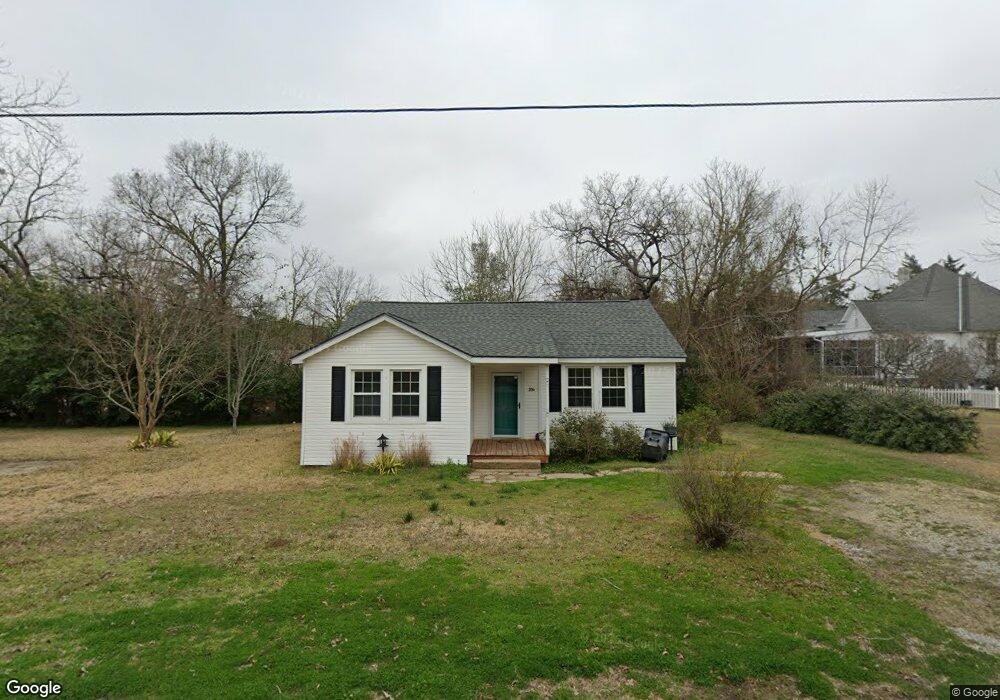
204 W Decatur St Demopolis, AL 36732
Estimated Value: $74,243 - $143,000
Studio
--
Bath
1,077
Sq Ft
$102/Sq Ft
Est. Value
About This Home
This home is located at 204 W Decatur St, Demopolis, AL 36732 and is currently estimated at $110,311, approximately $102 per square foot. 204 W Decatur St is a home located in Marengo County with nearby schools including Westside Elementary School, U.S. Jones Elementary School, and Demopolis Middle School.
Ownership History
Date
Name
Owned For
Owner Type
Purchase Details
Closed on
Oct 19, 2020
Sold by
Phillips Connie Lorraine
Bought by
Harbin Lorraine
Current Estimated Value
Purchase Details
Closed on
Jul 15, 2016
Sold by
Grant Stephen
Bought by
Phillips Connie Lorraine
Purchase Details
Closed on
Apr 11, 2014
Sold by
Mckinney Katherine A
Bought by
Grant Stephen C and Grant Christi J
Home Financials for this Owner
Home Financials are based on the most recent Mortgage that was taken out on this home.
Original Mortgage
$62,742
Interest Rate
4.37%
Mortgage Type
FHA
Create a Home Valuation Report for This Property
The Home Valuation Report is an in-depth analysis detailing your home's value as well as a comparison with similar homes in the area
Home Values in the Area
Average Home Value in this Area
Purchase History
We collect this data history from publicly available records. To have your information removed, we recommend requesting removal directly through your county’s website.
| Date | Buyer | Sale Price | Title Company |
|---|---|---|---|
| Harbin Lorraine | $81,500 | -- | |
| Phillips Connie Lorraine | -- | None Available | |
| Grant Stephen C | $63,900 | -- |
Source: Public Records
Mortgage History
We collect this data history from publicly available records. To have your information removed, we recommend requesting removal directly through your county’s website.
| Date | Status | Borrower | Loan Amount |
|---|---|---|---|
| Previous Owner | Grant Stephen C | $62,742 |
Source: Public Records
Tax History
| Year | Tax Paid | Tax Assessment Tax Assessment Total Assessment is a certain percentage of the fair market value that is determined by local assessors to be the total taxable value of land and additions on the property. | Land | Improvement |
|---|---|---|---|---|
| 2025 | $370 | $7,580 | $1,140 | $6,440 |
| 2024 | $370 | $7,580 | $1,140 | $6,440 |
| 2023 | $370 | $7,300 | $0 | $0 |
| 2022 | $323 | $6,740 | $0 | $0 |
| 2021 | $317 | $6,640 | $1,140 | $5,500 |
| 2020 | $292 | $6,200 | $1,140 | $5,060 |
| 2019 | $276 | $6,200 | $1,140 | $5,060 |
| 2018 | $276 | $6,200 | $1,140 | $5,060 |
| 2017 | $255 | $5,800 | $1,140 | $4,660 |
| 2016 | $186 | $4,500 | $1,140 | $3,360 |
| 2015 | $186 | $0 | $0 | $0 |
| 2014 | $236 | $0 | $0 | $0 |
| 2013 | $225 | $0 | $0 | $0 |
Source: Public Records
Map
Nearby Homes
- 500 S Main Ave Unit S
- 210 S Chestnut Ave
- 205 S Ash Ave
- 306 N Ash Ave
- 1006 S Commissioners Ave
- 800 Arcola Rd
- 0 U S 80 Unit 20102631
- 00 Forest Brook
- County Highway 21
- 0000 Creekside Ln
- 1805 Cypress Cove Rd
- 0 Highway 80
- 721 Cypress Cove
- 0 River Ranch Rd
- 5469 County Road 19
- 482 Sandpiper Dr
- 480 Sandpiper Dr
- 476 Bailey Dr
- 104 Candys Landing Rd
- Lot 21 Judge Greene Place Rd
- 211 S Commissioners Ave
- 209 S Commissioners Ave
- 206 S Main Ave
- 207 W Decatur St
- 209 W Decatur St
- 200 S Main Ave
- 300 S Main Ave
- 301 W Decatur St
- 302 S Main Ave
- 305 S Commissioners Ave
- 306 W Decatur St
- 303 W Decatur St
- 306 N Commissioners Ave
- 310 S Main Ave
- 310 S Main Ave
- 209 S Main Ave
- 300 W Perry St
- 211 S Main Ave
- 304 W Perry St
- 301 S Main Ave
Your Personal Tour Guide
Ask me questions while you tour the home.