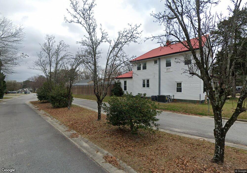
204 W Robinson Ave Grovetown, GA 30813
Estimated Value: $242,000 - $297,000
3
Beds
2
Baths
2,250
Sq Ft
$115/Sq Ft
Est. Value
About This Home
This home is located at 204 W Robinson Ave, Grovetown, GA 30813 and is currently estimated at $258,969, approximately $115 per square foot. 204 W Robinson Ave is a home located in Columbia County with nearby schools including Grovetown Elementary School, Grovetown Middle School, and Grovetown High School.
Ownership History
Date
Name
Owned For
Owner Type
Purchase Details
Closed on
Sep 20, 2021
Sold by
Coleman Stephanie N
Bought by
Brazell Stephanie N and Brazell Christopher J
Current Estimated Value
Purchase Details
Closed on
Dec 19, 2005
Sold by
Michael D Tomberlin Holdings Lllp
Bought by
Withrow Michael T
Home Financials for this Owner
Home Financials are based on the most recent Mortgage that was taken out on this home.
Original Mortgage
$146,074
Interest Rate
6.28%
Mortgage Type
VA
Create a Home Valuation Report for This Property
The Home Valuation Report is an in-depth analysis detailing your home's value as well as a comparison with similar homes in the area
Home Values in the Area
Average Home Value in this Area
Purchase History
| Date | Buyer | Sale Price | Title Company |
|---|---|---|---|
| Brazell Stephanie N | -- | -- | |
| Withrow Michael T | $143,000 | -- |
Source: Public Records
Mortgage History
| Date | Status | Borrower | Loan Amount |
|---|---|---|---|
| Previous Owner | Withrow Michael T | $146,074 |
Source: Public Records
Tax History Compared to Growth
Tax History
| Year | Tax Paid | Tax Assessment Tax Assessment Total Assessment is a certain percentage of the fair market value that is determined by local assessors to be the total taxable value of land and additions on the property. | Land | Improvement |
|---|---|---|---|---|
| 2025 | $2,142 | $77,996 | $15,204 | $62,792 |
| 2024 | $2,121 | $73,379 | $14,804 | $58,575 |
| 2023 | $2,121 | $71,247 | $14,804 | $56,443 |
| 2022 | $1,304 | $43,802 | $10,804 | $32,998 |
| 2021 | $1,164 | $37,648 | $9,004 | $28,644 |
| 2020 | $1,264 | $40,081 | $9,004 | $31,077 |
| 2019 | $1,478 | $46,183 | $8,604 | $37,579 |
| 2018 | $818 | $25,797 | $7,004 | $18,793 |
| 2017 | $760 | $24,827 | $7,804 | $17,023 |
| 2016 | $792 | $26,483 | $7,780 | $18,703 |
| 2015 | $800 | $26,638 | $7,980 | $18,658 |
| 2014 | $690 | $22,966 | $7,680 | $15,286 |
Source: Public Records
Map
Nearby Homes
- 303 Hazelnut Dr
- 1120 Jolly Ln
- 1130 Jolly Ln
- 7609 Main St
- 211 Whiskey Rd
- 213 Whiskey Rd
- 974 Arbor Springs Cir
- 202 Newmantown Rd
- 6222 Freedom Cir
- 104 Adams Ln
- 425 Whiskey Rd
- 118 Adams Ln
- 705 Sycamore Ct
- The Kershaw Plan at Ferguson Farms
- The Jefferson Plan at Ferguson Farms
- 2027 Saylor Ln
- The Sadler Plan at Ferguson Farms
- The Tyndall Plan at Ferguson Farms
- 3010 Dale St
- 3008 Dale St
- 100 Harvestwood Dr
- 202 W Robinson Ave
- 101 Harvestwood Dr
- 102 Harvestwood Dr
- 103 Harvestwood Dr
- 104 Harvestwood Dr
- 106 Harvestwood Dr
- 105 Harvestwood Dr
- 101 Charlotte Ave
- 208 W Robinson Ave
- 107 Harvestwood Dr
- 109 Harvestwood Dr
- 110 Harvestwood Dr
- 111 Harvestwood Dr
- 120 W Robinson Ave
- 103 Charlotte Ave
- 112 Harvestwood Dr
- 210 W Robinson Ave
- 113 Harvestwood Dr