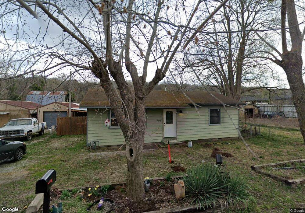
204 Wilson St Huntsville, AR 72740
Estimated Value: $89,293 - $159,000
--
Bed
1
Bath
912
Sq Ft
$129/Sq Ft
Est. Value
About This Home
This home is located at 204 Wilson St, Huntsville, AR 72740 and is currently estimated at $117,573, approximately $128 per square foot. 204 Wilson St is a home located in Madison County.
Ownership History
Date
Name
Owned For
Owner Type
Purchase Details
Closed on
Jun 8, 2007
Sold by
Bilyeu Billy J and Bilyeu Melba
Bought by
Bolinger James Junior and Bolinger Kari Denise
Current Estimated Value
Home Financials for this Owner
Home Financials are based on the most recent Mortgage that was taken out on this home.
Original Mortgage
$51,750
Interest Rate
6.16%
Mortgage Type
Future Advance Clause Open End Mortgage
Purchase Details
Closed on
Jan 15, 1993
Bought by
Bilyeu Billy J
Create a Home Valuation Report for This Property
The Home Valuation Report is an in-depth analysis detailing your home's value as well as a comparison with similar homes in the area
Home Values in the Area
Average Home Value in this Area
Purchase History
| Date | Buyer | Sale Price | Title Company |
|---|---|---|---|
| Bolinger James Junior | $55,878 | -- | |
| Bilyeu Billy J | $22,000 | -- |
Source: Public Records
Mortgage History
| Date | Status | Borrower | Loan Amount |
|---|---|---|---|
| Closed | Bolinger James Junior | $51,750 |
Source: Public Records
Tax History Compared to Growth
Tax History
| Year | Tax Paid | Tax Assessment Tax Assessment Total Assessment is a certain percentage of the fair market value that is determined by local assessors to be the total taxable value of land and additions on the property. | Land | Improvement |
|---|---|---|---|---|
| 2024 | $389 | $13,710 | $2,880 | $10,830 |
| 2023 | $353 | $7,210 | $2,880 | $4,330 |
| 2022 | $353 | $7,210 | $2,880 | $4,330 |
| 2021 | $353 | $7,210 | $2,880 | $4,330 |
| 2020 | $329 | $6,710 | $2,700 | $4,010 |
| 2019 | $329 | $6,710 | $2,700 | $4,010 |
| 2018 | $303 | $6,710 | $2,700 | $4,010 |
| 2017 | $303 | $6,710 | $2,700 | $4,010 |
| 2016 | $303 | $6,710 | $2,700 | $4,010 |
| 2015 | $386 | $8,560 | $2,700 | $5,860 |
| 2014 | -- | $8,560 | $2,700 | $5,860 |
| 2013 | -- | $8,560 | $2,700 | $5,860 |
Source: Public Records
Map
Nearby Homes
- 0 Tbd 5551 Unit 1306152
- 0 Tbd 5551 Unit 1306149
- 103 War Eagle Ave
- 306 N College St
- 205 Cherry Ln
- 0 Jenee Dr
- 305 Hawkins Ave
- 311 Madison St
- 0 Madison St
- TBD 5551 Madison St
- TBD Madison St
- 601 S Parrott Dr
- 108 Cedar Heights
- 707 S Parrott Dr
- 701 Skyline Dr
- TBD S Gaskill St
- 106 S Gaskill St
- 113 Cedar Heights
- 001 Arkansas 74
- 902 Acorn St
- 205 Wilson St
- 208 Wilson St
- 408 Labarge Ave
- 403 War Eagle Ave
- 203 Wilson St
- 201 Wilson St
- 309 E War Eagle Ave
- 309 Labarge St
- 311 Labarge Ave
- 602 Labarge St
- 307 E War Eagle Ave
- 308 E War Eagle Ave
- 305 Labarge Ave
- 307 Labarge Ave
- 204 N Parrott Dr
- 306 E War Eagle Ave
- 303 Labarge Ave
- 208 N Parrott Dr
- 304 E War Eagle Ave
- 226 N Parrott Dr