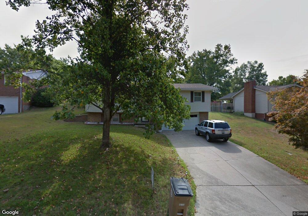
2040 Anthony Dr Cape Girardeau, MO 63701
Estimated Value: $231,039 - $274,000
3
Beds
2
Baths
6
Sq Ft
$42,085/Sq Ft
Est. Value
About This Home
This home is located at 2040 Anthony Dr, Cape Girardeau, MO 63701 and is currently estimated at $252,510, approximately $42,085 per square foot. 2040 Anthony Dr is a home located in Cape Girardeau County with nearby schools including Alma Schrader Elementary School, Central Middle School, and Central Junior High School.
Ownership History
Date
Name
Owned For
Owner Type
Purchase Details
Closed on
Jan 5, 2016
Sold by
Doran Ashton E and Pecaut Keith R
Bought by
Pecaut Keith R
Current Estimated Value
Purchase Details
Closed on
Jun 30, 2010
Sold by
Tolbert Mary Jo
Bought by
Pecaut Keith R
Home Financials for this Owner
Home Financials are based on the most recent Mortgage that was taken out on this home.
Original Mortgage
$117,638
Interest Rate
4.81%
Mortgage Type
FHA
Create a Home Valuation Report for This Property
The Home Valuation Report is an in-depth analysis detailing your home's value as well as a comparison with similar homes in the area
Home Values in the Area
Average Home Value in this Area
Purchase History
| Date | Buyer | Sale Price | Title Company |
|---|---|---|---|
| Pecaut Keith R | -- | -- | |
| Pecaut Keith R | -- | None Available |
Source: Public Records
Mortgage History
| Date | Status | Borrower | Loan Amount |
|---|---|---|---|
| Previous Owner | Pecaut Keith R | $117,638 |
Source: Public Records
Tax History Compared to Growth
Tax History
| Year | Tax Paid | Tax Assessment Tax Assessment Total Assessment is a certain percentage of the fair market value that is determined by local assessors to be the total taxable value of land and additions on the property. | Land | Improvement |
|---|---|---|---|---|
| 2025 | $13 | $26,740 | $3,260 | $23,480 |
| 2024 | $13 | $25,460 | $3,100 | $22,360 |
| 2023 | $1,323 | $25,460 | $3,100 | $22,360 |
| 2022 | $1,220 | $23,470 | $2,860 | $20,610 |
| 2021 | $1,220 | $23,470 | $2,860 | $20,610 |
| 2020 | $1,224 | $23,470 | $2,860 | $20,610 |
| 2019 | $1,222 | $23,470 | $0 | $0 |
| 2018 | $1,220 | $23,470 | $0 | $0 |
| 2017 | $1,223 | $23,470 | $0 | $0 |
| 2016 | $1,218 | $23,470 | $0 | $0 |
| 2015 | $1,219 | $23,470 | $0 | $0 |
| 2014 | $1,225 | $23,470 | $0 | $0 |
Source: Public Records
Map
Nearby Homes
- 2062 Concord Place
- 1960 Briarwood Dr
- 1623 Lexington Ave
- 1966 Randol Ave
- 1910 Sherwood Dr
- 1608 Lexington Ave
- 1577 Saratoga St
- 2415 Perryville Rd
- 1572 Lexington Ave
- 1938 Westwood Dr
- 1553 Valley Forge Ln
- 2213 Crown Point Dr
- 1912 Perryville Rd
- 1413 Parkmor Dr
- 2085 Derbyshire Ln
- 7 Turtle Ln
- 1230 Brookshire Rd Unit 1230 & 1232
- 1736 El Rio Dr
- 11 Dumaine St
- 2528 Palomino Dr
- 2036 Anthony Dr
- 2044 Anthony Dr
- 2041 Steven Dr
- 2028 Anthony Dr
- 2041 Anthony Dr
- 2048 Anthony Dr
- 2045 Steven Dr
- 2045 Anthony Dr
- 2037 Anthony Dr
- 2049 Steven Dr
- 2037 Steven Dr
- 2033 Anthony Dr
- 2024 Anthony Dr
- 2049 Anthony Dr
- 2053 Steven Dr
- 2033 Steven Dr
- 2029 Anthony Dr
- 2058 Anthony Dr
- 2044 Steven Dr
- 2057 Steven Dr