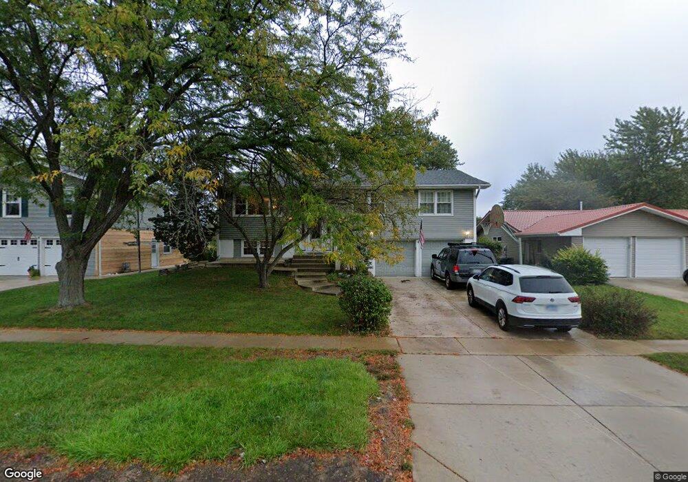
2040 Carling Rd Hoffman Estates, IL 60169
High Point Park NeighborhoodEstimated Value: $383,000 - $500,000
3
Beds
3
Baths
1,597
Sq Ft
$269/Sq Ft
Est. Value
About This Home
This home is located at 2040 Carling Rd, Hoffman Estates, IL 60169 and is currently estimated at $429,326, approximately $268 per square foot. 2040 Carling Rd is a home located in Cook County with nearby schools including MacArthur International Spanish Academy, Dwight D Eisenhower Junior High School, and Hoffman Estates High School.
Ownership History
Date
Name
Owned For
Owner Type
Purchase Details
Closed on
Feb 17, 2014
Sold by
Martin Gary J and Martin Deborah A
Bought by
Martin Family Trust
Current Estimated Value
Purchase Details
Closed on
Jan 29, 1996
Sold by
Martin Gary J and Smith Deborah A
Bought by
Martin Gary J and Martin Deborah A S
Home Financials for this Owner
Home Financials are based on the most recent Mortgage that was taken out on this home.
Original Mortgage
$150,000
Outstanding Balance
$1,003
Interest Rate
7.11%
Estimated Equity
$428,323
Purchase Details
Closed on
Dec 27, 1994
Sold by
Wright George R
Bought by
Martin Gary J and Smith Deborah A
Home Financials for this Owner
Home Financials are based on the most recent Mortgage that was taken out on this home.
Original Mortgage
$150,000
Interest Rate
9.24%
Create a Home Valuation Report for This Property
The Home Valuation Report is an in-depth analysis detailing your home's value as well as a comparison with similar homes in the area
Home Values in the Area
Average Home Value in this Area
Purchase History
| Date | Buyer | Sale Price | Title Company |
|---|---|---|---|
| Martin Family Trust | -- | None Available | |
| Martin Gary J | -- | Ticor Title Insurance | |
| Martin Gary J | $165,000 | -- |
Source: Public Records
Mortgage History
| Date | Status | Borrower | Loan Amount |
|---|---|---|---|
| Open | Martin Gary J | $150,000 | |
| Closed | Martin Gary J | $150,000 |
Source: Public Records
Tax History
| Year | Tax Paid | Tax Assessment Tax Assessment Total Assessment is a certain percentage of the fair market value that is determined by local assessors to be the total taxable value of land and additions on the property. | Land | Improvement |
|---|---|---|---|---|
| 2025 | $8,256 | $40,000 | $9,450 | $30,550 |
| 2024 | $8,256 | $30,217 | $7,875 | $22,342 |
| 2023 | $7,958 | $30,217 | $7,875 | $22,342 |
| 2022 | $7,958 | $30,217 | $7,875 | $22,342 |
| 2021 | $6,780 | $23,568 | $5,250 | $18,318 |
| 2020 | $6,697 | $23,568 | $5,250 | $18,318 |
| 2019 | $6,663 | $26,187 | $5,250 | $20,937 |
| 2018 | $6,214 | $22,492 | $4,462 | $18,030 |
| 2017 | $6,122 | $22,492 | $4,462 | $18,030 |
| 2016 | $5,957 | $22,492 | $4,462 | $18,030 |
| 2015 | $5,336 | $19,236 | $3,937 | $15,299 |
| 2014 | $5,259 | $19,236 | $3,937 | $15,299 |
| 2013 | $5,860 | $21,688 | $3,937 | $17,751 |
Source: Public Records
Map
Nearby Homes
- 1095 Lancaster Ct
- 730 Ashley Ct
- 1665 Chippendale Rd
- 1410 Nottingham Ln
- 590 Durham Ct
- 1360 Devonshire Ln
- 1570 Jefferson Rd
- 755 Cambridge Ln
- 1930 Kenilworth Cir Unit E
- 1938 Huntington Blvd
- 123 Willow Brook Ct Unit 3
- 1712 Fayette Walk Unit D
- 1750 Sleepy Hollow Ct Unit 3
- 1769 Sessions Walk Unit C
- 1724 Fayette Walk Unit J
- 1365 Newcastle Ln
- 100 White Oak Ct Unit 1
- 2021 Kensington Ln Unit 3004
- 2027 Kensington Ln Unit 3001
- 2025 Kensington Ln Unit 3002
- 2050 Carling Rd
- 2030 Carling Rd
- 2060 Carling Rd
- 2020 Carling Rd
- 1010 Mayfield Ln
- 2010 Carling Rd
- 2070 Carling Rd
- 1015 Nottingham Ln
- 1015 Mayfield Ln
- 1020 Mayfield Ln
- 2080 Carling Rd
- 980 Hassell Rd
- 1025 Nottingham Ln
- 990 Hassell Rd
- 970 Hassell Rd
- 1025 Mayfield Ln
- 2090 Carling Rd
- 1030 Mayfield Ln
- 1010 Hassell Rd
- 1010 Nottingham Ln
Your Personal Tour Guide
Ask me questions while you tour the home.