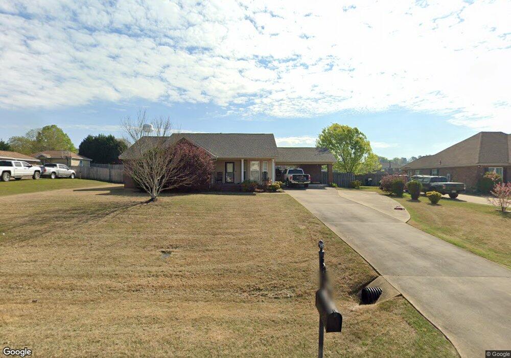
2040 Cedar Ridge Loop Prattville, AL 36067
Estimated Value: $246,000 - $260,000
Studio
--
Bath
1,589
Sq Ft
$159/Sq Ft
Est. Value
About This Home
This home is located at 2040 Cedar Ridge Loop, Prattville, AL 36067 and is currently estimated at $252,758, approximately $159 per square foot. 2040 Cedar Ridge Loop is a home located in Autauga County with nearby schools including Pine Level Elementary School, Marbury Middle School, and Marbury High School.
Ownership History
Date
Name
Owned For
Owner Type
Purchase Details
Closed on
Mar 6, 2012
Sold by
Sexton Amie S and Snider Amie Su
Bought by
Sexton Amie S and Sexton Steven D
Current Estimated Value
Purchase Details
Closed on
May 18, 2011
Sold by
Donovan Shaun
Bought by
Lynam Angelia L
Home Financials for this Owner
Home Financials are based on the most recent Mortgage that was taken out on this home.
Original Mortgage
$116,958
Interest Rate
4.75%
Mortgage Type
FHA
Purchase Details
Closed on
Sep 30, 2004
Bought by
Amie Su Snider
Create a Home Valuation Report for This Property
The Home Valuation Report is an in-depth analysis detailing your home's value as well as a comparison with similar homes in the area
Home Values in the Area
Average Home Value in this Area
Purchase History
| Date | Buyer | Sale Price | Title Company |
|---|---|---|---|
| Sexton Amie S | -- | -- | |
| Lynam Angelia L | -- | -- | |
| Amie Su Snider | $132,000 | -- |
Source: Public Records
Mortgage History
| Date | Status | Borrower | Loan Amount |
|---|---|---|---|
| Previous Owner | Lynam Angelia L | $116,958 |
Source: Public Records
Tax History
| Year | Tax Paid | Tax Assessment Tax Assessment Total Assessment is a certain percentage of the fair market value that is determined by local assessors to be the total taxable value of land and additions on the property. | Land | Improvement |
|---|---|---|---|---|
| 2025 | $638 | $23,640 | $0 | $0 |
| 2024 | $618 | $22,880 | $0 | $0 |
| 2023 | $576 | $21,320 | $0 | $0 |
| 2022 | $487 | $18,020 | $0 | $0 |
| 2021 | $470 | $17,400 | $0 | $0 |
| 2020 | $441 | $16,320 | $0 | $0 |
| 2019 | $431 | $15,960 | $0 | $0 |
| 2018 | $434 | $16,080 | $0 | $0 |
| 2017 | $397 | $14,720 | $0 | $0 |
| 2015 | $389 | $0 | $0 | $0 |
| 2014 | $392 | $14,500 | $3,000 | $11,500 |
| 2013 | -- | $14,740 | $3,000 | $11,740 |
Source: Public Records
Map
Nearby Homes
- 1920 Cedar Ridge Loop
- 104 Laurel Hill Dr
- 108 Laurel Hill Dr
- 173 Laurel Hill Dr
- 140 Laurel Hill Dr
- 321 County Road 82
- 2578 County Road 66
- 85 W County Rd
- County Road 14
- 2452 County Road 85
- 1231 Kenner Creek Cir
- 00 County Rd 85
- 2283 US Highway 31 N
- 1212 Kenner Creek Cir
- 1535 White Cloud Dr
- 1703 County Road 39
- 2405 Landing Loop
- 1506 White Cloud Dr
- 2002 Landcaster Ct
- 3145 Landing Ln
- 2042 Cedar Ridge Loop
- 2038 Cedar Ridge Loop
- 1816 Aspen Way
- 2036 Cedar Ridge Loop
- 1814 Aspen Way
- 2044 Cedar Ridge Loop
- 1818 Aspen Way
- 2041 Cedar Ridge Loop
- 2039 Cedar Ridge Loop
- 2043 Cedar Ridge Loop
- 1812 Aspen Way
- 1820 Aspen Way
- 2037 Cedar Ridge Loop
- 2034 Cedar Ridge Loop
- 2046 Cedar Ridge Loop
- 41 Aspen Way Unit LOT 41
- 1810 Aspen Way
- 2035 Cedar Ridge Loop
- 1822 Aspen Way
- 2047 Cedar Ridge Loop
Your Personal Tour Guide
Ask me questions while you tour the home.