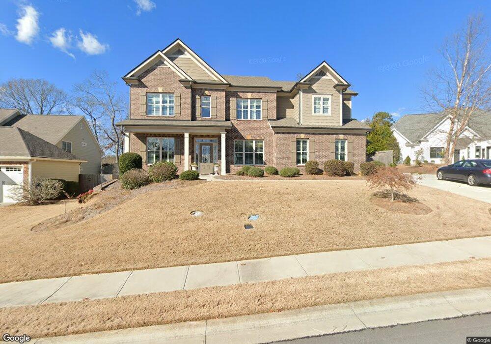
2040 Democracy Dr Unit 153 Buford, GA 30519
Estimated Value: $615,001 - $656,000
4
Beds
3
Baths
3,218
Sq Ft
$197/Sq Ft
Est. Value
About This Home
This home is located at 2040 Democracy Dr Unit 153, Buford, GA 30519 and is currently estimated at $635,500, approximately $197 per square foot. 2040 Democracy Dr Unit 153 is a home located in Hall County with nearby schools including Friendship Elementary School, Cherokee Bluff Middle School, and Cherokee Bluff High School.
Ownership History
Date
Name
Owned For
Owner Type
Purchase Details
Closed on
Jun 9, 2015
Sold by
Chafin Builders Llc
Bought by
Gable Michael F and Gable Sharon K
Current Estimated Value
Purchase Details
Closed on
Oct 31, 2013
Sold by
Cf Southeast Reo Llc
Bought by
Chafin Builders Llc
Purchase Details
Closed on
Sep 3, 2013
Sold by
Embry Custom Homes Llc
Bought by
Cf Southeast Reo Llc
Purchase Details
Closed on
Aug 26, 2004
Sold by
Chateau Corners Development Corporation
Bought by
Embry Custom Homes Llc
Create a Home Valuation Report for This Property
The Home Valuation Report is an in-depth analysis detailing your home's value as well as a comparison with similar homes in the area
Home Values in the Area
Average Home Value in this Area
Purchase History
| Date | Buyer | Sale Price | Title Company |
|---|---|---|---|
| Gable Michael F | $334,000 | -- | |
| Chafin Builders Llc | $90,000 | -- | |
| Cf Southeast Reo Llc | $120,000 | -- | |
| Embry Custom Homes Llc | $1,360,000 | -- |
Source: Public Records
Tax History Compared to Growth
Tax History
| Year | Tax Paid | Tax Assessment Tax Assessment Total Assessment is a certain percentage of the fair market value that is determined by local assessors to be the total taxable value of land and additions on the property. | Land | Improvement |
|---|---|---|---|---|
| 2024 | $6,099 | $243,040 | $40,880 | $202,160 |
| 2023 | $5,354 | $213,360 | $28,920 | $184,440 |
| 2022 | $4,781 | $184,800 | $27,360 | $157,440 |
| 2021 | $4,117 | $156,520 | $17,000 | $139,520 |
| 2020 | $4,136 | $152,840 | $17,000 | $135,840 |
| 2019 | $3,955 | $144,960 | $16,000 | $128,960 |
| 2018 | $4,133 | $146,640 | $16,000 | $130,640 |
| 2017 | $3,991 | $138,320 | $12,000 | $126,320 |
| 2016 | $3,390 | $120,560 | $12,000 | $108,560 |
| 2015 | -- | $12,000 | $12,000 | $0 |
| 2014 | -- | $12,000 | $12,000 | $0 |
Source: Public Records
Map
Nearby Homes
- 7235 Coral Lake Dr
- 2228 Mayors Way
- 7272 Coral Lake Dr
- 7464 Williams Rd
- 2638 Democracy Dr Unit 1
- 7343 Peacebrook Dr
- 7207 Spout Springs Rd
- 7005 Litany Ct
- 7289 Mulberry Trace Ln Unit LOT 178
- Sierra Plan at Sherwood Square
- Sawnee Plan at Sherwood Square
- 7296 Mulberry Trace Ln Unit LOT 180
- 7296 Mulberry Trace Ln
- 7144 Maple Brook Ln
- 7300 Mulberry Trace Ln
- 7300 Mulberry Trace Ln Unit LOT 181
- 7304 Mulberry Trace Ln Unit LOT 182
- 7304 Mulberry Trace Ln
- 7012 Litany Ct
- 7308 Mulberry Trace Ln Unit LOT 183
- 2040 Democracy Dr
- 2044 Democracy Dr
- 2036 Democracy Dr
- 2048 Democracy Dr Unit 151
- 2048 Democracy Dr
- 2031 Democracy Dr
- 2032 Democracy Dr
- 2028 Democracy Dr
- 7317 Clubcrest Dr
- 2045 Democracy Dr
- 2052 Democracy Dr Unit 150
- 2052 Democracy Dr
- 7313 Clubcrest Dr
- 2024 Democracy Dr
- 2023 Democracy Dr
- 7321 Clubcrest Dr
- 2049 Democracy Dr
- 7309 Clubcrest Dr
- 2056 Democracy Dr
- 7246 Tascosa Dr