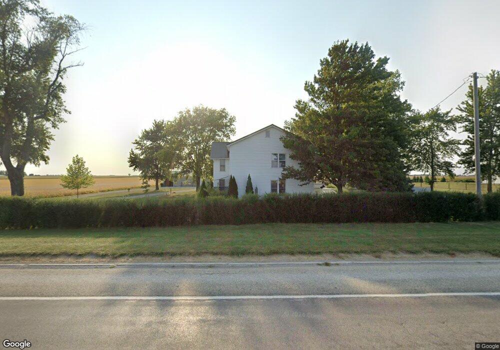
2040 Jonathan Creek Rd Arthur, IL 61911
Estimated Value: $232,210 - $295,000
5
Beds
2
Baths
2,374
Sq Ft
$110/Sq Ft
Est. Value
About This Home
This home is located at 2040 Jonathan Creek Rd, Arthur, IL 61911 and is currently estimated at $261,553, approximately $110 per square foot. 2040 Jonathan Creek Rd is a home located in Moultrie County with nearby schools including Arthur Grade School, Arthur Lovington Atwood Hammond High School, and Plainview Parochial School.
Ownership History
Date
Name
Owned For
Owner Type
Purchase Details
Closed on
Oct 30, 2019
Sold by
Herschberger Darrell N and Herschberger Wanda M
Bought by
State Bank Of Arthur
Current Estimated Value
Purchase Details
Closed on
Oct 4, 2013
Sold by
Otto Daniel Ray and Otto Viola E
Bought by
Herschberger Darrell N and Herschberger Wanda M
Home Financials for this Owner
Home Financials are based on the most recent Mortgage that was taken out on this home.
Original Mortgage
$128,000
Interest Rate
4.37%
Mortgage Type
New Conventional
Create a Home Valuation Report for This Property
The Home Valuation Report is an in-depth analysis detailing your home's value as well as a comparison with similar homes in the area
Home Values in the Area
Average Home Value in this Area
Purchase History
| Date | Buyer | Sale Price | Title Company |
|---|---|---|---|
| State Bank Of Arthur | -- | None Available | |
| Herschberger Darrell N | $160,000 | None Available |
Source: Public Records
Mortgage History
| Date | Status | Borrower | Loan Amount |
|---|---|---|---|
| Previous Owner | Herschberger Darrell N | $128,000 |
Source: Public Records
Tax History Compared to Growth
Tax History
| Year | Tax Paid | Tax Assessment Tax Assessment Total Assessment is a certain percentage of the fair market value that is determined by local assessors to be the total taxable value of land and additions on the property. | Land | Improvement |
|---|---|---|---|---|
| 2024 | $2,839 | $53,423 | $7,637 | $45,786 |
| 2023 | $2,718 | $50,464 | $7,168 | $43,296 |
| 2022 | $2,195 | $41,428 | $7,723 | $33,705 |
| 2021 | $2,183 | $39,607 | $7,350 | $32,257 |
| 2020 | $2,142 | $38,192 | $7,046 | $31,146 |
| 2019 | $2,113 | $37,372 | $6,698 | $30,674 |
| 2018 | $1,618 | $29,995 | $3,948 | $26,047 |
| 2017 | $1,618 | $29,880 | $3,926 | $25,954 |
| 2016 | $1,676 | $29,944 | $3,937 | $26,007 |
| 2015 | $1,640 | $29,391 | $3,851 | $25,540 |
| 2014 | -- | $30,991 | $4,188 | $26,803 |
| 2013 | -- | $30,980 | $4,177 | $26,803 |
Source: Public Records
Map
Nearby Homes
- 531 S Vine St
- Lot 16 N Beech St
- Lot 17 N Beech St
- 221 S Hickory St
- 206 E Logan St
- 101 Rhine Blvd
- 623 W Parkview Dr
- 530 S Union St
- 705 E Illinois St
- 411 Crestwood Dr
- 226 S Noah St
- 426 W Springfield Rd
- 90 N 1150 East Rd
- 1227 E 100 North Rd
- 1233 E 100 Rd N
- 507 S C St
- 14 E Okaw Estates
- 6 Roley Estates
- 219 S Missouri St
- 320 S Main St