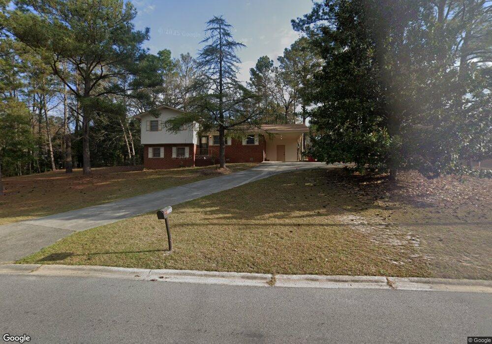
2040 Manson Rd Macon, GA 31217
Estimated Value: $134,000 - $163,000
3
Beds
2
Baths
1,397
Sq Ft
$105/Sq Ft
Est. Value
About This Home
This home is located at 2040 Manson Rd, Macon, GA 31217 and is currently estimated at $146,663, approximately $104 per square foot. 2040 Manson Rd is a home located in Bibb County with nearby schools including Martin Luther King Jr. Elementary School, Appling Middle School, and Northeast High School.
Ownership History
Date
Name
Owned For
Owner Type
Purchase Details
Closed on
Mar 11, 2021
Sold by
Willis Avis T
Bought by
Wilson Timothy James
Current Estimated Value
Home Financials for this Owner
Home Financials are based on the most recent Mortgage that was taken out on this home.
Original Mortgage
$10,000
Outstanding Balance
$8,923
Interest Rate
2.7%
Mortgage Type
VA
Estimated Equity
$137,740
Purchase Details
Closed on
Mar 2, 1990
Sold by
Willis Avis T
Bought by
Willis Avis T -Jonathon
Create a Home Valuation Report for This Property
The Home Valuation Report is an in-depth analysis detailing your home's value as well as a comparison with similar homes in the area
Home Values in the Area
Average Home Value in this Area
Purchase History
| Date | Buyer | Sale Price | Title Company |
|---|---|---|---|
| Wilson Timothy James | $100,000 | None Available | |
| Willis Avis T -Jonathon | -- | -- |
Source: Public Records
Mortgage History
| Date | Status | Borrower | Loan Amount |
|---|---|---|---|
| Open | Wilson Timothy James | $10,000 |
Source: Public Records
Tax History Compared to Growth
Tax History
| Year | Tax Paid | Tax Assessment Tax Assessment Total Assessment is a certain percentage of the fair market value that is determined by local assessors to be the total taxable value of land and additions on the property. | Land | Improvement |
|---|---|---|---|---|
| 2025 | -- | $47,104 | $3,840 | $43,264 |
| 2024 | -- | $47,104 | $3,840 | $43,264 |
| 2023 | $0 | $43,899 | $3,840 | $40,059 |
| 2022 | $1,475 | $38,804 | $6,634 | $32,170 |
| 2021 | $961 | $25,291 | $2,985 | $22,306 |
| 2020 | $914 | $23,531 | $2,985 | $20,546 |
| 2019 | $576 | $14,725 | $2,985 | $11,740 |
| 2018 | $1,063 | $14,725 | $2,985 | $11,740 |
| 2017 | $552 | $14,725 | $2,985 | $11,740 |
| 2016 | $509 | $14,726 | $2,985 | $11,740 |
| 2015 | $865 | $17,660 | $2,985 | $14,675 |
| 2014 | $1,537 | $27,299 | $5,286 | $22,013 |
Source: Public Records
Map
Nearby Homes
- 3380 Warpath Rd
- 3339 Club Dr
- 1940 Manson Rd
- 2035 Fairway Dr
- 1669 Griswoldville Rd
- 299 E Virginia Ln
- 0 Shady Road Plaza
- 3145 Pasadena Dr
- 2940 Shurling Dr
- 0 Shady Rd
- 157 Country World Dr
- 144 Country World Dr
- 134 Country World Dr
- 148 Country World Dr
- 3048 Bethune Ave
- 3128 Commodore Dr
- 2954 Tyler Place
- 3154 Bethune Ave
- 2750 Lakeshore Dr
- 3320 Joycliff Rd
- 2050 Cherokee Ct
- 2038 Cherokee Ct
- 2030 Manson Rd
- 3377 Mohawk Rd
- 0 Cherokee Ct
- 2054 Manson Rd
- 0 Manson Rd Unit 7039124
- 2055 Apache Ct
- 2049 Manson Rd
- 3378 Mohawk Rd
- 2062 Cherokee Ct
- 2025 Manson Rd
- 2020 Manson Rd
- 2037 Cherokee Ct
- 3363 Mohawk Rd
- 2055 Manson Rd
- 0 Shawnee Ln
- 2067 Apache Ct
- 2062 Manson Rd
- 3370 Mohawk Rd