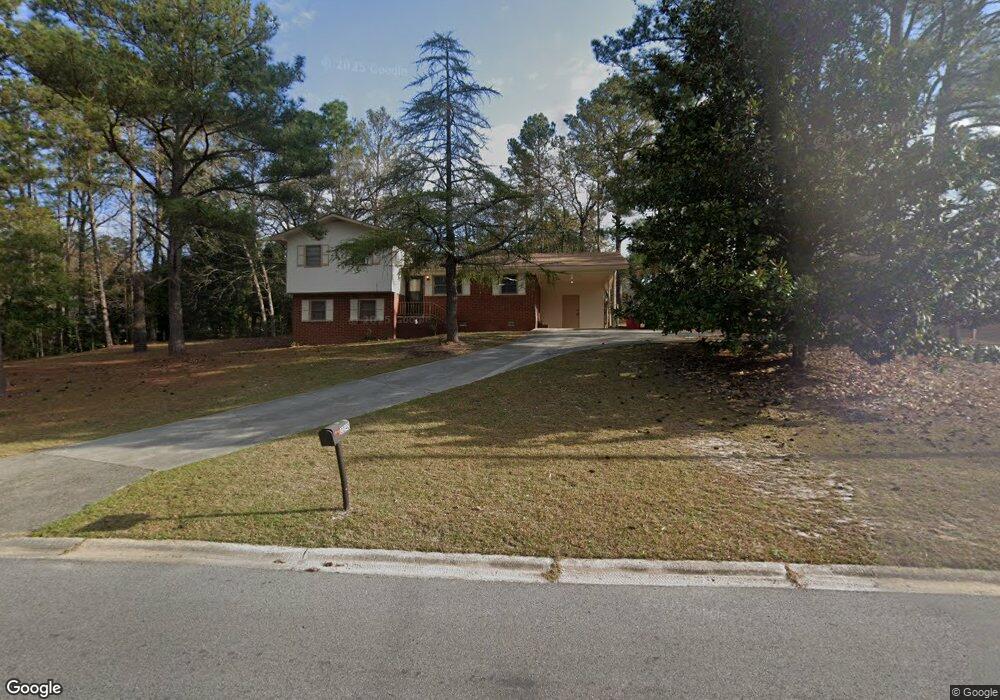
2040 Manson Rd Macon, GA 31217
Estimated Value: $118,000 - $170,000
About This Home
This home is located at 2040 Manson Rd, Macon, GA 31217 and is currently estimated at $139,078, approximately $99 per square foot. 2040 Manson Rd is a home located in Bibb County with nearby schools including Martin Luther King Jr. Elementary School, Appling Middle School, and Northeast High School.
Ownership History
We collect this data history from publicly available records. To have your information removed, we recommend requesting removal directly through your county’s website.
Purchase Details
Home Financials for this Owner
Home Financials are based on the most recent Mortgage that was taken out on this home.Purchase Details
Purchase History
We collect this data history from publicly available records. To have your information removed, we recommend requesting removal directly through your county’s website.
| Date | Buyer | Sale Price | Title Company |
|---|---|---|---|
| $100,000 | None Available | ||
| -- | -- |
Mortgage History
We collect this data history from publicly available records. To have your information removed, we recommend requesting removal directly through your county’s website.
| Date | Status | Borrower | Loan Amount |
|---|---|---|---|
| Open | $10,000 |
Tax History
We collect this data history from publicly available records. To have your information removed, we recommend requesting removal directly through your county’s website.
| Year | Tax Paid | Tax Assessment Tax Assessment Total Assessment is a certain percentage of the fair market value that is determined by local assessors to be the total taxable value of land and additions on the property. | Land | Improvement |
|---|---|---|---|---|
| 2025 | -- | $47,104 | $3,840 | $43,264 |
| 2024 | -- | $47,104 | $3,840 | $43,264 |
| 2023 | $0 | $43,899 | $3,840 | $40,059 |
| 2022 | $1,475 | $38,804 | $6,634 | $32,170 |
| 2021 | $961 | $25,291 | $2,985 | $22,306 |
| 2020 | $914 | $23,531 | $2,985 | $20,546 |
| 2019 | $576 | $14,725 | $2,985 | $11,740 |
| 2018 | $1,063 | $14,725 | $2,985 | $11,740 |
| 2017 | $552 | $14,725 | $2,985 | $11,740 |
| 2016 | $509 | $14,726 | $2,985 | $11,740 |
| 2015 | $865 | $17,660 | $2,985 | $14,675 |
| 2014 | $1,537 | $27,299 | $5,286 | $22,013 |
Map
- 3319 Mohawk Rd
- 2113 Joseph Waller Dr
- 2035 Fairway Dr
- 0 Shady Road Plaza
- 3103 Stratford Dr
- 3020 Millersfield Rd
- 3020 Millerfield Rd
- 3009 Millerfield Rd
- 176 Country World Dr
- 132 Spradley Dr
- 3612 Fleming Dr
- 2792 Jordan Ave
- 149 Tanner Terrace
- 211 Largo Dr
- 3353 W Victory Ct
- 0 Champions Dr Unit 183850
- 128 N Robbie Dr
- 0 Kings Ct N Unit 10666708
- 2837 Skyline Rd
- 3098 Masseyville Rd
- 2050 Cherokee Ct
- 2038 Cherokee Ct
- 2030 Manson Rd
- 3377 Mohawk Rd
- 2054 Manson Rd
- 2055 Apache Ct
- 2049 Manson Rd
- 3378 Mohawk Rd
- 2062 Cherokee Ct
- 2025 Manson Rd
- 2020 Manson Rd
- 2037 Cherokee Ct
- 3363 Mohawk Rd
- 2055 Manson Rd
- 2067 Apache Ct
- 2062 Manson Rd
- 3370 Mohawk Rd
- 2049 Cherokee Ct
- 3429 Shawnee Ln
- 3357 Mohawk Rd
Ask me questions while you tour the home.