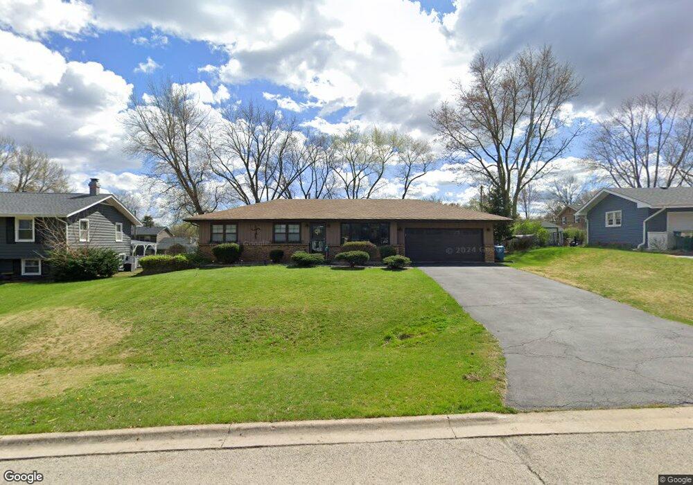
2040 Radcliffe Dr Unit 9 Aurora, IL 60506
Pine Knoll NeighborhoodEstimated Value: $321,000 - $344,000
4
Beds
1
Bath
1,440
Sq Ft
$229/Sq Ft
Est. Value
About This Home
This home is located at 2040 Radcliffe Dr Unit 9, Aurora, IL 60506 and is currently estimated at $330,073, approximately $229 per square foot. 2040 Radcliffe Dr Unit 9 is a home located in Kane County with nearby schools including Freeman Elementary School, Washington Middle School, and West Aurora High School.
Ownership History
Date
Name
Owned For
Owner Type
Purchase Details
Closed on
Jul 24, 2003
Sold by
Nichol Michael T
Bought by
Nichol Michael T and Nichol Kimberly R
Current Estimated Value
Home Financials for this Owner
Home Financials are based on the most recent Mortgage that was taken out on this home.
Original Mortgage
$134,000
Interest Rate
5.31%
Mortgage Type
Purchase Money Mortgage
Purchase Details
Closed on
Sep 29, 2000
Sold by
Hickernell Jeffrey A
Bought by
Nichol Michael T
Home Financials for this Owner
Home Financials are based on the most recent Mortgage that was taken out on this home.
Original Mortgage
$134,000
Interest Rate
7.69%
Create a Home Valuation Report for This Property
The Home Valuation Report is an in-depth analysis detailing your home's value as well as a comparison with similar homes in the area
Home Values in the Area
Average Home Value in this Area
Purchase History
| Date | Buyer | Sale Price | Title Company |
|---|---|---|---|
| Nichol Michael T | -- | Law Title Insurance Co Inc | |
| Nichol Michael T | $156,000 | Ticor Title Insurance Compan |
Source: Public Records
Mortgage History
| Date | Status | Borrower | Loan Amount |
|---|---|---|---|
| Closed | Nichol Michael T | $134,000 | |
| Previous Owner | Nichol Michael T | $134,000 |
Source: Public Records
Tax History
| Year | Tax Paid | Tax Assessment Tax Assessment Total Assessment is a certain percentage of the fair market value that is determined by local assessors to be the total taxable value of land and additions on the property. | Land | Improvement |
|---|---|---|---|---|
| 2024 | $4,728 | $87,559 | $13,260 | $74,299 |
| 2023 | $3,607 | $78,234 | $11,848 | $66,386 |
| 2022 | $4,824 | $71,381 | $10,810 | $60,571 |
| 2021 | $4,596 | $66,456 | $10,064 | $56,392 |
| 2020 | $4,346 | $61,728 | $9,348 | $52,380 |
| 2019 | $4,193 | $57,192 | $8,661 | $48,531 |
| 2018 | $4,278 | $56,730 | $8,011 | $48,719 |
| 2017 | $4,107 | $53,204 | $7,381 | $45,823 |
| 2016 | $4,032 | $50,699 | $6,327 | $44,372 |
| 2015 | -- | $48,180 | $5,441 | $42,739 |
| 2014 | -- | $48,235 | $5,233 | $43,002 |
| 2013 | -- | $47,547 | $5,158 | $42,389 |
Source: Public Records
Map
Nearby Homes
- 2021 Radcliffe Dr
- 925 Lindenwood Dr Unit 1
- 433 Cottrell Ln
- 425 Cottrell Ln
- 417 Cottrell Ln
- 413 Cottrell Ln
- 417 S Constitution Dr
- 396 Cottrell Ln
- 393 S Constitution Dr
- 387 S Constitution Dr
- 381 S Constitution Dr
- 527 S Calumet Ave
- 375 S Constitution Dr
- 378 Cottrell Ln
- 19 Pasadena Dr
- 1 Highway 30
- 1035 Allaire Ave
- 170 Alschuler Dr
- 911 Jericho Rd
- 1931 Stephen Dr
- 2050 Radcliffe Dr Unit 8
- 2030 Radcliffe Dr
- 2051 Bryn Mawr Dr Unit 10
- 2041 Bryn Mawr Dr
- 2031 Bryn Mawr Dr Unit 12
- 2061 Bryn Mawr Dr Unit 10
- 2068 Radcliffe Dr Unit 8
- 2041 Radcliffe Dr
- 2020 Radcliffe Dr
- 2051 Radcliffe Dr
- 2031 Radcliffe Dr
- 2021 Bryn Mawr Dr
- 2071 Bryn Mawr Dr Unit 10
- 2070 Radcliffe Dr
- 2061 Radcliffe Dr
- 1145 Lindenwood Dr
- 2050 Bryn Mawr Dr
- 2060 Bryn Mawr Dr
- 2040 Bryn Mawr Dr
- 1920 Swarthmore Dr Unit 6
Your Personal Tour Guide
Ask me questions while you tour the home.