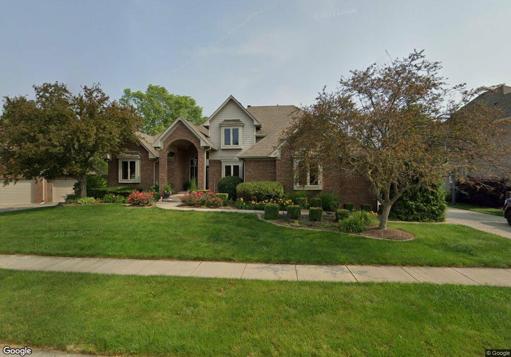
2040 Saint Andrews Ct Franklin, IN 46131
Estimated Value: $490,580 - $844,000
4
Beds
4
Baths
2,786
Sq Ft
$224/Sq Ft
Est. Value
About This Home
This home is located at 2040 Saint Andrews Ct, Franklin, IN 46131 and is currently estimated at $623,395, approximately $223 per square foot. 2040 Saint Andrews Ct is a home located in Johnson County with nearby schools including Needham Elementary School, Franklin Community Middle School, and Custer Baker Intermediate School.
Ownership History
Date
Name
Owned For
Owner Type
Purchase Details
Closed on
Jul 2, 2013
Sold by
Hillenburg Danny R and Hillenburg Debra A
Bought by
Lancer Terry and Lancer Jennifera
Current Estimated Value
Home Financials for this Owner
Home Financials are based on the most recent Mortgage that was taken out on this home.
Original Mortgage
$334,800
Outstanding Balance
$243,346
Interest Rate
3.91%
Mortgage Type
FHA
Estimated Equity
$380,049
Create a Home Valuation Report for This Property
The Home Valuation Report is an in-depth analysis detailing your home's value as well as a comparison with similar homes in the area
Home Values in the Area
Average Home Value in this Area
Purchase History
| Date | Buyer | Sale Price | Title Company |
|---|---|---|---|
| Lancer Terry | -- | Chicago Title Company Llc |
Source: Public Records
Mortgage History
| Date | Status | Borrower | Loan Amount |
|---|---|---|---|
| Open | Lancer Terry | $334,800 |
Source: Public Records
Tax History
| Year | Tax Paid | Tax Assessment Tax Assessment Total Assessment is a certain percentage of the fair market value that is determined by local assessors to be the total taxable value of land and additions on the property. | Land | Improvement |
|---|---|---|---|---|
| 2025 | $5,443 | $502,300 | $44,500 | $457,800 |
| 2024 | $5,443 | $486,200 | $44,500 | $441,700 |
| 2023 | $5,374 | $479,100 | $44,500 | $434,600 |
| 2022 | $5,147 | $454,200 | $41,900 | $412,300 |
| 2021 | $4,278 | $378,600 | $41,900 | $336,700 |
| 2020 | $3,732 | $331,100 | $41,900 | $289,200 |
| 2019 | $3,769 | $334,300 | $41,900 | $292,400 |
| 2018 | $3,240 | $332,800 | $41,900 | $290,900 |
| 2017 | $3,140 | $312,700 | $41,900 | $270,800 |
| 2016 | $3,108 | $301,900 | $41,900 | $260,000 |
| 2014 | $2,973 | $297,300 | $53,300 | $244,000 |
| 2013 | $2,973 | $266,800 | $53,300 | $213,500 |
Source: Public Records
Map
Nearby Homes
- 2080 Fairway Lakes Dr
- 409 Paris Dr
- 1810 E Jefferson St
- 1185 Beechtree Ln
- 1682 Millpond Ln
- 1636 Millpond Ln
- 1679 Millpond Ln
- 1663 Millpond Ln
- 1640 Millpond Ln
- 1650 Millpond Ln
- 1660 Millpond Ln
- 1653 Millpond Ln
- 1686 Millpond Ln
- 1630 Millpond Ln
- 1658 Millpond Ln
- 1627 Millpond Ln
- 1634 Millpond Ln
- 1668 Millpond Ln
- 1672 Millpond Ln
- 1680 Millpond Ln
- 2020 Saint Andrews Ct
- 2060 Saint Andrews Ct
- 2080 Saint Andrews Ct
- 2055 Saint Andrews Ct
- 2075 Saint Andrews Ct
- 2005 Saint Andrews Ct
- 2035 Saint Andrews Ct
- 430 Saint Andrews Dr
- 2090 Saint Andrews Ct
- 565 Augusta Ct
- 525 Augusta Ct
- 420 Saint Andrews Dr
- 510 Paris Dr
- 530 Paris Dr
- 2070 Fairway Lakes Dr
- 445 Saint Andrews Dr
- 2060 Fairway Lakes Dr
- 485 Augusta Ct
- 572 Paris Dr
Your Personal Tour Guide
Ask me questions while you tour the home.