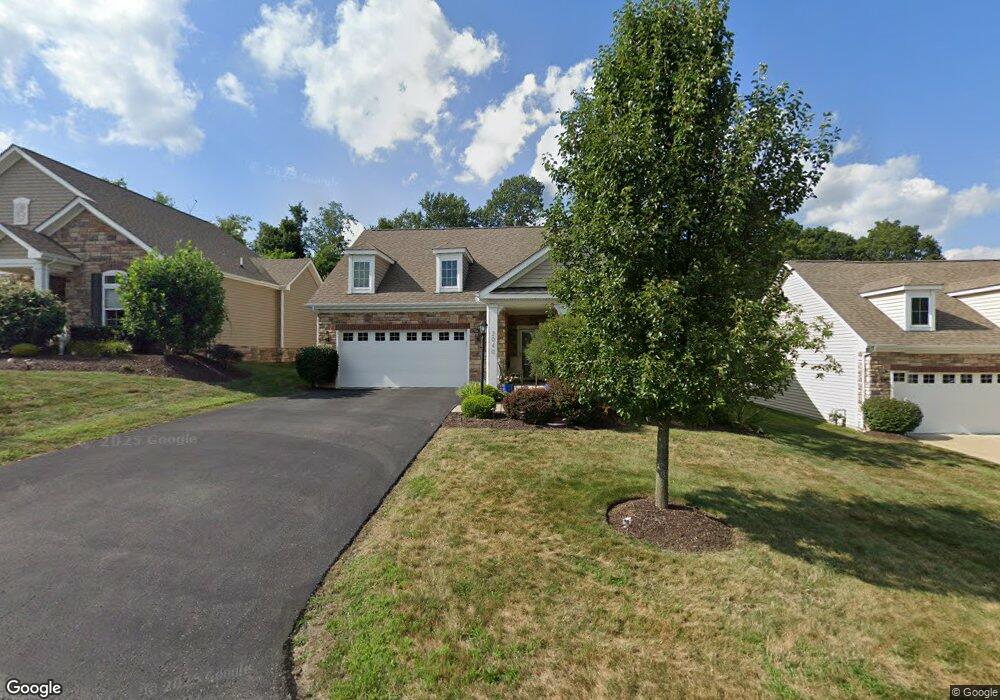
2040 Sir Patrick Dr Mc Donald, PA 15057
Estimated Value: $421,000 - $496,000
2
Beds
2
Baths
1,986
Sq Ft
$231/Sq Ft
Est. Value
About This Home
This home is located at 2040 Sir Patrick Dr, Mc Donald, PA 15057 and is currently estimated at $459,019, approximately $231 per square foot. 2040 Sir Patrick Dr is a home with nearby schools including Canon-Mcmillan Senior High School.
Ownership History
Date
Name
Owned For
Owner Type
Purchase Details
Closed on
Sep 26, 2017
Sold by
Hawthorne Partners Ii Llc
Bought by
Kotfis Robert A and Koerner Lynda S
Current Estimated Value
Home Financials for this Owner
Home Financials are based on the most recent Mortgage that was taken out on this home.
Original Mortgage
$110,000
Outstanding Balance
$92,053
Interest Rate
3.89%
Mortgage Type
New Conventional
Estimated Equity
$366,966
Purchase Details
Closed on
May 1, 2017
Sold by
Windsor Woods Llc A Pennsylvania Limited
Bought by
Hawthorne Partners Ii Llc A Pennsylvania
Home Financials for this Owner
Home Financials are based on the most recent Mortgage that was taken out on this home.
Original Mortgage
$743,200
Interest Rate
4.23%
Mortgage Type
Commercial
Create a Home Valuation Report for This Property
The Home Valuation Report is an in-depth analysis detailing your home's value as well as a comparison with similar homes in the area
Home Values in the Area
Average Home Value in this Area
Purchase History
| Date | Buyer | Sale Price | Title Company |
|---|---|---|---|
| Kotfis Robert A | $372,195 | None Available | |
| Hawthorne Partners Ii Llc A Pennsylvania | $180,000 | None Available |
Source: Public Records
Mortgage History
| Date | Status | Borrower | Loan Amount |
|---|---|---|---|
| Open | Kotfis Robert A | $110,000 | |
| Previous Owner | Hawthorne Partners Ii Llc A Pennsylvania | $743,200 |
Source: Public Records
Tax History
| Year | Tax Paid | Tax Assessment Tax Assessment Total Assessment is a certain percentage of the fair market value that is determined by local assessors to be the total taxable value of land and additions on the property. | Land | Improvement |
|---|---|---|---|---|
| 2025 | $6,118 | $352,500 | $51,700 | $300,800 |
| 2024 | $5,615 | $352,500 | $51,700 | $300,800 |
| 2023 | $5,615 | $352,500 | $51,700 | $300,800 |
| 2022 | $5,599 | $352,500 | $51,700 | $300,800 |
| 2021 | $5,599 | $352,500 | $51,700 | $300,800 |
| 2020 | $5,492 | $352,500 | $51,700 | $300,800 |
| 2019 | $5,404 | $352,500 | $51,700 | $300,800 |
| 2018 | $4,604 | $352,500 | $51,700 | $300,800 |
| 2017 | $0 | $306,500 | $51,700 | $254,800 |
| 2016 | $0 | $0 | $0 | $0 |
Source: Public Records
Map
Nearby Homes
- 2046 Sir Patrick Dr
- Lot 1 Millers Run Rd
- 24 - 25 Millers Run Rd
- 540 Coleman Rd
- Lot 2 Starcrest Dr
- 16 Ridgewood Dr
- 640 Redwood Dr
- 1902 Reissing Rd
- 804 Redwood Dr
- 59 Ridgewood Dr
- Lot 18 Ridgewood Dr
- 228 Frances Ln
- 288 Frances Ln
- 18 Crestwood Dr
- 79 Ridgewood Dr
- 3127 Millers Run Rd
- 77 Ridgewood Dr
- 53 Ridgewood Dr
- LOT 10-7-6-5 Windcrest Dr
- Lot 4 Valleycrest Dr
- 2042 Sir Patrick Dr
- 2038 Sir Patrick Dr
- 2044 Sir Patrick Dr
- 2036 Sir Patrick Dr
- 3002 Sir Charles Dr Unit Lot529
- 3002 Sir Charles Dr
- 2034 Sir Patrick Dr
- 4001 Sir James Dr
- 3004 Sir Charles Dr
- 2047 Sir Patrick Dr
- 2047 Sir Patrick Dr Unit LOT436
- 4055 Sir James Dr
- 4003 Sir James Dr
- 2032 Sir Patrick Dr
- 4005 Sir James Dr
- 3006 Sir Charles Dr
- 2045 Sir Patrick Dr
- 2030 Sir Patrick Dr
- 4007 Sir James Dr
- 3001 Sir Charles Dr
Your Personal Tour Guide
Ask me questions while you tour the home.