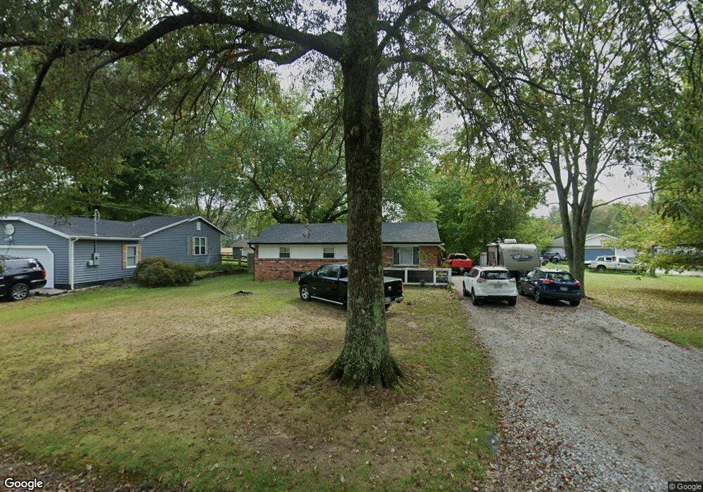
2041 Harvey Rd New Richmond, OH 45157
Estimated Value: $162,982 - $244,000
3
Beds
1
Bath
1,000
Sq Ft
$190/Sq Ft
Est. Value
About This Home
This home is located at 2041 Harvey Rd, New Richmond, OH 45157 and is currently estimated at $189,996, approximately $189 per square foot. 2041 Harvey Rd is a home located in Clermont County with nearby schools including Monroe Elementary School, New Richmond Middle School, and New Richmond High School.
Ownership History
Date
Name
Owned For
Owner Type
Purchase Details
Closed on
Apr 18, 1997
Sold by
Tumbleson Dennis J
Bought by
Thompson David H and Thompson Lisa A
Current Estimated Value
Home Financials for this Owner
Home Financials are based on the most recent Mortgage that was taken out on this home.
Original Mortgage
$77,900
Outstanding Balance
$10,107
Interest Rate
7.93%
Mortgage Type
FHA
Estimated Equity
$179,889
Purchase Details
Closed on
Aug 31, 1994
Purchase Details
Closed on
Jul 27, 1990
Purchase Details
Closed on
Mar 1, 1988
Create a Home Valuation Report for This Property
The Home Valuation Report is an in-depth analysis detailing your home's value as well as a comparison with similar homes in the area
Home Values in the Area
Average Home Value in this Area
Purchase History
| Date | Buyer | Sale Price | Title Company |
|---|---|---|---|
| Thompson David H | $77,750 | -- | |
| -- | $70,000 | -- | |
| -- | $54,000 | -- | |
| -- | $20,000 | -- |
Source: Public Records
Mortgage History
| Date | Status | Borrower | Loan Amount |
|---|---|---|---|
| Open | Thompson David H | $77,900 |
Source: Public Records
Tax History Compared to Growth
Tax History
| Year | Tax Paid | Tax Assessment Tax Assessment Total Assessment is a certain percentage of the fair market value that is determined by local assessors to be the total taxable value of land and additions on the property. | Land | Improvement |
|---|---|---|---|---|
| 2024 | $1,446 | $36,230 | $7,320 | $28,910 |
| 2023 | $1,445 | $36,230 | $7,320 | $28,910 |
| 2022 | $1,372 | $28,070 | $5,670 | $22,400 |
| 2021 | $1,331 | $28,070 | $5,670 | $22,400 |
| 2020 | $1,328 | $28,070 | $5,670 | $22,400 |
| 2019 | $998 | $24,220 | $5,600 | $18,620 |
| 2018 | $998 | $24,220 | $5,600 | $18,620 |
| 2017 | $922 | $24,220 | $5,600 | $18,620 |
| 2016 | $922 | $22,230 | $5,150 | $17,080 |
| 2015 | $855 | $22,230 | $5,150 | $17,080 |
| 2014 | $855 | $22,230 | $5,150 | $17,080 |
| 2013 | $950 | $24,400 | $5,670 | $18,730 |
Source: Public Records
Map
Nearby Homes
- 2339 Laurel Lindale Rd
- 1847 Carnes Rd
- 2354 Franklin Laurel Rd
- 2123 Josephs Run Rd
- 1512 Bethel New Richmond Rd
- 1455 Bethel New Richmond Rd
- 8.2 Ac N Altman Rd
- ac N Altman Rd
- 2363 Crane Schoolhouse Rd
- 116 Junction Point
- 128 Crossing Circle Ct
- 1459 Ginn Rd
- 2780 Lindale-Mt Holly Rd Unit 73
- 2780 Lindale-Mt Holly Rd Unit 81
- 2780 Lindale-Mt Holly Rd Unit 102
- 2780 Lindale-Mt Holly Rd Unit 105
- 2780 Lindale-Mt Holly Rd Unit 71
- 2780 Lindale-Mt Holly Rd Unit 97
- Taylor Plan at Ashburn Woods
- Aldridge Plan at Ashburn Woods
- 2041 Harvey Rd
- 2049 Harvey Rd
- 2031 Harvey Rd
- 2055 Harvey Rd
- 2036 Harvey Rd
- 2334 Laurel Lindale Rd
- 2061 Harvey Rd
- 2302 Laurel Lindale Rd
- 2062 Harvey Rd
- 2069 Harvey Rd
- 2327 Laurel Lindale Rd
- 2069 Harvey Rd
- 2342 Laurel Lindale Rd
- 2068 Harvey Rd
- 2330 Laurel Lindale Rd
- 2075 Harvey Rd
- 2338 Laurel Lindale Rd
- 2300 Laurel Lindale Rd
- 2076 Harvey Rd
- 2315 Laurel Lindale Rd