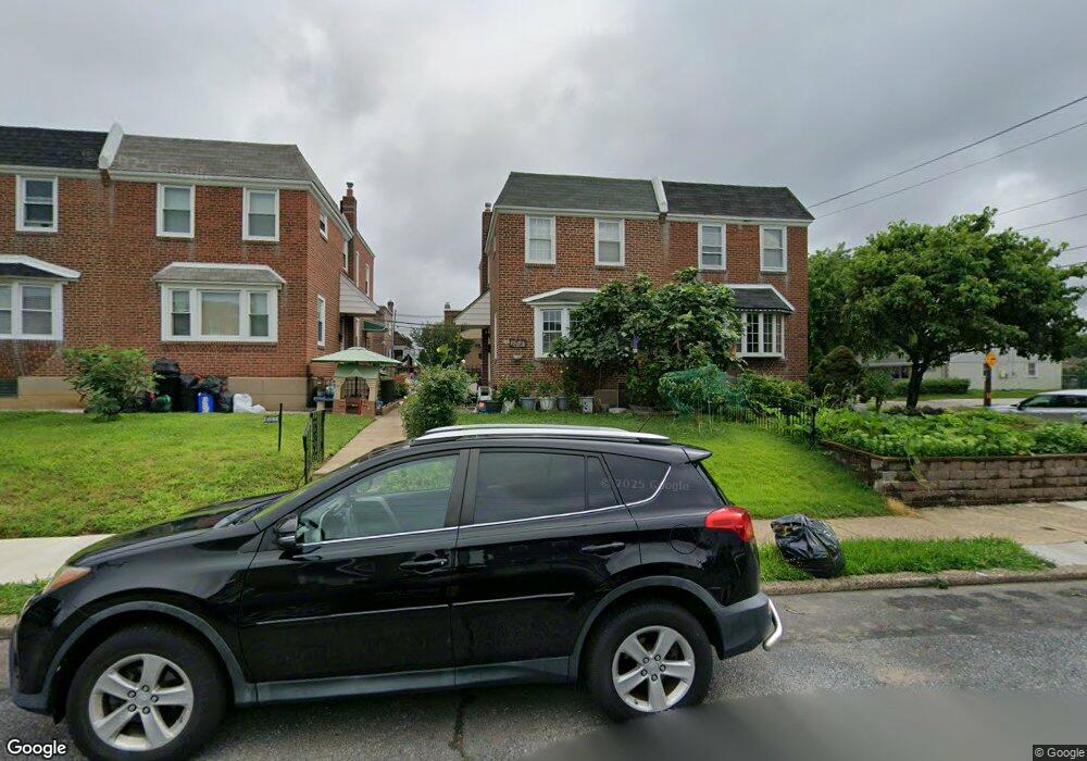
2041 Lansing St Philadelphia, PA 19152
Rhawnhurst NeighborhoodEstimated Value: $284,000 - $315,390
--
Bed
--
Bath
1,306
Sq Ft
$235/Sq Ft
Est. Value
About This Home
This home is located at 2041 Lansing St, Philadelphia, PA 19152 and is currently estimated at $306,598, approximately $234 per square foot. 2041 Lansing St is a home with nearby schools including Rhawnhurst School, Castor Gardens Middle School, and Northeast High School.
Ownership History
Date
Name
Owned For
Owner Type
Purchase Details
Closed on
Jun 1, 2015
Sold by
Patel Bhumiben T and Patel Tushar R
Bought by
Jiang Yan and Jiang Liang
Current Estimated Value
Purchase Details
Closed on
Jul 20, 2006
Sold by
Quinn Dennis Michael and Quinn Florence Ann
Bought by
Patel Tushar and Patel Bhumibent
Home Financials for this Owner
Home Financials are based on the most recent Mortgage that was taken out on this home.
Original Mortgage
$152,000
Interest Rate
6.67%
Mortgage Type
Purchase Money Mortgage
Create a Home Valuation Report for This Property
The Home Valuation Report is an in-depth analysis detailing your home's value as well as a comparison with similar homes in the area
Home Values in the Area
Average Home Value in this Area
Purchase History
| Date | Buyer | Sale Price | Title Company |
|---|---|---|---|
| Jiang Yan | $120,000 | None Available | |
| Patel Tushar | $190,000 | None Available |
Source: Public Records
Mortgage History
| Date | Status | Borrower | Loan Amount |
|---|---|---|---|
| Previous Owner | Patel Tushar | $152,000 |
Source: Public Records
Tax History Compared to Growth
Tax History
| Year | Tax Paid | Tax Assessment Tax Assessment Total Assessment is a certain percentage of the fair market value that is determined by local assessors to be the total taxable value of land and additions on the property. | Land | Improvement |
|---|---|---|---|---|
| 2025 | $3,270 | $277,500 | $55,500 | $222,000 |
| 2024 | $3,270 | $277,500 | $55,500 | $222,000 |
| 2023 | $3,270 | $233,600 | $46,720 | $186,880 |
| 2022 | $2,381 | $188,600 | $46,720 | $141,880 |
| 2021 | $3,011 | $0 | $0 | $0 |
| 2020 | $3,011 | $0 | $0 | $0 |
| 2019 | $2,741 | $0 | $0 | $0 |
| 2018 | $2,349 | $0 | $0 | $0 |
| 2017 | $2,349 | $0 | $0 | $0 |
| 2016 | $2,349 | $0 | $0 | $0 |
| 2015 | $2,249 | $0 | $0 | $0 |
| 2014 | -- | $167,800 | $39,815 | $127,985 |
| 2012 | -- | $22,176 | $4,261 | $17,915 |
Source: Public Records
Map
Nearby Homes
- 2023 Hartel Ave
- 2120 Napfle St
- 7815 Horrocks St
- 1919 Lansing St
- 1834 Lansing St
- 2029 Loney St
- 1917 Griffith St
- 2123 Loney St
- 1826 Hartel Ave
- 7912 14 Loretto Ave
- 7528 Loretto Ave
- 1821 Afton St
- 1824 Afton St
- 1807 Napfle Ave
- 1858 Glendale Ave
- 7414 Castor Ave
- 1931 33 Rhawn St
- 2301 Ripley St
- 2302 Rhawn St
- 1714 Afton St
- 2043 Lansing St
- 2039 Lansing St
- 2037 Lansing St
- 2035 Lansing St
- 2033 Lansing St
- 2036 Hartel Ave
- 2034 Hartel Ave
- 2038 Hartel Ave
- 2031 Lansing St
- 2032 Hartel Ave
- 2030 Hartel Ave
- 2029 Lansing St
- 2028 Hartel Ave
- 2042 Lansing St
- 7725 Large St
- 2040 Lansing St
- 2044 Lansing St
- 2038 Lansing St
- 2036 Lansing St
- 2027 Lansing St