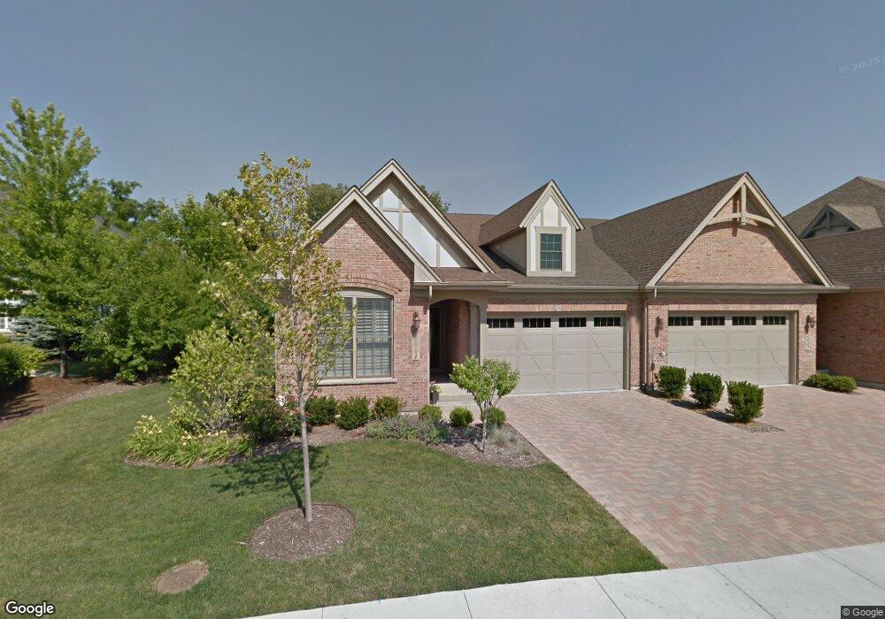
2041 Mackenzie Place Wheaton, IL 60187
Hawthorne NeighborhoodEstimated Value: $489,428 - $719,000
3
Beds
3
Baths
1,811
Sq Ft
$335/Sq Ft
Est. Value
About This Home
This home is located at 2041 Mackenzie Place, Wheaton, IL 60187 and is currently estimated at $607,107, approximately $335 per square foot. 2041 Mackenzie Place is a home located in DuPage County with nearby schools including Washington Elementary School, Franklin Middle School, and Wheaton North High School.
Ownership History
Date
Name
Owned For
Owner Type
Purchase Details
Closed on
Apr 15, 2010
Sold by
Chicago Title Land Trust Company
Bought by
Riley William J and Riley Sally R
Current Estimated Value
Create a Home Valuation Report for This Property
The Home Valuation Report is an in-depth analysis detailing your home's value as well as a comparison with similar homes in the area
Home Values in the Area
Average Home Value in this Area
Purchase History
| Date | Buyer | Sale Price | Title Company |
|---|---|---|---|
| Riley William J | $532,000 | Chicago Title Insurance Co |
Source: Public Records
Tax History
| Year | Tax Paid | Tax Assessment Tax Assessment Total Assessment is a certain percentage of the fair market value that is determined by local assessors to be the total taxable value of land and additions on the property. | Land | Improvement |
|---|---|---|---|---|
| 2024 | $9,598 | $148,924 | $28,529 | $120,395 |
| 2023 | $9,264 | $137,080 | $26,260 | $110,820 |
| 2022 | $10,922 | $157,710 | $24,820 | $132,890 |
| 2021 | $10,897 | $153,970 | $24,230 | $129,740 |
| 2020 | $10,867 | $152,530 | $24,000 | $128,530 |
| 2019 | $10,632 | $148,510 | $23,370 | $125,140 |
| 2018 | $11,670 | $161,120 | $22,750 | $138,370 |
| 2017 | $11,517 | $155,180 | $21,910 | $133,270 |
| 2016 | $11,387 | $148,980 | $21,030 | $127,950 |
| 2015 | $11,328 | $142,130 | $20,060 | $122,070 |
| 2014 | $10,768 | $138,800 | $24,270 | $114,530 |
| 2013 | $11,325 | $149,810 | $19,980 | $129,830 |
Source: Public Records
Map
Nearby Homes
- 2009 Mackenzie Place
- 1017 Tartan Ct
- 1906 N Summit St
- 808 Bridle Ln
- 491 Timber Ridge Dr Unit 102
- 835 Avon Ct
- 831 Avon Ct
- 464 S President St Unit 204
- 1607 Stoddard Ave
- 1603 Ashton Ct
- 1902 N Washington St
- 305 Maple St
- 333 Elm St
- 817 E Forest Ave
- 859 Saddlewood Dr
- 720 E Harrison Ave
- 731 Western Ave
- 820 Cherry St
- 142 Kennebunk Ct Unit 32
- 412 Lawrence Ave
- 2037 Mackenzie Place
- 2111 Tartan Ct
- 2031 Mackenzie Place
- 2027 Mackenzie Place
- 2117 Tartan Ct
- 2021 Mackenzie Place
- 1018 Tartan Ct
- 2040 Mackenzie Place
- 2030 Mackenzie Place
- 1014 Tartan Ct
- 2020 Stoddard Ave
- 2100 Stoddard Ave
- 2123 Tartan Ct
- 2011 Mackenzie Place
- 2120 Tartan Ct
- 2024 Mackenzie Place
- 2020 Mackenzie Place
- 2127 Tartan Ct
- 2124 Tartan Ct
- 1010 Tartan Ct
Your Personal Tour Guide
Ask me questions while you tour the home.